109.239.83.34 - IP Lookup: Free IP Address Lookup, Postal Code Lookup, IP Location Lookup, IP ASN, Public IP
Country:
Region:
City:
Location:
Time Zone:
Postal Code:
IP information under different IP Channel
ip-api
Country
Region
City
ASN
Time Zone
ISP
Blacklist
Proxy
Latitude
Longitude
Postal
Route
Luminati
Country
Region
eng
City
croydon
ASN
Time Zone
Europe/London
ISP
Six Degrees Technology Group Limited
Latitude
Longitude
Postal
IPinfo
Country
Region
City
ASN
Time Zone
ISP
Blacklist
Proxy
Latitude
Longitude
Postal
Route
IP2Location
109.239.83.34Country
Region
scotland
City
broadford
Time Zone
Europe/London
ISP
Language
User-Agent
Latitude
Longitude
Postal
db-ip
Country
Region
City
ASN
Time Zone
ISP
Blacklist
Proxy
Latitude
Longitude
Postal
Route
ipdata
Country
Region
City
ASN
Time Zone
ISP
Blacklist
Proxy
Latitude
Longitude
Postal
Route
Popular places and events near this IP address

Skye and Lochalsh
A government district of the former Highland Region of Scotland
Distance: Approx. 3260 meters
Latitude and longitude: 57.21666667,-5.88333333
Skye and Lochalsh (Scottish Gaelic: 'An t-Eilean Sgitheanach agus Loch Aillse') was a local government district, created in 1975 as one of eight districts within the Highland region in Scotland. It include the Isle of Skye and the Lochalsh area on the mainland. The main offices of the council were in Portree, on the Isle of Skye.

Ross, Skye and Lochaber (UK Parliament constituency)
Parliamentary constituency in the United Kingdom, 2005–2024
Distance: Approx. 3698 meters
Latitude and longitude: 57.274,-5.896
Ross, Skye and Lochaber was a constituency of the House of Commons of the Parliament of the United Kingdom (Westminster). It elected one Member of Parliament (MP) by the first past the post system of election. The constituency covered a central portion of the Highland council area, and at 12,000 square kilometres (4,600 sq mi), it covered the largest area of any House of Commons constituency in Britain.

Broadford, Skye
Village on the Isle of Skye, Scotland
Distance: Approx. 263 meters
Latitude and longitude: 57.241,-5.907
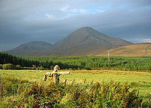
Broadford (Scottish Gaelic: An t-Àth Leathann [ən̪ˠ t̪aːh ˈʎɛhən̪ˠ]), together with nearby Harrapool, is the second-largest settlement on the Isle of Skye, Scotland. Lying in the shadow of the Red Cuillin mountains, Broadford is within the parish of Strath. A long meandering village historically consisting of a few buildings on either side of the Broadford River, the many small townships around the wide sweep of the bay have grown together and Broadford now stretches for 1+1⁄2 miles (2.4 kilometres) around the southern side of Broadford Bay.

Upper Breakish
Human settlement in Scotland
Distance: Approx. 4369 meters
Latitude and longitude: 57.243442,-5.838632
Upper Breakish (Scottish Gaelic: Breacais Àrd) is a village on the Isle of Skye in Scotland in the United Kingdom.

Beinn na Caillich (Red Hills)
Mountain in Scotland
Distance: Approx. 3942 meters
Latitude and longitude: 57.23777778,-5.97611111
Beinn na Caillich (Scottish Gaelic for 'mountain of the old woman or Cailleach') is a mountain with a height of 732 metres (2,402 ft), west of Broadford on the Isle of Skye, Scotland. It is one of the Red Hills, or Red Cuillin. There is another Beinn na Caillich at Kyle Rhea on Skye, with an identical height.

Mackinnon Memorial Hospital
Hospital in Isle of Skye, Scotland
Distance: Approx. 542 meters
Latitude and longitude: 57.24666667,-5.91083333
The former Mackinnon Memorial Hospital building is now vacant; it sits adjacent to the new Broadford Hospital, all services having moved into this new purpose built building in March 2022. It was a community hospital, located in the village of Broadford on the Isle of Skye. It was managed by NHS Highland.

Corriechatachan
Farmstead on the Isle of Skye, Scotland
Distance: Approx. 2044 meters
Latitude and longitude: 57.23194444,-5.93972222
Corriechatachan (Gaelic for “Corrie of the wild cats”) is a farmstead (now ruined), lying at the foot of Beinn na Caillich, near Broadford, on the Isle of Skye. Until the 19th century, it was a tack farmed by a cadet branch of the Clan Mackinnon. Notable visitors included Thomas Pennant, in the course of the travels that resulted in the publication of A Tour of Scotland in 1769, and Samuel Johnson and James Boswell, on their tour of the Highlands.

Lower Breakish
Human settlement in Scotland
Distance: Approx. 4369 meters
Latitude and longitude: 57.243442,-5.838632
Lower Breakish (Scottish Gaelic: Breacais Ìosal) is a village on the Isle of Skye in Scotland.

Harrapool
Human settlement in Scotland
Distance: Approx. 1280 meters
Latitude and longitude: 57.24244,-5.88989
Harrapool (Scottish Gaelic: Harrapul) is a village, that lies on the right hand side of Broadford Bay, in Isle of Skye, Scottish Highlands and is in the Scottish council area of Highland. The town of Broadford lies in the other corner of Broadford Bay to the east along the A87 road.

Cill Chriosd
Church in Strath Suardal, Scotland
Distance: Approx. 3758 meters
Latitude and longitude: 57.21472222,-5.94833333
Cill Chriosd or Kilchrist (Christ's Church) is a ruined former parish church of Strath, on the Isle of Skye, Scotland. It was constructed around the 16th century, replacing an earlier medieval church on the same location, and was used until 1840 when the parish church was relocated to Broadford. It lies on the B8083 Broadford to Torrin and Elgol road.

Skye Marble Railway
Former railway line in Scotland
Distance: Approx. 3273 meters
Latitude and longitude: 57.218,-5.943
The Skye Marble Railway was a 3 ft (914 mm) narrow gauge industrial railway on the Isle of Skye, Scotland which operated from 1910 to 1912. Marble was discovered near Kilchrist in Strath Suardal about 3 miles (5 kilometres) south west of Broadford around 1907. A large factory was built near the quarry for cutting and polishing the quarried blocks.
Broadford Parish Church
Church in Skye, Scotland
Distance: Approx. 145 meters
Latitude and longitude: 57.24134444,-5.90884167
Broadford Parish Church, Skye is a parish church in the Church of Scotland in Broadford, Skye.
Weather in this IP's area
scattered clouds
5 Celsius
2 Celsius
5 Celsius
5 Celsius
1014 hPa
62 %
1014 hPa
1004 hPa
10000 meters
5.22 m/s
9.09 m/s
315 degree
27 %
