Country:
 Netherlands
Region:
City:
Latitude and Longitude:
Time Zone:
Postal Code:
IP information under different IP Channel
ip-api
Country
Region
City
ASN
Time Zone
ISP
Blacklist
Proxy
Latitude
Longitude
Postal
Route
IPinfo
Country
Region
City
ASN
Time Zone
ISP
Blacklist
Proxy
Latitude
Longitude
Postal
Route
MaxMind
Country
Region
City
ASN
Time Zone
ISP
Blacklist
Proxy
Latitude
Longitude
Postal
Route
Luminati
Country
NLRegion
ze
City
terneuzen
ASN
Time Zone
Europe/Amsterdam
ISP
Cyso Group B.V.
Latitude
Longitude
Postal
db-ip
Country
Region
City
ASN
Time Zone
ISP
Blacklist
Proxy
Latitude
Longitude
Postal
Route
ipdata
Country
Region
City
ASN
Time Zone
ISP
Blacklist
Proxy
Latitude
Longitude
Postal
Route
Popular places and events near this IP address

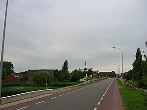
Terneuzen
Municipality in Zeeland, Netherlands
Distance: Approx. 705 meters
Latitude and longitude: 51.33333333,3.83333333
Terneuzen (Dutch pronunciation: [tɛrˈnøːzə(n)] ) is a city and municipality in the southwestern Netherlands, in the province of Zeeland, in the middle of Zeelandic Flanders. With almost 55,000 inhabitants, it is the most populous municipality of Zeeland.

Zeelandic Flanders
Region in Zeeland, Netherlands
Distance: Approx. 1268 meters
Latitude and longitude: 51.33333333,3.81666667
Zeelandic Flanders (Dutch: Zeeuws-Vlaanderen [ˌzeːusˈflaːndərə(n)] ; Zeeuws: Zeêuws-Vlaonderen; West Flemish: Zêeuws-Vloandern) is the southernmost region of the province of Zeeland in the south-western Netherlands. It lies south of the Western Scheldt that separates the region from the remainder of Zeeland and the Netherlands to the north. Zeelandic Flanders is bordered to the south and to the east by Belgium.

Alan-A-Dale
Distance: Approx. 3786 meters
Latitude and longitude: 51.36,3.78833333
Alan-A-Dale was a cargo motor ship that was built in Denmark in 1938 as Nordvest (lit.: Northwest). In the Second World War the United States requisitioned her in 1941 and renamed her Alan-A-Dale. In December 1944 she was sunk by a German submarine off the coast of the Netherlands.
Spui, Zeeland
Village in Zeeland, Netherlands
Distance: Approx. 5678 meters
Latitude and longitude: 51.29777778,3.87861111
Spui is a village in the Dutch province of Zeeland. It is a part of the municipality of Terneuzen, and lies about 27 km southeast of Vlissingen. The village was first mentioned in 1549 as "ter Zouter Speye", and refers to a type of discharge lock.

Hoek, Zeeland
Village in Zeeland, Netherlands
Distance: Approx. 4972 meters
Latitude and longitude: 51.30944444,3.77916667
Hoek (Dutch pronunciation: [ɦuk]) is a village in the Dutch province of Zeeland. It is a part of the municipality of Terneuzen, and lies about 22 km south-east of Vlissingen.
Zaamslag
Village in Zeeland, Netherlands
Distance: Approx. 6401 meters
Latitude and longitude: 51.3125,3.91305556
Zaamslag is a village in the Dutch province of Zeeland. It is a part of the municipality of Terneuzen, and lies about 28 km southeast of Vlissingen. Zaamslag was a separate municipality until 1970, when it was merged with Terneuzen.

Reuzenhoek
Hamlet in Zeeland, Netherlands
Distance: Approx. 5812 meters
Latitude and longitude: 51.3263,3.9127
Reuzenhoek is a hamlet in the Dutch province of Zeeland. It is a part of the municipality of Terneuzen and is about 28 kilometres (17 mi) southeast of Vlissingen. Reuzenhoek is not a statistical entity, and the postal authorities have placed it under Terneuzen.

Ellewoutsdijk
Village in Zeeland, Netherlands
Distance: Approx. 5751 meters
Latitude and longitude: 51.39027778,3.81583333
Ellewoutsdijk (Zeeuws: Ellesdiek) is a village in the Dutch province of Zeeland. It is a part of the municipality of Borsele, and lies about 18 km east of Vlissingen.
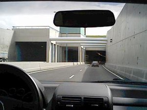
Western Scheldt Tunnel
Distance: Approx. 4006 meters
Latitude and longitude: 51.3691,3.7989
The Western Scheldt Tunnel (Dutch: Westerscheldetunnel) is a 6.6-kilometre (4.1 mi) tunnel in the Netherlands that carries highway N62 under the Western Scheldt estuary between Ellewoutsdijk and Terneuzen. It is the longest tunnel for highway traffic in the Netherlands.
Eendragt, Zeeland
Village in Zeeland, Netherlands
Distance: Approx. 4875 meters
Latitude and longitude: 51.35,3.9
Eendragt is a village in Zeeland, Netherlands.

HMS Valentine (L69)
Destroyer of the Royal Navy
Distance: Approx. 1268 meters
Latitude and longitude: 51.33333333,3.81666667
HMS Valentine was a V and W-class destroyer, built in 1917 for the Royal Navy. She fought in both world wars, serving in several capacities. She was heavily damaged by air attack and beached in 1940 near Terneuzen.

Zaamslag Castle
Castle in Zeelandic Flanders, the Netherlands
Distance: Approx. 6659 meters
Latitude and longitude: 51.310833,3.915833
Zaamslag Castle was a Motte-and-bailey castle in Zeelandic Flanders, the motte (artificial hill) remains. It is called Torenberg.
Weather in this IP's area
overcast clouds
17 Celsius
17 Celsius
16 Celsius
18 Celsius
998 hPa
75 %
998 hPa
998 hPa
10000 meters
6.98 m/s
10.79 m/s
205 degree
97 %
07:57:00
19:06:58