109.235.139.130 - IP Lookup: Free IP Address Lookup, Postal Code Lookup, IP Location Lookup, IP ASN, Public IP
Country:
Region:
City:
Location:
Time Zone:
Postal Code:
IP information under different IP Channel
ip-api
Country
Region
City
ASN
Time Zone
ISP
Blacklist
Proxy
Latitude
Longitude
Postal
Route
Luminati
Country
ASN
Time Zone
Europe/Berlin
ISP
Arvato Systems GmbH
Latitude
Longitude
Postal
IPinfo
Country
Region
City
ASN
Time Zone
ISP
Blacklist
Proxy
Latitude
Longitude
Postal
Route
IP2Location
109.235.139.130Country
Region
nordrhein-westfalen
City
saarn
Time Zone
Europe/Berlin
ISP
Language
User-Agent
Latitude
Longitude
Postal
db-ip
Country
Region
City
ASN
Time Zone
ISP
Blacklist
Proxy
Latitude
Longitude
Postal
Route
ipdata
Country
Region
City
ASN
Time Zone
ISP
Blacklist
Proxy
Latitude
Longitude
Postal
Route
Popular places and events near this IP address

Mülheim
City in North Rhine-Westphalia, Germany
Distance: Approx. 2738 meters
Latitude and longitude: 51.4275,6.8825
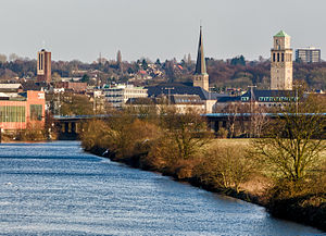
Mülheim, officially Mülheim an der Ruhr (Low German: Mölm; Kölsch: Müllem; German pronunciation: [ˈmyːlhaɪm ʔan deːɐ̯ ˈʁuːɐ̯] ) and also described as "City on the River", is a city in North Rhine-Westphalia in Germany. It is located in the Ruhr Area between Duisburg, Essen, Oberhausen and Ratingen. It is home to many companies, and two Max Planck Institutes.
Max Planck Institute for Chemical Energy Conversion
Distance: Approx. 1798 meters
Latitude and longitude: 51.41777778,6.88638889
The Max Planck Institute for Chemical Energy Conversion (MPI CEC) is a research institute of the Max Planck Society. It is located in the German town of Mülheim.
2007 German Open Grand Prix
Badminton tournament
Distance: Approx. 2583 meters
Latitude and longitude: 51.4236,6.8929
The 2007 German Open Grand Prix (officially known as the Yonex German Open 2007 for sponsorship reasons) was a badminton tournament which took place in Mülheim from 27 February to 4 March 2007. It had a total purse of $80,000.

Max Planck Institute for Coal Research
Research institute in Mülheim an der Ruhr, Germany
Distance: Approx. 1798 meters
Latitude and longitude: 51.41777778,6.88638889
The Max Planck Institute for Coal Research (German: Max-Planck-Institut für Kohlenforschung, MPI KoFo) is an institute located in Mülheim an der Ruhr, Germany specializing in chemical research on catalysis. It is one of the 86 institutes in the Max Planck Society (Max-Planck-Gesellschaft). It was founded in 1912 in Mülheim an der Ruhr as the Kaiser Wilhelm Institute for Coal Research (Kaiser-Wilhelm-Institut für Kohlenforschung) to study the chemistry and uses of coal, and became an independent Max Planck Institute in 1949.

Mülheim (Ruhr) Hauptbahnhof
Railway station in Mülheim an der Ruhr, Germany
Distance: Approx. 3221 meters
Latitude and longitude: 51.43138889,6.88638889
Mülheim (Ruhr) Hauptbahnhof is a railway station for the city of Mülheim in the German state of North Rhine-Westphalia. It was renamed as a Hauptbahnhof in 1974 at the time of the rebuilding of the Dortmund–Duisburg line as part of the establishment of the Rhine-Ruhr S-Bahn. It is classified by Deutsche Bahn as a category 3 station.

Mülheim (Ruhr) West station
Railway station in Mülheim an der Ruhr, Germany
Distance: Approx. 4042 meters
Latitude and longitude: 51.439649,6.871205
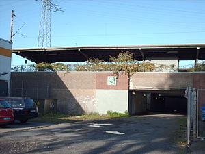
Mülheim (Ruhr) West station is located in the German city of Mülheim in the German state of North Rhine-Westphalia. It is on the Witten/Dortmund–Oberhausen/Duisburg line and is classified by Deutsche Bahn as a category 5 station. The station was opened 1 March 1862 by the Bergisch-Märkische Railway Company and was called Mülheim (BM) station until 1892, when it was renamed Mülheim (Ruhr).
Rumbach (Ruhr)
River in Germany
Distance: Approx. 2743 meters
Latitude and longitude: 51.428,6.8769
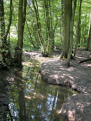
The Rumbach or Ruhmbach is a river of North Rhine-Westphalia, Germany. It is 7.4 km (4.6 mi) long and is a right tributary of the Ruhr in Mülheim.
Freilichtbühne Mülheim an der Ruhr
Distance: Approx. 2207 meters
Latitude and longitude: 51.42194444,6.88583333
The Freilichtbühne Mülheim an der Ruhr (Mülheim an der Ruhr Open-Air Theatre) is an open-air amphitheatre in North Rhine-Westphalia, Germany, built in 1936 as a Nazi Thingplatz. It is the most important open-air theatre in the Rhine-Ruhr region and with 2,000 seats, one of the largest in Germany.

Stücke
Distance: Approx. 2621 meters
Latitude and longitude: 51.42694444,6.87472222
Stücke. Mülheimer Theatertage NRW is a theatre festival in Mülheim, North Rhine-Westphalia, Germany. The Mülheimer Dramatikerpreis is awarded at this festival.

Nürnberger Flugdienst Flight 108
1988 aviation accident
Distance: Approx. 4277 meters
Latitude and longitude: 51.3743,6.9148
Nürnberger Flugdienst Flight 108 was a scheduled regional flight which crashed near Essen, Germany, on 8 February 1988 with the loss of all 21 occupants. The flight was operated by Swearingen SA.227BC Metroliner III D-CABB for Nürnberger Flugdienst, from Hannover Airport to Düsseldorf Airport. It is the deadliest aviation accident involving the Swearingen Fairchild Metroliner.
Essen/Mülheim Airport
Aerodrome in Germany
Distance: Approx. 4542 meters
Latitude and longitude: 51.40333333,6.94
Essen/Mülheim Airport (IATA: ESS, ICAO: EDLE), is a minor unscheduled airport located 6 km (3.7 mi) south-west of Essen and 3 km (1.9 mi) south-east of Mülheim, North Rhine-Westphalia. It serves the western Rhine-Ruhr metropolitan region, the largest urban agglomeration in Germany.

Museum zur Vorgeschichte des Films
Museum
Distance: Approx. 2895 meters
Latitude and longitude: 51.4291,6.86818
The Museum zur Vorgeschichte des Films (English: Museum of the Prehistory of Film) is a permanent exhibition on the development of moving images before the invention of cinematography. Together with the world's largest walk-in camera obscura, the museum is housed in a 25.5 m high water tower in the Broich district of Mülheim. Together with the neighbouring roundhouse, the water tower is part of the Industrial Heritage Trail.
Weather in this IP's area
clear sky
8 Celsius
8 Celsius
7 Celsius
11 Celsius
1036 hPa
76 %
1036 hPa
1029 hPa
10000 meters
1.54 m/s
110 degree


