109.233.84.24 - IP Lookup: Free IP Address Lookup, Postal Code Lookup, IP Location Lookup, IP ASN, Public IP
Country:
 San Marino
Region:
City:
Location:
Time Zone:
Postal Code:
ISP:
ASN:
language:
User-Agent:
Proxy IP:
Blacklist:
IP information under different IP Channel
ip-api
Country
Region
City
ASN
Time Zone
ISP
Blacklist
Proxy
Latitude
Longitude
Postal
Route
db-ip
Country
Region
City
ASN
Time Zone
ISP
Blacklist
Proxy
Latitude
Longitude
Postal
Route
IPinfo
Country
Region
City
ASN
Time Zone
ISP
Blacklist
Proxy
Latitude
Longitude
Postal
Route
IP2Location
109.233.84.24Country
smRegion
serravalle
City
serravalle
Time Zone
Europe/San_Marino
ISP
Language
User-Agent
Latitude
Longitude
Postal
ipdata
Country
Region
City
ASN
Time Zone
ISP
Blacklist
Proxy
Latitude
Longitude
Postal
Route
Popular places and events near this IP address
Domagnano
Castello of San Marino
Distance: Approx. 2671 meters
Latitude and longitude: 43.95,12.46666667
Domagnano (Romagnol: Munt Dmagnên) is one of the nine castelli of San Marino. It has 3,565 inhabitants (May 2018) in an area of 6.62 km2.

Faetano
Castello of San Marino
Distance: Approx. 2724 meters
Latitude and longitude: 43.92555556,12.49833333
Faetano (Romagnol: Faitén) is one of the nine castelli of San Marino. It has 1,177 inhabitants (May 2018) in an area of 7.75 km2.

Fiumicello (river)
River in San Marino, Italy
Distance: Approx. 1671 meters
Latitude and longitude: 43.9398,12.5153
The Fiumicello is a river in the Italian peninsula. It rises in San Marino, flowing east to the Italian border. It is a left tributary of the Marano.

Torraccia Airfield
General aviation aerodrome in San Marino
Distance: Approx. 890 meters
Latitude and longitude: 43.95,12.51111111
Torraccia Airfield (Italian: Aviosuperficie di Torraccia), also known as Toraccia Helipad and Airfield (Italian: Aviosuperficie ed elisuperficie di Torraccia) or Toraccia Airport (Italian: Aeroporto di Torraccia), is a small general aviation aerodrome in Torraccia, a village east of the castello of Domagnano, Republic of San Marino, less than 200 metres (660 feet) from the Italian border. Torraccia is the only airfield in San Marino. Its only grass runway was first used in 1981, but the airfield's structure was opened in 1985.
Piandivello
Curazia of Domagnano, San Marino
Distance: Approx. 1338 meters
Latitude and longitude: 43.95,12.4833
Piandivello is a curazia of San Marino, in the castello of Domagnano.

Spaccio Giannoni
Curazia of Domagnano, San Marino
Distance: Approx. 2671 meters
Latitude and longitude: 43.95,12.466667
Spaccio Giannoni is a curazia of San Marino, in the castello of Domagnano.
Calligaria
Curazia of Faetano, San Marino
Distance: Approx. 2718 meters
Latitude and longitude: 43.9256,12.4988
Calligaria is a curazia of San Marino, in the castello of Faetano.
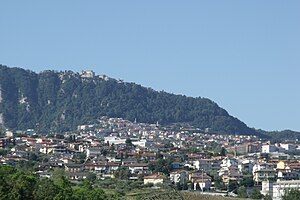
Cinque Vie
Curazia of Serravalle, San Marino
Distance: Approx. 0 meters
Latitude and longitude: 43.95,12.5
Cinque Vie (lit. 'Five Ways') is a curazia of San Marino. It belongs to the municipality of Serravalle.
Lesignano
Curazia of Serravalle, San Marino
Distance: Approx. 1908 meters
Latitude and longitude: 43.962,12.483
Lesignano is a curazia of San Marino. It belongs to the municipality of Serravalle.
Ponte Mellini
Curazia of Serravalle, San Marino
Distance: Approx. 1859 meters
Latitude and longitude: 43.9667,12.5
Ponte Mellini is a curazia of San Marino. It belongs to the municipality of Serravalle.
Lago di Faetano
Artificial lake in Faetano
Distance: Approx. 1648 meters
Latitude and longitude: 43.94055556,12.51583333
Lago di Faetano is a small artificial lake opened in 1968 used for trout fishing near the border with Italy in the castello of Faetano near the road that connects Faetano with Rimini and not far from the Marano stream which also borders to the east the border with Italy.

San Marino Shrine
The first Shinto Shrine in Europe
Distance: Approx. 1692 meters
Latitude and longitude: 43.95812,12.48215
San Marino Shrine (サンマリノ神社) is a shrine in Serravalle, Republic of San Marino. It is the first official shinto shrine in Europe supported by the Jinja Honcho when the shrine was established.
Weather in this IP's area
moderate rain
9 Celsius
7 Celsius
8 Celsius
9 Celsius
1013 hPa
91 %
1013 hPa
989 hPa
10000 meters
2.68 m/s
4.47 m/s
201 degree
100 %