109.233.45.189 - IP Lookup: Free IP Address Lookup, Postal Code Lookup, IP Location Lookup, IP ASN, Public IP
Country:
Region:
City:
Location:
Time Zone:
Postal Code:
ISP:
ASN:
language:
User-Agent:
Proxy IP:
Blacklist:
IP information under different IP Channel
ip-api
Country
Region
City
ASN
Time Zone
ISP
Blacklist
Proxy
Latitude
Longitude
Postal
Route
db-ip
Country
Region
City
ASN
Time Zone
ISP
Blacklist
Proxy
Latitude
Longitude
Postal
Route
IPinfo
Country
Region
City
ASN
Time Zone
ISP
Blacklist
Proxy
Latitude
Longitude
Postal
Route
IP2Location
109.233.45.189Country
Region
england
City
yarmouth
Time Zone
Europe/London
ISP
Language
User-Agent
Latitude
Longitude
Postal
ipdata
Country
Region
City
ASN
Time Zone
ISP
Blacklist
Proxy
Latitude
Longitude
Postal
Route
Popular places and events near this IP address

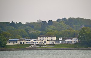
Yarmouth, Isle of Wight
Human settlement in England
Distance: Approx. 153 meters
Latitude and longitude: 50.704,-1.5
Yarmouth is a town, port and civil parish in the west of the Isle of Wight, off the south coast of England. The town is named for its location at the mouth of the small Western Yar river. The town grew near the river crossing, originally a ferry, which was replaced with a road bridge in 1863.

Yarmouth Castle
English artillery fort
Distance: Approx. 167 meters
Latitude and longitude: 50.706667,-1.500278
Yarmouth Castle is an artillery fort built by Henry VIII in 1547 to protect Yarmouth Harbour on the Isle of Wight from the threat of French attack. Just under 100 feet (30 m) across, the square castle was initially equipped with 15 artillery guns and a garrison of 20 men. It featured an Italianate "arrow-head" bastion on its landward side; this was very different in style from the earlier circular bastions used in the Device Forts built by Henry and was the first of its kind to be constructed in England.
Western Yar
River on the Isle of Wight, England
Distance: Approx. 409 meters
Latitude and longitude: 50.70194444,-1.50166667
The River Yar on the Isle of Wight, England, rises near the beach at Freshwater Bay, on the south coast, and flows only a few miles north to Yarmouth where it meets the Solent. Most of the river is a tidal estuary. Its headwaters have been truncated by erosion of the south coast.

Yarmouth railway station (Isle of Wight)
Former railway station in Yarmouth, Isle of Wight
Distance: Approx. 409 meters
Latitude and longitude: 50.7029,-1.4949
Yarmouth railway station, was an intermediate station of the Freshwater, Yarmouth and Newport Railway.

St James' Church, Yarmouth
Church
Distance: Approx. 30 meters
Latitude and longitude: 50.705544,-1.499133
St. James' Church, Yarmouth is a Grade II* listed parish church in the Church of England located in Yarmouth, Isle of Wight.
Thorley Manor
Manor in Isle of Wight, England
Distance: Approx. 1420 meters
Latitude and longitude: 50.7004,-1.4807
Thorley Manor is a manor house just outside Yarmouth, on the Isle of Wight, England. Built in 1712, it features a modillion cornice, hipped roof, as well as tall chimneys.

Yarmouth Lifeboat Station
RNLI lifeboat station on the Isle of Wight, UK
Distance: Approx. 125 meters
Latitude and longitude: 50.70613889,-1.50047222
Yarmouth Lifeboat station (not to be confused with Great Yarmouth and Gorleston) is located at Yarmouth, a harbour town overlooking the Solent, on the north-west coast of the Isle of Wight. A lifeboat managed by a local committee was stationed at Yarmouth for two years from 1868, before being relocated in 1870, to a new station established at Totland Bay. In 1924, for the arrival of a motor-powered lifeboat, the Totland Bay station, now managed by the Royal National Lifeboat Institution (RNLI), was closed, and a new station established at Yarmouth.

Norton Grange
Distance: Approx. 1003 meters
Latitude and longitude: 50.706,-1.51348
Norton Grange is a country house near Yarmouth on the Isle of Wight.

Yarmouth Pier
Distance: Approx. 268 meters
Latitude and longitude: 50.7077,-1.4995
Yarmouth Pier is a Victorian pleasure pier, located in Yarmouth, Isle of Wight. It is the longest wooden pier in England, and frequently requires restoration due to the relatively short lifespan of the wooden piles. Following its latest restoration scheme, it reopened to the public in 2008.
Yarmouth Roads Wreck
Distance: Approx. 542 meters
Latitude and longitude: 50.7092,-1.4947
The remains of a late sixteenth or early seventeenth century carrack was discovered in Yarmouth Roads, Isle of Wight, England in 1984. The site was designated under the Protection of Wrecks Act on 9 April 1984. The wreck is a Protected Wreck managed by Historic England.

Yarmouth Town Hall, Isle of Wight
Municipal building in Yarmouth, Isle of Wight, England
Distance: Approx. 68 meters
Latitude and longitude: 50.7059,-1.4995
Yarmouth Town Hall is a municipal building in The Square in Yarmouth, Isle of Wight, England. The structure, which is used as a community events venue, is a Grade II listed building.

Norton, Isle of Wight
Human settlement in England
Distance: Approx. 1068 meters
Latitude and longitude: 50.703,-1.514
Norton is a hamlet in the civil parish of Freshwater, on the outskirts of Yarmouth, in the Isle of Wight, England. It is situated in the West of the island and has a coast on the Solent. It is located 3.5 miles (5.6 km) southeast of Lymington, Hampshire.
Weather in this IP's area
overcast clouds
7 Celsius
6 Celsius
7 Celsius
7 Celsius
1019 hPa
87 %
1019 hPa
1017 hPa
10000 meters
1.72 m/s
1.66 m/s
210 degree
100 %

