109.233.44.87 - IP Lookup: Free IP Address Lookup, Postal Code Lookup, IP Location Lookup, IP ASN, Public IP
Country:
Region:
City:
Location:
Time Zone:
Postal Code:
IP information under different IP Channel
ip-api
Country
Region
City
ASN
Time Zone
ISP
Blacklist
Proxy
Latitude
Longitude
Postal
Route
Luminati
Country
ASN
Time Zone
Europe/London
ISP
Applied Satellite Technology Ltd
Latitude
Longitude
Postal
IPinfo
Country
Region
City
ASN
Time Zone
ISP
Blacklist
Proxy
Latitude
Longitude
Postal
Route
IP2Location
109.233.44.87Country
Region
england
City
lowestoft
Time Zone
Europe/London
ISP
Language
User-Agent
Latitude
Longitude
Postal
db-ip
Country
Region
City
ASN
Time Zone
ISP
Blacklist
Proxy
Latitude
Longitude
Postal
Route
ipdata
Country
Region
City
ASN
Time Zone
ISP
Blacklist
Proxy
Latitude
Longitude
Postal
Route
Popular places and events near this IP address

Lowestoft
Town and civil parish in Suffolk, England
Distance: Approx. 545 meters
Latitude and longitude: 52.48,1.75
Lowestoft ( LOH-(ih)-stoft, LOH-stəf) is a coastal town and civil parish in the East Suffolk district of Suffolk, England. As the most easterly UK settlement, it is 38 miles (61 km) north-east of Ipswich and 22 miles (35 km) south-east of Norwich, and the main town in its district. Its development grew with the fishing industry and as a seaside resort with wide sandy beaches.

Waveney District
Former non-metropolitan district in England
Distance: Approx. 931 meters
Latitude and longitude: 52.4831,1.7561
Waveney was a local government district in Suffolk, England, named after the River Waveney that formed its north-east border. The district council was based in Lowestoft, the major settlement in Waveney. The other towns in the district were Beccles, Bungay, Halesworth and Southwold.

Lowestoft railway station
Railway station in Suffolk, England
Distance: Approx. 165 meters
Latitude and longitude: 52.4742,1.7498
Lowestoft railway station (formerly Lowestoft Central) serves the town of Lowestoft, Suffolk. It is the eastern terminus of the East Suffolk Line from Ipswich and is one of two eastern termini of the Wherry Lines from Norwich (the other being Great Yarmouth). Lowestoft is 23 miles 41 chains (37.8 km) down the line from Norwich and 48 miles 75 chains (78.8 km) measured from Ipswich; it is the easternmost station on the National Rail network in the United Kingdom.
Lowestoft Town F.C.
Association football club in England
Distance: Approx. 690 meters
Latitude and longitude: 52.48074444,1.74704444
Lowestoft Town Football Club is a semi-professional football club based in Lowestoft, Suffolk, England. They are currently members of the Southern League Premier Division Central and play at Crown Meadow.

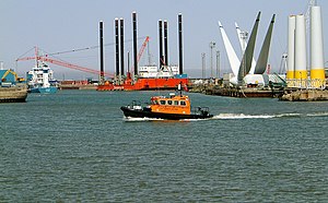
Port of Lowestoft
Distance: Approx. 824 meters
Latitude and longitude: 52.473,1.74
The Port of Lowestoft is a harbour and commercial port in Lowestoft in the English county of Suffolk owned by Associated British Ports. It is the most easterly harbour in the United Kingdom and has direct sea access to the North Sea. The harbour is made up of two sections divided by a bascule bridge.
Mincarlo (trawler)
Distance: Approx. 363 meters
Latitude and longitude: 52.472,1.7526
Mincarlo is the last surviving sidewinder fishing trawler of the Lowestoft fishing fleet. She is also the last surviving fishing vessel built in Lowestoft, with an engine made in the town.

Royal Norfolk and Suffolk Yacht Club
Historic site in Suffolk, England
Distance: Approx. 367 meters
Latitude and longitude: 52.472,1.7503
The Royal Norfolk and Suffolk Yacht Club is a private yacht club based in Lowestoft, Suffolk, England. It was founded on 16 April 1859 and the first club house was constructed in 1866 but was undersized. The current club house was designed by George Skipper and built between 1902 and 1903, in 2006 it was restored.

Lowestoft Hospital
Hospital in Suffolk, United Kingdom
Distance: Approx. 543 meters
Latitude and longitude: 52.48,1.753
Lowestoft Hospital was a National Health Service (NHS) hospital on Tennyson Road in Lowestoft in the English county of Suffolk. It was managed by the James Paget University Hospitals NHS Foundation Trust. It provided convalescing community care for elderly people, a minor injuries unit and a variety of other services.

Lowestoft Lifeboat Station
RNLI Lifeboat Station in Suffolk, England
Distance: Approx. 406 meters
Latitude and longitude: 52.47166667,1.75305556
Lowestoft Lifeboat Station is a Royal National Lifeboat Institution (RNLI) operated lifeboat station in the town of Lowestoft in the English county of Suffolk. The station is located at the mouth of Lowestoft's outer harbour on the South pier. It is one of the oldest lifeboat stations in the United Kingdom, having been established in 1801.

Our Lady Star of the Sea Church, Lowestoft
Church in Lowestoft, United Kingdom
Distance: Approx. 212 meters
Latitude and longitude: 52.4771,1.7513
Our Lady Star of the Sea Church is a Roman Catholic Parish church in Lowestoft, Suffolk. It is situated on Gordon Road in the centre of the town. It was founded by the Diocese of Northampton in 1881 and it is now administered by the Diocese of East Anglia.

Lowestoft Town Hall
Municipal building in Lowestoft, Suffolk, England
Distance: Approx. 935 meters
Latitude and longitude: 52.4832,1.7558
Lowestoft Town Hall is a municipal building in the High Street, Lowestoft, Suffolk, England. The town hall, which was the meeting place of Lowestoft Council, is a Grade II listed building.
South Pier, Lowestoft
Pier in Lowestoft, Suffolk, England
Distance: Approx. 454 meters
Latitude and longitude: 52.4715,1.7544
South Pier is a leisure pier in Lowestoft, Suffolk, engineered by William Cubitt and opened in 1846 at a length of 1,320 feet (400 m). The pavilion was used by the Royal Naval Patrol Service as a headquarters during World War I, although it suffered significant damage during World War II and was subsequently demolished.
Weather in this IP's area
light snow
1 Celsius
-3 Celsius
1 Celsius
2 Celsius
1011 hPa
80 %
1011 hPa
1010 hPa
10000 meters
4.2 m/s
6.79 m/s
175 degree
100 %
