109.232.33.195 - IP Lookup: Free IP Address Lookup, Postal Code Lookup, IP Location Lookup, IP ASN, Public IP
Country:
Region:
City:
Location:
Time Zone:
Postal Code:
ISP:
ASN:
language:
User-Agent:
Proxy IP:
Blacklist:
IP information under different IP Channel
ip-api
Country
Region
City
ASN
Time Zone
ISP
Blacklist
Proxy
Latitude
Longitude
Postal
Route
db-ip
Country
Region
City
ASN
Time Zone
ISP
Blacklist
Proxy
Latitude
Longitude
Postal
Route
IPinfo
Country
Region
City
ASN
Time Zone
ISP
Blacklist
Proxy
Latitude
Longitude
Postal
Route
IP2Location
109.232.33.195Country
Region
valle d'aosta
City
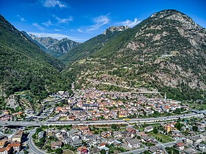
pont-saint-martin
Time Zone
Europe/Rome
ISP
Language
User-Agent
Latitude
Longitude
Postal
ipdata
Country
Region
City
ASN
Time Zone
ISP
Blacklist
Proxy
Latitude
Longitude
Postal
Route
Popular places and events near this IP address

Arnad
Comune in Aosta Valley, Italy
Distance: Approx. 7387 meters
Latitude and longitude: 45.63333333,7.71666667
Arnad (Arpitan: Arnà; Issime Walser: Arnoal); is a town and comune in the Aosta Valley region of northwestern Italy.

Bard, Aosta Valley
Comune in Aosta Valley, Italy
Distance: Approx. 4105 meters
Latitude and longitude: 45.60894167,7.74546944
Bard (French pronunciation: [baʁ]; Valdôtain: Bar [bar]; Issime Walser: Board) is a town and comune in the Aosta Valley region of northwestern Italy. It is part of the Unité des communes valdôtaines du Mont-Rose and has a population of 134. It is one of I Borghi più belli d'Italia ("The most beautiful villages of Italy").

Donnas
Comune in Aosta Valley, Italy
Distance: Approx. 2228 meters
Latitude and longitude: 45.6,7.76666667
Donnas (French pronunciation: [dɔnas]; Valdôtain: Dounah or Dounàs; Issime Walser: Dunaz; Piedmontese: Donàs) is a town and comune in the Aosta Valley region of northwestern Italy.
Lillianes
Comune in Aosta Valley, Italy
Distance: Approx. 6042 meters
Latitude and longitude: 45.63333333,7.85
Lillianes (French pronunciation: [liljan]; Valdôtain: Yian-e; Issime Walser: Elljini) is a town and comune in the Aosta Valley region of north-western Italy.

Perloz
Comune in Aosta Valley, Italy
Distance: Approx. 2930 meters
Latitude and longitude: 45.61666667,7.81666667
Perloz (French pronunciation: [pɛʁlo]; Valdôtain: Pèrlo) is a town and comune in the Aosta Valley region of northwestern Italy. The population from the 2011 census was at 453.

Hône
Comune in Aosta Valley, Italy
Distance: Approx. 5319 meters
Latitude and longitude: 45.61666667,7.73333333
Hône (French pronunciation: [on]; Valdôtain: One (locally Vión-a); Issime Walser: Ounu) is a town and comune (population 1,146) in the Aosta Valley region of north-western Italy.

Tavagnasco
Comune in Piedmont, Italy
Distance: Approx. 5341 meters
Latitude and longitude: 45.55,7.81666667
Tavagnasco is a comune (municipality) in the Metropolitan City of Turin in the Italian region Piedmont, located about 50 kilometres (31 mi) north of Turin. Tavagnasco borders the following municipalities: Settimo Vittone, Quincinetto, Traversella, Brosso, and Quassolo.

Pont Saint-Martin
Bridge in Italy, built by Romans
Distance: Approx. 617 meters
Latitude and longitude: 45.59932628,7.80009985
The Pont Saint-Martin is a Roman bridge in the Aosta Valley in Italy dating to the 1st century BC. The span is 31.4 metres (103 ft) according to recent research, but frequently stated to be 35.64 m or 36.65 m. Other extant Roman bridges in the Aosta valley include the Pont d'Aël in the Cogne Valley and the Pont de Pierre in Aosta.
Lys (Dora Baltea)
River in Italy
Distance: Approx. 621 meters
Latitude and longitude: 45.59,7.7925
The Lys (Walser German: Liisu or Lyesu) is a small 40 kilometres (25 mi) river (classified as a torrente).

Fort Bard
Fortified complex above Bard, Aosta Valley, Italy
Distance: Approx. 4136 meters
Latitude and longitude: 45.60833333,7.74472222
Fort Bard, also known as Bard Fort (Italian: Forte di Bard; French: Fort de Bard [fɔʁ də baʁ]), is a fortified complex built in the 19th century by the House of Savoy on a rocky prominence above Bard, a town and comune in the Aosta Valley region of northwestern Italy. Fort Bard has been completely restored after many years of neglect. In 2006 it reopened to tourists as the Museum of the Alps, it has additional art exhibitions and galleries.
Montestrutto Castle
Neo-gothic Italian Castle
Distance: Approx. 7071 meters
Latitude and longitude: 45.54,7.83888889
The Castle of Montestrutto towers above the village of Montestrutto, in the Commune of Settimo Vittone, Piedmont, Italy. It lies on the east bank of the Dora Baltea river and straddles an ancient Roman road that became a part of the Via Francigena, a medieval pilgrimage route from Canterbury to Rome. Indeed, the original Roman name for the village, "Mons obstructus," signifies the fact it partially blocks access to the Valle d'Aosta and the (rest of the) Alps.
Échallod Bridge
Bridge in Arnad, Italy
Distance: Approx. 7483 meters
Latitude and longitude: 45.635614,7.717487
The Échallod Bridge (Italian: Ponte di Échallod; French: pont d'Échallod) is a stone arch bridge over the Dora Baltea near Échallod in Arnad, Italy.
Weather in this IP's area
broken clouds
6 Celsius
5 Celsius
6 Celsius
7 Celsius
1021 hPa
93 %
1021 hPa
888 hPa
10000 meters
1.34 m/s
3.13 m/s
294 degree
77 %


