Country:
Region:
City:
Latitude and Longitude:
Time Zone:
Postal Code:
IP information under different IP Channel
ip-api
Country
Region
City
ASN
Time Zone
ISP
Blacklist
Proxy
Latitude
Longitude
Postal
Route
Luminati
Country
Region
20
City
bialystok
ASN
Time Zone
Europe/Warsaw
ISP
KOBA Sp. z o.o.
Latitude
Longitude
Postal
IPinfo
Country
Region
City
ASN
Time Zone
ISP
Blacklist
Proxy
Latitude
Longitude
Postal
Route
db-ip
Country
Region
City
ASN
Time Zone
ISP
Blacklist
Proxy
Latitude
Longitude
Postal
Route
ipdata
Country
Region
City
ASN
Time Zone
ISP
Blacklist
Proxy
Latitude
Longitude
Postal
Route
Popular places and events near this IP address

Osiedle Piaski, Białystok
District of Białystok in Podlaskie Voivodeship, Poland
Distance: Approx. 595 meters
Latitude and longitude: 53.125,23.155
Piaski is one of the districts of the Polish city of Białystok.

Białystok County
County in Podlaskie Voivodeship, Poland
Distance: Approx. 627 meters
Latitude and longitude: 53.11666667,23.16666667
Białystok County (Polish: powiat białostocki) is a unit of territorial administration and local government (powiat) in Podlaskie Voivodeship, north-eastern Poland, on the border with Belarus. It was created on 1 January 1999 as a result of the Polish local government reforms passed in 1998. Its administrative seat is the city of Białystok, although the city is not part of the county (it constitutes a separate city county).

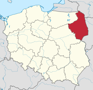
Podlaskie Voivodeship
Voivodeship of Poland
Distance: Approx. 627 meters
Latitude and longitude: 53.11666667,23.16666667
Podlaskie Voivodeship (Polish: Województwo podlaskie [vɔjɛˈvut͡stfɔ pɔˈdlaskʲɛ] ) is a voivodeship (province) in northeastern Poland. The name of the province refers to the historical region of Podlachia (in Polish, Podlasie), and part of its territory corresponds to that region. The capital and largest city is Białystok.

Jewish Heritage Trail in Białystok
Place
Distance: Approx. 782 meters
Latitude and longitude: 53.11666667,23.15
Jewish Heritage Trail in Białystok is a marked foot trail created in June 2008 in Białystok, Poland, by a group of students and doctorate candidates, who participate as volunteers at The University of Białystok Foundation. One of the goals of the project was to generate social capital by engaging cooperation between local institutions and social groups. Project included: planning the trail, publicizing an informative booklet and map in printed and electronic version, building an interactive website of the project, marking the trail sites and opening the trail to the public with a walk around the city, publicizing teacher's materials.

Białystok metropolitan area
Urban area in Podlaskie, Poland
Distance: Approx. 781 meters
Latitude and longitude: 53.116667,23.15
Metropolitan Białystok is a metropolitan area designated by the Governor of the Regulation No. 52/05 of 16 May 2005 in order to help economically develop the region. In 2006, the metropolitan area population was 450,254 inhabitants.
Politics of Białystok
Distance: Approx. 781 meters
Latitude and longitude: 53.116667,23.15
This is a sub-article to Białystok Białystok, like other major cities in Poland, is a City with powiat rights (Polish: miasto na prawach powiatu). The Legislative power in the city is vested in the unicameral Białystok City Council (Polish: Rada Miasta), which has 28 members. Council members are elected directly every four years, one of whom is the mayor, or President of Białystok (Polish: Prezydent).

University Clinical Hospital in Białystok
Hospital in Podlaskie Voivodeship, Poland
Distance: Approx. 446 meters
Latitude and longitude: 53.12448773,23.1591361
University Clinical Hospital in Białystok (Polish: Uniwersytecki Szpital Kliniczny w Białymstoku) is a university hospital and the largest medical facility in Podlaskie Voivodeship, a province located in north-eastern Poland. has 26 clinics with 836 beds, where over 36,000 are treated annually. There are also 30 Specialist Outpatient Facilities within the hospital.

Podlaskie Museum in Białystok
Distance: Approx. 416 meters
Latitude and longitude: 53.12416667,23.15861111
Podlaskie Museum in Białystok is the biggest museum of Podlaskie Voivodeship. It is based in Białystok, a city located in north-eastern Poland.

Voivodeship Hospital in Białystok
Hospital in Podlaskie Voivodeship, Poland
Distance: Approx. 607 meters
Latitude and longitude: 53.12548318,23.16347989
Śniadeckiego Voivodeship Hospital in Bialystok (Polish: Samodzielny Publiczny Zakład Opieki Zdrowotnej Wojewódzki Szpital Zespolony im. J. Śniadeckiego w Białymstoku) is a general hospital in Białystok capital of Podlaskie Voivodeship in north-east Poland. It is under the jurisdiction of the Podlaskie Voivodeship Marshal's Office and is located in a complex of buildings in Skłodowskiej Street.

University Children Clinical Hospital in Białystok
Hospital in Podlaskie Voivodeship, Poland
Distance: Approx. 425 meters
Latitude and longitude: 53.12361111,23.15611111
Ludwig Zamenhoff University Children Clinical Hospital in Białystok (Polish: Uniwersytecki Dziecięcy Szpital Kliniczny im. L. Zamenhofa w Białymstoku) is a children hospital located in the Piaski district in Bialystok, the capital of Podlaskie Voivodeship. The hospital is the largest children's hospital in north-eastern Poland.

Zwierzyniecki Forest (Białystok)
Forest in Białystok, Poland
Distance: Approx. 651 meters
Latitude and longitude: 53.11555556,23.165
Zwierzyniecki Forest (Polish: Las Zwierzyniecki) is a forest and natural reserve in Białystok, Poland.

Constitution of 3 May Park (Białystok)
Distance: Approx. 255 meters
Latitude and longitude: 53.12055556,23.16361111
Constitution of 3 May Park (Polish: Park Konstytucji 3 Maja w Białymstoku) is a park in Piaski District in Białystok, Podlaskie Voivodeship
Weather in this IP's area
overcast clouds
3 Celsius
1 Celsius
3 Celsius
5 Celsius
1003 hPa
86 %
1003 hPa
985 hPa
10000 meters
2.24 m/s
5.36 m/s
217 degree
99 %
06:57:31
15:27:58