Country:
 Poland
Region:
City:
Latitude and Longitude:
Time Zone:
Postal Code:
IP information under different IP Channel
ip-api
Country
Region
City
ASN
Time Zone
ISP
Blacklist
Proxy
Latitude
Longitude
Postal
Route
IPinfo
Country
Region
City
ASN
Time Zone
ISP
Blacklist
Proxy
Latitude
Longitude
Postal
Route
MaxMind
Country
Region
City
ASN
Time Zone
ISP
Blacklist
Proxy
Latitude
Longitude
Postal
Route
Luminati
Country
PLRegion
20
City
bialystok
ASN
Time Zone
Europe/Warsaw
ISP
KOBA Sp. z o.o.
Latitude
Longitude
Postal
db-ip
Country
Region
City
ASN
Time Zone
ISP
Blacklist
Proxy
Latitude
Longitude
Postal
Route
ipdata
Country
Region
City
ASN
Time Zone
ISP
Blacklist
Proxy
Latitude
Longitude
Postal
Route
Popular places and events near this IP address

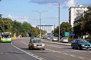
Osiedle Centrum, Białystok
District of Białystok in Podlaskie Voivodeship, Poland
Distance: Approx. 603 meters
Latitude and longitude: 53.13277778,23.15527778
Osiedle Centrum is the oldest, central, representative district of the Polish city of Białystok.
Osiedle Sienkiewicza, Białystok
District of Białystok in Podlaskie Voivodeship, Poland
Distance: Approx. 402 meters
Latitude and longitude: 53.13972222,23.16444444
Osiedle Sienkiewicza is one of the districts of the Polish city of Białystok. It is one of the smaller districts in terms of the area but is relatively densely populated. The district lies directly north to the city centre on the right bank of the Biala river (with the exception of a small segment of Pilsudski alley, which lies on the left bank).

Białystok Ghetto
Nazi ghetto in occupied Poland
Distance: Approx. 71 meters
Latitude and longitude: 53.13805556,23.15916667
The Białystok Ghetto (Polish: getto w Białymstoku) was a Nazi ghetto set up by the German SS between July 26 and early August 1941 in the newly formed District of Bialystok within occupied Poland. About 50,000 Jews from the vicinity of Białystok and the surrounding region were confined into a small area of the city, which was turned into the district's capital. The ghetto was split in two by the Biała River running through it (see map).
Roman Catholic Archdiocese of Białystok
Roman Catholic archdiocese in Poland
Distance: Approx. 572 meters
Latitude and longitude: 53.13311944,23.16418889
The Archdiocese of Białystok (Latin: Bialostocen(sis); Belarusian: Беластоцкая архідыяцэзія, romanized: Biełastockaja archidyjacezia) is a Latin Church ecclesiastical territory or archdiocese of the Catholic Church in Podlaskie Voivodeship, Northeastern Poland. It is a metropolitan see with two suffragan dioceses. Its cathedral archiepiscopal see is Bazylika Archikatedralna Wniebowzięcia NMP, a minor basilica in the episcopal see of Białystok.

VI High School – King Sigismund Augustus
Liceum ogólnokształcące school in Białystok, Poland
Distance: Approx. 576 meters
Latitude and longitude: 53.134742,23.16699
VI High School – King Sigismund Augustus is a secondary school in the Bojary district of the city of Białystok in Poland.

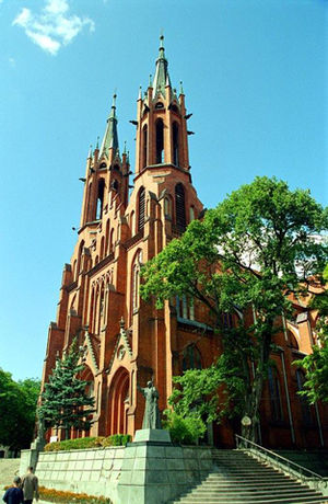
Białystok Cathedral
Church in Białystok, Poland
Distance: Approx. 592 meters
Latitude and longitude: 53.1325,23.1627
The Cathedral Basilica of the Assumption of the Blessed Virgin Mary (Polish: Bazylika archikatedralna Wniebowzięcia Najświętszej Maryi Panny w Białymstoku) also called Białystok Cathedral is a Roman Catholic cathedral in the city of Bialystok in Poland. It was designed by architect Józef Pius Dziekoński. The three-nave church is 90 meters long and can accommodate 9,500 worshipers.

Cytron Synagogue
Former synagogue, now art gallery, in Białystok, Poland
Distance: Approx. 437 meters
Latitude and longitude: 53.136861,23.15325
The Cytron Synagogue (Polish: Synagoga Cytronów), also known as the Beit Midrash Cytron, is a former Orthodox Jewish congregation and synagogue, located at 24a Ludwika Waryńskiego Street in Białystok, in Podlaskie Voivodeship, Poland. Completed in 1936 in the Modernist style, the construction was funded by Shmuel Cytron, it served as a house of prayer until World War II; subsequently used for profane purposes, and as the Sleńdzińscy Gallery, an art gallery.
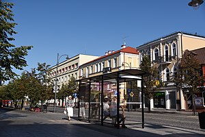
Lipowa Street, Białystok
Street in Białystok, Poland
Distance: Approx. 629 meters
Latitude and longitude: 53.13305556,23.15388889
Lipowa Street is a representative street at the center of Białystok, Poland, running from the Kościuszko Square (corner of Spółdzielcza Street) to Romana Dmowskiego Niepodległości Square (corner of Krakowska street). The street is made up of low buildings mostly of 2-3 floors with various shops, offices and restaurants located at the ground floor.
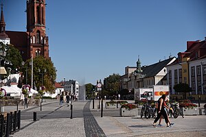
Kościuszko Market Square
Square in Białystok, Poland
Distance: Approx. 652 meters
Latitude and longitude: 53.13194444,23.16277778
Kościuszko Square (Polish: Rynek Kościuszki) is the representative and central square of Białystok, capital of Podlaskie Voivodeship in north-eastern Poland.
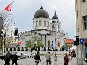
Orthodox Cathedral of St. Nicholas, Białystok
Church in Centrum District, Białystok
Distance: Approx. 632 meters
Latitude and longitude: 53.13274167,23.15454722
The Orthodox Cathedral of St. Nicholas in Białystok (Polish: Sobór św. Mikołaja Cudotwórcy; Russian: Николаевский собор) is an historic Orthodox cathedral in Bialystok, Poland St.

Białystok Ghetto cemetery
Jewish cemetery in the Białystok Ghetto, Poland
Distance: Approx. 666 meters
Latitude and longitude: 53.13794,23.14975
Białystok Ghetto cemetery (Polish: Cmentarz żydowski przy ul. Żabiej) was a Jewish cemetery in the Białystok Ghetto, located in the city of Białystok in north-eastern Poland.
Chorszul Synagogue (Białystok)
Former synagogue in Białystok, Poland
Distance: Approx. 472 meters
Latitude and longitude: 53.133467,23.157519
The Chorszul Synagogue in Białystok (from Yiddish: Chóralna), known as the Zabłudowski Synagogue was a synagogue that was located in Białystok at Białówny Street (at those times Żydowska Street, in the centre of the new Jewish district.
Weather in this IP's area
overcast clouds
9 Celsius
9 Celsius
8 Celsius
9 Celsius
1025 hPa
61 %
1025 hPa
1009 hPa
10000 meters
1.34 m/s
4.47 m/s
28 degree
100 %
06:27:20
18:07:02