109.224.33.236 - IP Lookup: Free IP Address Lookup, Postal Code Lookup, IP Location Lookup, IP ASN, Public IP
Country:
Region:
City:
Location:
Time Zone:
Postal Code:
ISP:
ASN:
language:
User-Agent:
Proxy IP:
Blacklist:
IP information under different IP Channel
ip-api
Country
Region
City
ASN
Time Zone
ISP
Blacklist
Proxy
Latitude
Longitude
Postal
Route
db-ip
Country
Region
City
ASN
Time Zone
ISP
Blacklist
Proxy
Latitude
Longitude
Postal
Route
IPinfo
Country
Region
City
ASN
Time Zone
ISP
Blacklist
Proxy
Latitude
Longitude
Postal
Route
IP2Location
109.224.33.236Country
Region
maysan
City
al 'amarah
Time Zone
Asia/Baghdad
ISP
Language
User-Agent
Latitude
Longitude
Postal
ipdata
Country
Region
City
ASN
Time Zone
ISP
Blacklist
Proxy
Latitude
Longitude
Postal
Route
Popular places and events near this IP address

Amarah
City in Maysan, Iraq
Distance: Approx. 1273 meters
Latitude and longitude: 31.83333333,47.15
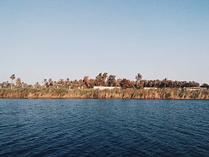
Amarah (Arabic: ٱلْعَمَارَة, romanized: al-ʿAmārah), also spelled Amara, is a city in south-eastern Iraq, located on a low ridge next to the Tigris River waterway south of Baghdad about 50 km (31 mi) from the border with Iran. It lies at the northern tip of the marshlands between the Tigris and Euphrates. It had a population of about 340,000 in 2002, 420,000 in 2005, and 1,100,000 in 2020.
Maysan Olympic Stadium
Stadium in Maysan, Iraq
Distance: Approx. 1330 meters
Latitude and longitude: 31.835328,47.126977
Maysan Olympic Stadium (Arabic: ملعب ميسان الأولمبي) is a multi-use stadium in Amarah, Iraq. The stadium holds 25,000 people and was opened in 1987.
Battle of Amarah
Distance: Approx. 1273 meters
Latitude and longitude: 31.83333333,47.15
The Battle of Amarah took place from October 19 to October 20, 2006, between the Mahdi Army and police, who were largely members of the Badr Organization. Fighting began on October 19, when 800 masked members of the Mahdi army stormed three police stations in Amarah.
University of Misan
Public university in Amarah, Maysan, Iraq
Distance: Approx. 4767 meters
Latitude and longitude: 31.81083333,47.17583333
The University of Misan is an Iraqi university located in Amarah, Maysan, Iraq. It was established in 2007. Originally, the university consisted of the College of Basic Education and the College of Education, which were part of University of Basrah.
Missan Oil Company
Iraqi state-owned oil and gas company
Distance: Approx. 3051 meters
Latitude and longitude: 31.82083333,47.16194444
Missan Oil Company (MOC) (Arabic: شركة نفط ميسان) is a state-owned oil and gas company located in the Maysan Governorate, Iraq. The headquarters are located in the capital of the province, Amarah. Missan was spun off from South Oil Company in 2008 to expand oil activities in Maysan and to set up and oversee joint ventures with international companies to develop the province's oil fields.

Amara War Cemetery
WWI CWGC cemetery in Iraq
Distance: Approx. 2057 meters
Latitude and longitude: 31.8454,47.1606
The Amara War Cemetery is a First World War British military cemetery in Amara, now known as Amarah, southern Iraq, that is the responsibility of the Commonwealth War Graves Commission (CWGC). It contains more than 4,600 graves including three recipients of the Victoria Cross but is now in poor condition as the CWGC have not been able to work in Iraq since 1991.

Amara (Left Bank) Indian War Cemetery
WWI CWGC war cemetery in Iraq
Distance: Approx. 2001 meters
Latitude and longitude: 31.8439,47.1604
The Amara (Left Bank) Indian War Cemetery is a military cemetery in Amara, now known as Amarah, southern Iraq, which contains the graves of more than 5,000 Indian soldiers who died during the First World War. It is the responsibility of the Commonwealth War Graves Commission (CWGC).
Weather in this IP's area
few clouds
19 Celsius
17 Celsius
19 Celsius
19 Celsius
1022 hPa
27 %
1022 hPa
1021 hPa
10000 meters
2.09 m/s
2.13 m/s
287 degree
18 %