Country:
 France
Region:
City:
Latitude and Longitude:
Time Zone:
Postal Code:
IP information under different IP Channel
ip-api
Country
Region
City
ASN
Time Zone
ISP
Blacklist
Proxy
Latitude
Longitude
Postal
Route
IPinfo
Country
Region
City
ASN
Time Zone
ISP
Blacklist
Proxy
Latitude
Longitude
Postal
Route
MaxMind
Country
Region
City
ASN
Time Zone
ISP
Blacklist
Proxy
Latitude
Longitude
Postal
Route
Luminati
Country
FRRegion
bre
City
crevin
ASN
Time Zone
Europe/Paris
ISP
Orange
Latitude
Longitude
Postal
db-ip
Country
Region
City
ASN
Time Zone
ISP
Blacklist
Proxy
Latitude
Longitude
Postal
Route
ipdata
Country
Region
City
ASN
Time Zone
ISP
Blacklist
Proxy
Latitude
Longitude
Postal
Route
Popular places and events near this IP address
Bourg-des-Comptes
Commune in Brittany, France
Distance: Approx. 5701 meters
Latitude and longitude: 47.93,-1.7411
Bourg-des-Comptes (French pronunciation: [buʁ de kɔ̃t]; Breton: Gwikomm; Gallo: Bórg-Cons) is a commune in the Ille-et-Vilaine department in Brittany in northwestern France.

Le Sel-de-Bretagne
Commune in Brittany, France
Distance: Approx. 5898 meters
Latitude and longitude: 47.8964,-1.6092
Le Sel-de-Bretagne (French pronunciation: [lə sɛl də bʁətaɲ], literally The Salt of Brittany; Breton: Ar Sal) is a commune in the Ille-et-Vilaine department in Brittany in northwestern France.

Saulnières, Ille-et-Vilaine
Commune in Brittany, France
Distance: Approx. 6164 meters
Latitude and longitude: 47.9167,-1.5864
Saulnières (French pronunciation: [so(l)njɛʁ]; Gallo: Saunierr, Breton: Saoner) is a commune in the Ille-et-Vilaine department in Brittany in northwestern France.
Poligné
Commune in Brittany, France
Distance: Approx. 5325 meters
Latitude and longitude: 47.8881,-1.685
Poligné (French pronunciation: [pɔliɲe]; Gallo: Polinyae, Breton: Polinieg) is a commune in the Ille-et-Vilaine department of Brittany in northwestern France.

Pléchâtel
Commune in Brittany, France
Distance: Approx. 7501 meters
Latitude and longitude: 47.8953,-1.7472
Pléchâtel (French pronunciation: [pleʃatɛl]; Breton: Plegastell) is a commune in the Ille-et-Vilaine department of Brittany in northwestern France.

Le Petit-Fougeray
Commune in Brittany, France
Distance: Approx. 4323 meters
Latitude and longitude: 47.9286,-1.6075
Le Petit-Fougeray (French pronunciation: [lə pəti fuʒʁɛ]; Gallo: Le Petit-Foujeraè, Breton: Felgerieg-Vihan) is a commune in the Ille-et-Vilaine department of Brittany in northwestern France.

Pancé
Commune in Brittany, France
Distance: Approx. 5797 meters
Latitude and longitude: 47.8822,-1.6569
Pancé (French pronunciation: [pɑ̃se]; Breton: Pantieg; Gallo: Panczaé) is a commune in the Ille-et-Vilaine department of Brittany in northwestern France.

Orgères, Ille-et-Vilaine
Commune in Brittany, France
Distance: Approx. 7315 meters
Latitude and longitude: 47.9997,-1.6667
Orgères (French pronunciation: [ɔʁʒɛʁ] ; Breton: An Heizeg; Gallo: Orjèrr) is a commune in the Ille-et-Vilaine department in Brittany in northwestern France.

Laillé
Commune in Brittany, France
Distance: Approx. 6313 meters
Latitude and longitude: 47.9786,-1.7172
Laillé (French pronunciation: [laje]; Breton: Lalieg) is a commune in the Ille-et-Vilaine department in Brittany in northwestern France. Laillé joined the intercommunality Rennes Métropole on 1 July 2012.

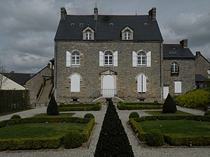
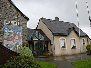
Crevin
Commune in Brittany, France
Distance: Approx. 558 meters
Latitude and longitude: 47.9381,-1.6606
Crevin (French pronunciation: [kʁəvɛ̃]; Gallo: Créven, Breton: Kreven) is a commune in the Ille-et-Vilaine department in Brittany in northwestern France.

Chanteloup, Ille-et-Vilaine
Commune in Brittany, France
Distance: Approx. 5248 meters
Latitude and longitude: 47.9667,-1.6142
Chanteloup (French pronunciation: [ʃɑ̃tlu]; Gallo: Chaunteló, Breton: Kantlou) is a commune in the Ille-et-Vilaine department in Brittany in northwestern France.

Canton of Le Sel-de-Bretagne
Former canton in Brittany, France
Distance: Approx. 4232 meters
Latitude and longitude: 47.8991347,-1.642276
The Canton of Le Sel-de-Bretagne is a former canton of France, in the Ille-et-Vilaine département, located in the south of the department. It was disbanded following the French canton reorganisation which came into effect in March 2015. It consisted of 8 communes, and its population was 7,255 in 2012.
Weather in this IP's area
clear sky
6 Celsius
4 Celsius
6 Celsius
6 Celsius
1016 hPa
93 %
1016 hPa
1007 hPa
10000 meters
2.57 m/s
110 degree
08:11:40
19:38:03