Country:
 France
Region:
City:
Latitude and Longitude:
Time Zone:
Postal Code:
IP information under different IP Channel
ip-api
Country
Region
City
ASN
Time Zone
ISP
Blacklist
Proxy
Latitude
Longitude
Postal
Route
IPinfo
Country
Region
City
ASN
Time Zone
ISP
Blacklist
Proxy
Latitude
Longitude
Postal
Route
MaxMind
Country
Region
City
ASN
Time Zone
ISP
Blacklist
Proxy
Latitude
Longitude
Postal
Route
Luminati
Country
FRRegion
bfc
City
saone
ASN
Time Zone
Europe/Paris
ISP
Orange
Latitude
Longitude
Postal
db-ip
Country
Region
City
ASN
Time Zone
ISP
Blacklist
Proxy
Latitude
Longitude
Postal
Route
ipdata
Country
Region
City
ASN
Time Zone
ISP
Blacklist
Proxy
Latitude
Longitude
Postal
Route
Popular places and events near this IP address
Chalezeule
Commune in Bourgogne-Franche-Comté, France
Distance: Approx. 4915 meters
Latitude and longitude: 47.26,6.0758
Chalezeule (French pronunciation: [ʃalzœl]) is a commune in the Doubs department in the Bourgogne-Franche-Comté region in eastern France.

La Chevillotte
Commune in Bourgogne-Franche-Comté, France
Distance: Approx. 4131 meters
Latitude and longitude: 47.2208,6.1669
La Chevillotte (French pronunciation: [la ʃəvijɔt]) is a commune in the Doubs department in the Bourgogne-Franche-Comté region in eastern France.

Mamirolle
Commune in Bourgogne-Franche-Comté, France
Distance: Approx. 4729 meters
Latitude and longitude: 47.1978,6.1622
Mamirolle (French pronunciation: [mamiʁɔl]) is a commune in the Doubs department in the Bourgogne-Franche-Comté region in eastern France.

Montfaucon, Doubs
Commune in Bourgogne-Franche-Comté, France
Distance: Approx. 2739 meters
Latitude and longitude: 47.2353,6.0806
Montfaucon (French pronunciation: [mɔ̃fokɔ̃]) is an affluent commune in the Doubs department in the region of Bourgogne-Franche-Comté, France.

Gennes, Doubs
Commune in Bourgogne-Franche-Comté, France
Distance: Approx. 2584 meters
Latitude and longitude: 47.2458,6.1219
Gennes (French pronunciation: [ʒɛn] ) is a commune in the Doubs department in the Bourgogne-Franche-Comté region in eastern France.

Le Gratteris
Commune in Bourgogne-Franche-Comté, France
Distance: Approx. 4812 meters
Latitude and longitude: 47.1842,6.1389
Le Gratteris is a commune in the Doubs department in the Bourgogne-Franche-Comté region in eastern France.

Morre
Commune in Bourgogne-Franche-Comté, France
Distance: Approx. 3515 meters
Latitude and longitude: 47.2264,6.0661
Morre (French pronunciation: [mɔʁ]) is a commune in the Doubs department in the Bourgogne-Franche-Comté region in eastern France.

Saône, Doubs
Commune in Bourgogne-Franche-Comté, France
Distance: Approx. 524 meters
Latitude and longitude: 47.2256,6.1186
Saône (French pronunciation: [son]) is a commune in the Doubs department in the Bourgogne-Franche-Comté region in eastern France.

La Vèze
Commune in Bourgogne-Franche-Comté, France
Distance: Approx. 3584 meters
Latitude and longitude: 47.2117,6.0683
La Vèze (French pronunciation: [la vɛz]) is a commune in the Doubs department in the Bourgogne-Franche-Comté region in eastern France.
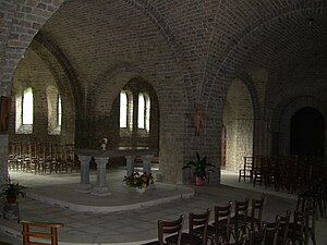
Our Lady of Liberation
Distance: Approx. 4632 meters
Latitude and longitude: 47.21972222,6.05138889
Our Lady of Liberation is a church built in an old fort at nearly 500 m of altitude near the hamlet of Chapelle des Buis, in the outskirts of the city of Besançon, in the department of Doubs, in eastern France.
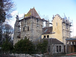
Château de la Juive
Residential castle in Chalezeule, France
Distance: Approx. 4730 meters
Latitude and longitude: 47.24888889,6.06222222
The Château de la Juive (in English: Castle of the Jewess; official name: Château de Clementigney), is a residential château located in the French city of Besançon (Franche-Comté). The first building was constructed at an unknown date, the earliest information going back to the 18th century. In the 19th century, a rich Jewish family (the Lippmans, founders of the LIP company) bought the house and transformed it into a luxurious villa.
Chapelle des Buis
Distance: Approx. 5003 meters
Latitude and longitude: 47.21833333,6.04666667
Chapelle des Buis is a hamlet south of the city of Besançon, in eastern France. It straddles the area of three communes: Besançon, Fontain and Morre. The church of Our Lady of Liberation is nearby.
Weather in this IP's area
few clouds
3 Celsius
1 Celsius
3 Celsius
4 Celsius
1018 hPa
94 %
1018 hPa
971 hPa
10000 meters
2.2 m/s
5.33 m/s
59 degree
24 %
07:40:03
19:07:27