Country:
 France
Region:
City:
Latitude and Longitude:
Time Zone:
Postal Code:
IP information under different IP Channel
ip-api
Country
Region
City
ASN
Time Zone
ISP
Blacklist
Proxy
Latitude
Longitude
Postal
Route
IPinfo
Country
Region
City
ASN
Time Zone
ISP
Blacklist
Proxy
Latitude
Longitude
Postal
Route
MaxMind
Country
Region
City
ASN
Time Zone
ISP
Blacklist
Proxy
Latitude
Longitude
Postal
Route
Luminati
Country
FRRegion
bfc
City
gray
ASN
Time Zone
Europe/Paris
ISP
Orange
Latitude
Longitude
Postal
db-ip
Country
Region
City
ASN
Time Zone
ISP
Blacklist
Proxy
Latitude
Longitude
Postal
Route
ipdata
Country
Region
City
ASN
Time Zone
ISP
Blacklist
Proxy
Latitude
Longitude
Postal
Route
Popular places and events near this IP address

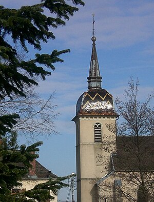
Gray, Haute-Saône
Commune in Bourgogne-Franche-Comté, France
Distance: Approx. 502 meters
Latitude and longitude: 47.445,5.5922
Gray (French pronunciation: [ɡʁe] ) is a commune in the Haute-Saône department, region of Bourgogne-Franche-Comté, eastern France.
Ancier
Commune in Bourgogne-Franche-Comté, France
Distance: Approx. 3065 meters
Latitude and longitude: 47.4489,5.6325
Ancier is a commune in the Haute-Saône department in the region of Bourgogne-Franche-Comté in eastern France.

Arc-lès-Gray
Commune in Bourgogne-Franche-Comté, France
Distance: Approx. 1075 meters
Latitude and longitude: 47.4581,5.5853
Arc-lès-Gray (French pronunciation: [aʁk lɛ ɡʁe], literally Arc near Gray) is a commune in the Haute-Saône department in the region of Bourgogne-Franche-Comté in eastern France.

Battrans
Commune in Bourgogne-Franche-Comté, France
Distance: Approx. 4123 meters
Latitude and longitude: 47.4294,5.6378
Battrans (French pronunciation: [batʁɑ̃]) is a commune in the Haute-Saône department in the region of Bourgogne-Franche-Comté in eastern France.
Chargey-lès-Gray
Commune in Bourgogne-Franche-Comté, France
Distance: Approx. 4484 meters
Latitude and longitude: 47.4883,5.5758
Chargey-lès-Gray (French pronunciation: [ʃaʁʒɛ lɛ ɡʁe], literally Chargey near Gray) is a commune in the Haute-Saône department in the region of Bourgogne-Franche-Comté in eastern France.

Rigny
Commune in Bourgogne-Franche-Comté, France
Distance: Approx. 4130 meters
Latitude and longitude: 47.4733,5.6339
Rigny (French pronunciation: [ʁiɲi]) is a commune in the Haute-Saône department in the region of Bourgogne-Franche-Comté in eastern France.
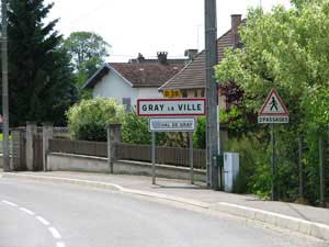
Gray-la-Ville
Commune in Bourgogne-Franche-Comté, France
Distance: Approx. 1741 meters
Latitude and longitude: 47.4403,5.5731
Gray-la-Ville (French pronunciation: [ɡʁe la vil]) is a commune in the Haute-Saône department, region of Bourgogne-Franche-Comté, eastern France.
Velet
Commune in Bourgogne-Franche-Comté, France
Distance: Approx. 2960 meters
Latitude and longitude: 47.4286,5.5675
Velet is a commune in the Haute-Saône department in the region of Bourgogne-Franche-Comté in eastern France.

Parc de l'Étang
Distance: Approx. 4123 meters
Latitude and longitude: 47.4294,5.6378
The Parc de l'Étang (3 hectares) is a private park with botanical garden and arboretum located on rue des Longeots, Battrans, Haute-Saône, Franche-Comté, France. It is open by appointment daily except Sunday in the warmer months; an admission fee is charged. The park was begun in 1971 with creation of a pond; the excavated soil was fashioned into surrounding berms, hills, and terraces.
Canton of Gray
Distance: Approx. 1225 meters
Latitude and longitude: 47.44,5.6
The canton of Gray is an administrative division of the Haute-Saône department, northeastern France. Its borders were modified at the French canton reorganisation which came into effect in March 2015. Its seat is in Gray.

Library of Gray
Distance: Approx. 413 meters
Latitude and longitude: 47.445827,5.592569
The Library of Gray was founded in 1799 after the confiscation of the properties of the Catholic Church. The library first opened in an old convent before moving to a proper building adjoining the city hall in 1859. The library is divided into two sections.
Murder of Alexia Daval
Murder in France, 2017
Distance: Approx. 738 meters
Latitude and longitude: 47.4446,5.5852
On 28 October 2017, Alexia Daval (née Fouillot; 18 February 1988 – 27 or 28 October 2017) was reported missing from her hometown of Gray-la-Ville, Haute-Saône, France, by her husband Jonathann Daval. Two days later, her body was discovered in a forest in Esmoulins. Three months later, Jonathann was arrested by the police and confessed to the murder.
Weather in this IP's area
clear sky
6 Celsius
3 Celsius
5 Celsius
6 Celsius
1018 hPa
95 %
1018 hPa
995 hPa
10000 meters
2.88 m/s
4.02 m/s
32 degree
4 %
07:42:17
19:09:23