Country:
Region:
City:
Latitude and Longitude:
Time Zone:
Postal Code:
IP information under different IP Channel
ip-api
Country
Region
City
ASN
Time Zone
ISP
Blacklist
Proxy
Latitude
Longitude
Postal
Route
Luminati
Country
ASN
Time Zone
Europe/Paris
ISP
Groupe convergence.com SAS
Latitude
Longitude
Postal
IPinfo
Country
Region
City
ASN
Time Zone
ISP
Blacklist
Proxy
Latitude
Longitude
Postal
Route
db-ip
Country
Region
City
ASN
Time Zone
ISP
Blacklist
Proxy
Latitude
Longitude
Postal
Route
ipdata
Country
Region
City
ASN
Time Zone
ISP
Blacklist
Proxy
Latitude
Longitude
Postal
Route
Popular places and events near this IP address

Saint-Omer
Subprefecture and commune in Hauts-de-France, France
Distance: Approx. 3180 meters
Latitude and longitude: 50.7461,2.2617
Saint-Omer (French pronunciation: [sɛ̃.t‿omɛʁ] ; West Flemish: Sint-Omaars; Picard: Saint-Onmé) is a commune and sub-prefecture of the Pas-de-Calais department in France. It is 68 km (42 mi) west-northwest of Lille on the railway to Calais, and is located in the Artois province. The town is named after Saint Audomar, who brought Christianity to the area.

Arques, Pas-de-Calais
Commune in Hauts-de-France, France
Distance: Approx. 275 meters
Latitude and longitude: 50.7361,2.3033
Arques (French pronunciation: [aʁk] ) is a commune in the Pas-de-Calais department in northern France, bordering Saint-Omer.
Fontinettes boat lift
Distance: Approx. 232 meters
Latitude and longitude: 50.7317,2.3033
The Fontinettes Boat Lift (French: Ascenseur des Fontinettes or Ascenseur à bateaux des Fontinettes was built in 1888 on the Canal de Neufossé and connected the river Aa and the Neuffossé Canal in Arques, near Saint-Omer in the Pas-de-Calais.
Lycée Alexandre Ribot
School in Saint-Omer, Pas-de-Calais, France
Distance: Approx. 3466 meters
Latitude and longitude: 50.7481,2.25874
The Lycée Alexandre Ribot is a school located at 42 rue Gambetta, in the town of Saint-Omer (Pas-de-Calais département), France. Founded as a Walloon Jesuit college in 1565 (the English College was founded nearby by English Jesuits in 1593), it has been a lycée since 1848. It was named in honor of its former student Alexandre Ribot in 1924.

Battle of Saint-Omer
Major field battle of the Hundred Years' War
Distance: Approx. 3180 meters
Latitude and longitude: 50.7461,2.2617
The Battle of Saint-Omer, fought on 26 July 1340, was a major engagement in the early stages of the Hundred Years' War, during Edward III's 1340 summer campaign against France launched from Flanders. The campaign was initiated in the aftermath of the English naval victory at the Battle of Sluys but was far less successful than Edward had hoped. At Saint-Omer, the heavily-outnumbered French men-at-arms, tasked with defending the city and awaiting reinforcements, unexpectedly defeated the Anglo-Flemish forces on their own.
Blendecques
Commune in Hauts-de-France, France
Distance: Approx. 2506 meters
Latitude and longitude: 50.7178,2.2772
Blendecques (French pronunciation: [blɑ̃dɛk]; West Flemish: Blendeke) is a commune in the Pas-de-Calais department in the Hauts-de-France region in northern France.
Campagne-lès-Wardrecques
Commune in Hauts-de-France, France
Distance: Approx. 2731 meters
Latitude and longitude: 50.7197,2.3342
Campagne-lès-Wardrecques (French pronunciation: [kɑ̃paɲ lɛ waʁdʁɛk], literally Campagne near Wardrecques) is a commune in the Pas-de-Calais department in the Hauts-de-France region of France.
Canton of Arques
Former canton in Hauts-de-France, France
Distance: Approx. 277 meters
Latitude and longitude: 50.73611,2.30333
The Canton of Arques is a former canton situated in the Pas-de-Calais département and in the Nord-Pas-de-Calais region of France. It was disbanded following the French canton reorganisation which came into effect in March 2015. It had a total of 20,550 inhabitants (2012, without double counting).
John Cowell (RAF airman)
Irish soldier, airman and flying ace
Distance: Approx. 3670 meters
Latitude and longitude: 50.73069444,2.2505
John J. Cowell, (1889 – 30 July 1918) was an Irish soldier, airman and flying ace of the First World War. He was credited with sixteen aerial victories; fifteen of these were gained as an observer/gunner and one as a pilot, before he was killed in action.

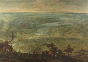
Siege of Saint-Omer
1638 battle of the Thirty Years' War
Distance: Approx. 3180 meters
Latitude and longitude: 50.7461,2.2617
The siege of Saint-Omer (24 May – 16 July 1638) was a siege in the Thirty Years' War in which a French army under Gaspard III de Coligny, Maréchal de Châtillon, laid siege to the Flemish city of Saint-Omer, defended by a small garrison in command of Lancelot II Schetz, count of Grobbendonck. Despite several initial successes in the capture of the minor forts around Saint-Omer, on the night of 8/9 June a Spanish relief army under Thomas Francis, Prince of Carignano, surprised Châtillon's troops and established a small fort in the middle of the French lines. An entire army corps under Maréchal de La Force was ordered to move towards Saint-Omer to support Châtillon siege, but on 12 July a further Imperial-Spanish force commanded by Ottavio Piccolomini entered Saint-Omer, resolving the French marshals to withdraw.
Battle of Arques (1303)
Battle in France
Distance: Approx. 275 meters
Latitude and longitude: 50.7361,2.3033
The Battle of Arques was fought on 4 April 1303 in the French city of Arques between the County of Flanders and the Kingdom of France.
George Hubert Kemp
Distance: Approx. 3615 meters
Latitude and longitude: 50.73088,2.25126
Second Lieutenant George Hubert Kemp (1897 – 1 June 1918) was a World War I British flying ace credited with twelve aerial victories. He served with the Durham Light Infantry, Royal Flying Corps, and Royal Air Force. The observer ace scored his last victory shortly before his death at age twenty in aerial combat over France.
Weather in this IP's area
broken clouds
7 Celsius
6 Celsius
7 Celsius
9 Celsius
1022 hPa
74 %
1022 hPa
1021 hPa
10000 meters
2.29 m/s
2.24 m/s
139 degree
62 %
07:49:38
17:19:08


