Country:
Region:
City:
Latitude and Longitude:
Time Zone:
Postal Code:
IP information under different IP Channel
ip-api
Country
Region
City
ASN
Time Zone
ISP
Blacklist
Proxy
Latitude
Longitude
Postal
Route
Luminati
Country
Region
occ
City
montpellier
ASN
Time Zone
Europe/Paris
ISP
Eurofiber France SAS
Latitude
Longitude
Postal
IPinfo
Country
Region
City
ASN
Time Zone
ISP
Blacklist
Proxy
Latitude
Longitude
Postal
Route
db-ip
Country
Region
City
ASN
Time Zone
ISP
Blacklist
Proxy
Latitude
Longitude
Postal
Route
ipdata
Country
Region
City
ASN
Time Zone
ISP
Blacklist
Proxy
Latitude
Longitude
Postal
Route
Popular places and events near this IP address

Mauguio
Commune in Occitania, France
Distance: Approx. 2906 meters
Latitude and longitude: 43.6169,4.0083
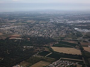
Mauguio (French pronunciation: [moɡjo] ; Occitan: Mauguiò, primarily Melguelh) is a commune in the Hérault department in southern France.

Vendargues
Commune in Occitania, France
Distance: Approx. 4155 meters
Latitude and longitude: 43.6583,3.97
Vendargues is a commune in the Hérault department in the Occitanie region in southern France. Since 2006, Vendargues has been twinned with Clackmannanshire, Scotland.
Baillargues
Commune in Occitania, France
Distance: Approx. 2195 meters
Latitude and longitude: 43.6619,4.0136
Baillargues (French pronunciation: [bajaʁɡ] ; Occitan: Balhargues) is a commune in the Hérault department in the Occitanie region in southern France. Baillargues station has rail connections to Narbonne, Montpellier and Avignon.
Saint-Brès, Hérault
Commune in Occitania, France
Distance: Approx. 3089 meters
Latitude and longitude: 43.6683,4.03
Saint-Brès (French pronunciation: [sɛ̃ bʁɛs]; Occitan: Sant Breç) is a commune in the Hérault department in the Occitanie region in southern France.

Valergues
Commune in Occitania, France
Distance: Approx. 4715 meters
Latitude and longitude: 43.6686,4.0625
Valergues (French pronunciation: [valɛʁɡ]; Occitan: Valèrgues) is a commune in the Hérault department in the Occitanie region in southern France. Valergues-Lansargues station has rail connections to Narbonne, Montpellier and Avignon.
Mudaison
Commune in Occitania, France
Distance: Approx. 1962 meters
Latitude and longitude: 43.6472,4.04
Mudaison (French pronunciation: [mydɛzɔ̃]; Occitan: Mudason) is a commune in the Hérault department in the Occitanie region in southern France.
Saint-Aunès
Commune in Occitania, France
Distance: Approx. 4097 meters
Latitude and longitude: 43.6408,3.9658
Saint-Aunès (French pronunciation: [sɛ̃.t‿onɛs] ; Occitan: Sant Aunès) is a commune in the Hérault department in the Occitanie region in southern France. Saint-Aunès station has rail connections to Narbonne, Montpellier and Avignon.
Château de Castries
Distance: Approx. 4575 meters
Latitude and longitude: 43.67734167,3.98693056
The Château de Castries is a château in Castries, Hérault, France.

Canton of Mauguio
Canton in Occitania, France
Distance: Approx. 2539 meters
Latitude and longitude: 43.62,4.01
The canton of Mauguio is an administrative division of the Hérault department, southern France. Its borders were modified at the French canton reorganisation which came into effect in March 2015. Its seat is in Mauguio.
Saint-Aunès station
Railway station in Saint-Aunès, France
Distance: Approx. 4361 meters
Latitude and longitude: 43.63543,3.96332
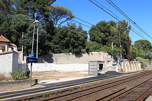
St-Aunès is a railway station in Saint-Aunès, Occitanie, southern France. Within TER Occitanie, it is part of line 21 (Narbonne–Avignon).

Baillargues station
Distance: Approx. 1446 meters
Latitude and longitude: 43.65327,4.00699
Baillargues Is a railway station in Baillargues, Occitanie, southern France. Within TER Occitanie, it is part of line 21 (Narbonne–Avignon).
Communauté d'agglomération du Pays de l'Or
Communauté d'agglomération in Occitania, France
Distance: Approx. 3156 meters
Latitude and longitude: 43.61666667,4.03333333
Communauté d'agglomération du Pays de l'Or is the communauté d'agglomération, an intercommunal structure, centred on the town of Mauguio. It is located in the Hérault department, in the Occitania region, southern France. Created in 1993, its seat is in Mauguio.
Weather in this IP's area
broken clouds
16 Celsius
16 Celsius
15 Celsius
17 Celsius
1025 hPa
88 %
1025 hPa
1023 hPa
10000 meters
5.14 m/s
60 degree
75 %
07:25:14
17:29:49


