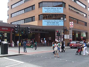
109.176.251.150 - IP Lookup: Free IP Address Lookup, Postal Code Lookup, IP Location Lookup, IP ASN, Public IP
Country:
Region:
City:
Location:
Time Zone:
Postal Code:
IP information under different IP Channel
ip-api
Country
Region
City
ASN
Time Zone
ISP
Blacklist
Proxy
Latitude
Longitude
Postal
Route
Luminati
Country
ASN
Time Zone
Europe/London
ISP
Hivelocity LLC
Latitude
Longitude
Postal
IPinfo
Country
Region
City
ASN
Time Zone
ISP
Blacklist
Proxy
Latitude
Longitude
Postal
Route
IP2Location
109.176.251.150Country
Region
england
City
harrow
Time Zone
Europe/London
ISP
Language
User-Agent
Latitude
Longitude
Postal
db-ip
Country
Region
City
ASN
Time Zone
ISP
Blacklist
Proxy
Latitude
Longitude
Postal
Route
ipdata
Country
Region
City
ASN
Time Zone
ISP
Blacklist
Proxy
Latitude
Longitude
Postal
Route
Popular places and events near this IP address
Harrow-on-the-Hill station
London Underground and railway station
Distance: Approx. 357 meters
Latitude and longitude: 51.5794,-0.337
Harrow-on-the-Hill is an interchange railway station in Harrow, served by suburban London Underground Metropolitan line services and commuter National Rail services on the London–Aylesbury line. It is 9 miles 18 chains (9.23 mi; 14.85 km) down the line from London Marylebone. Harrow-on-the-Hill is the final Metropolitan line station from Central London before the line splits with the main branch towards Watford, Chesham or Amersham and the diverged Uxbridge branch towards Uxbridge.
Harrow College
Further education school in Harrow, Middlesex, England
Distance: Approx. 253 meters
Latitude and longitude: 51.578,-0.3357
Harrow College is a further education college in England with two campuses, in Harrow and Harrow Weald. It was established in 1999 by the merger of two tertiary colleges; in 2017 it legally merged with Uxbridge College, and in 2023 merged with Richmond upon Thames College, forming Harrow, Richmond & Uxbridge Colleges (HRUC). Harrow College is (as of 2013) medium-sized and had over 2,400 full-time and 4,700 part-time learners.
St Mary's Church, Harrow on the Hill
Church in London, England
Distance: Approx. 601 meters
Latitude and longitude: 51.57416667,-0.3375
St Mary's, Harrow on the Hill, is the Borough and Parish Church at Harrow on the Hill in northwest London, England. It is a Grade I-listed building.

Harrow Central (UK Parliament constituency)
Parliamentary constituency in the United Kingdom, 1950–1983
Distance: Approx. 575 meters
Latitude and longitude: 51.58,-0.34
Harrow Central was a parliamentary constituency in Harrow, London, which returned one Member of Parliament (MP) to the House of Commons of the Parliament of the United Kingdom from 1950 until it was abolished for the 1983 general election.
Greenhill, Harrow
Human settlement in England
Distance: Approx. 621 meters
Latitude and longitude: 51.5839,-0.3336
Greenhill was an ecclesiastical parish and present day ward with similar but not identical boundaries in the London Borough of Harrow.

Harrow High School
Academy in Harrow, Greater London, England
Distance: Approx. 396 meters
Latitude and longitude: 51.58053,-0.32752
Harrow High School is a co-educational academy in the London Borough of Harrow and a specialist Sports College. It was previously called Gayton High School and Harrow County School for Boys. The school has a sixth form for post-16 studies part of the Harrow Sixth Form Collegiate.
Harrow bus station
Bus station in Greater London, England
Distance: Approx. 431 meters
Latitude and longitude: 51.5801,-0.3377
Harrow bus station serves the town of Harrow in Greater London, England. It is owned and maintained by Transport for London. The bus station is on College Road, opposite the St Ann's Shopping Centre and approximately 100 metres from the Harrow-on-the-Hill rail and tube stations.

St Anns (Harrow)
Shopping mall in Harrow, England
Distance: Approx. 400 meters
Latitude and longitude: 51.58070278,-0.33654167
St. Anns is a shopping centre in Harrow town centre in Greater London, England. It has two entrances, one on College Road opposite Harrow-on-the-Hill station and another on the pedestrianised St Anns Road.

Our Lady and St Thomas of Canterbury, Harrow
Roman Catholic church in London
Distance: Approx. 622 meters
Latitude and longitude: 51.57647,-0.340543
Our Lady and St Thomas of Canterbury is a Grade II listed Roman Catholic church at 22 Roxborough Park, Harrow-on-the-Hill, London. It was built in 1894 in a 14th-century style, and the architect was Arthur Young.

St George's Shopping Centre, Harrow
Shopping mall in Harrow , England
Distance: Approx. 594 meters
Latitude and longitude: 51.5814,-0.3392
St George's is a covered shopping centre in Harrow, Greater London, which opened in 1996. It is located at St Anns Road in the town centre nearby but separate from the St Anns centre. As of 2015 the centre has 30 units for retail, leisure and restaurant uses across three floors, including TK Maxx, Boots, Nando's, Vue and Fitness First.

The Grove, Harrow School
Boarding house of Harrow School
Distance: Approx. 531 meters
Latitude and longitude: 51.57444444,-0.33638889
The Grove (), is a boarding house for Harrow School, in Harrow on the Hill, Greater London, England. The Grove was converted into a boarding house in 1820 and is a Grade II listed building. It was constructed on the site of a rectory manor to St Mary's Church, Harrow on the Hill which was built around 1094.
International Centre of Justice for Palestinians
Distance: Approx. 581 meters
Latitude and longitude: 51.58141112,-0.3389544
International Centre of Justice for Palestinians or ICJP is a group of lawyers, academics and politicians that makes public statements and organises legal actions in relation to the human rights of Palestinians.
Weather in this IP's area
mist
3 Celsius
-0 Celsius
1 Celsius
4 Celsius
1041 hPa
92 %
1041 hPa
1035 hPa
7000 meters
2.57 m/s
180 degree
100 %


