Country:
Region:
City:
Latitude and Longitude:
Time Zone:
Postal Code:
IP information under different IP Channel
ip-api
Country
Region
City
ASN
Time Zone
ISP
Blacklist
Proxy
Latitude
Longitude
Postal
Route
Luminati
Country
Region
sh
City
sharjah
ASN
Time Zone
Asia/Dubai
ISP
Iomart Managed Services Limited
Latitude
Longitude
Postal
IPinfo
Country
Region
City
ASN
Time Zone
ISP
Blacklist
Proxy
Latitude
Longitude
Postal
Route
db-ip
Country
Region
City
ASN
Time Zone
ISP
Blacklist
Proxy
Latitude
Longitude
Postal
Route
ipdata
Country
Region
City
ASN
Time Zone
ISP
Blacklist
Proxy
Latitude
Longitude
Postal
Route
Popular places and events near this IP address
Al Hazzanah
Human settlement in United Arab Emirates
Distance: Approx. 3365 meters
Latitude and longitude: 25.3714,55.4209
Al Hazzanah (Arabic: الحزانة) is a suburb in the city of Sharjah, United Arab Emirates.
Sharjah Cricket Stadium
Test cricket stadium in the United Arab Emirates
Distance: Approx. 1165 meters
Latitude and longitude: 25.33083333,55.42083333
The Sharjah Cricket Stadium (Arabic: ملعب الشارقة للكريكيت) is in Sharjah in the United Arab Emirates. It holds the record for being the venue that hosted the highest number of international matches, 294 matches, up to March 17 2024. It was originally constructed in the early 1980s and has been much improved over the years.
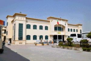
Etisalat University College
Distance: Approx. 577 meters
Latitude and longitude: 25.34628,55.42127
Etisalat University College (EUC) was a private college for men that was established by Etisalat by e& for engineering and was located in the city of Sharjah, United Arab Emirates, with programs in Engineering and Applied sciences. The college had departments for Communication engineering, Computer engineering, Electronic engineering, and General Studies. The university college complex was designed by the Italian architect Renato Restelli, project architect for WS Atkins International, winner of a design competition held in 1986.
Sharjah Stadium (football)
Sports stadium in the UAE
Distance: Approx. 934 meters
Latitude and longitude: 25.3332,55.4196
Sharjah Stadium (Arabic: استاد الشارقة) is a multi-purpose stadium in Sharjah, United Arab Emirates. It is currently used mostly for football matches and is the home ground of Sharjah FC. The stadium has a capacity of 18,000.
International School of Choueifat, Sharjah
Distance: Approx. 1346 meters
Latitude and longitude: 25.32968,55.42645
The International School of Choueifat, Sharjah is a branch of the International School of Choueifat located in Sharjah, United Arab Emirates that follows the 'SABIS' system. The school opened in 1975 and is located beside Sharjah Cricket Stadium. It was the first Choueifat School in the Middle East outside of Lebanon.

Sharjah Indian School
Secondary school in UAE
Distance: Approx. 1460 meters
Latitude and longitude: 25.34471337,55.40841941
Sharjah Indian School is a senior secondary school in Sharjah, United Arab Emirates, having approximately 13,937 students and 588 teachers. It is owned and managed by Indian Association Sharjah, located in the United Arab Emirates. It expanded in 2016 to a new building in the Juwaiza area of Sharjah near Sajaa.

Russian Orthodox Church, Sharjah
Russian Orthodox Church in Sharjah
Distance: Approx. 2079 meters
Latitude and longitude: 25.350086,55.404226
St. Philip the Apostle Russian Orthodox Church is a Russian Orthodox Church located in Sharjah, United Arab Emirates. The church is the biggest church in the country, with an area of 1,800 square metres (19,000 sq ft) capacity of 20,000 worshippers.

Abu Shagara
Populated area in Sharjah, UAE
Distance: Approx. 2716 meters
Latitude and longitude: 25.336307,55.395949
Abu Shagara or Bu Shaghara is a populated residential area in the emirate of Sharjah, UAE. It is one of the thickly populated areas of the Emirates. One of the biggest parks is Abu Shagara Park.

Mahatta Fort
Distance: Approx. 2784 meters
Latitude and longitude: 25.346107,55.395265
Mahatta Fort ("the station" in Arabic) is located in central Sharjah in the United Arab Emirates. The fort was built by the Ruler of Sharjah in 1932 to afford protection for the passengers and staff of Imperial Airways. It was the first British establishment on the Trucial Coast, after an agreement was struck between the British government (on behalf of Imperial Airways) and the ruler of Sharjah in June 1932.
German International School Sharjah
Distance: Approx. 1242 meters
Latitude and longitude: 25.35126,55.42774
German International School Sharjah (German: Deutsche Internationale Schule Sharjah, DSS) is a German international school in Sharjah in the UAE, serving kindergarten through grade 12.It was established in 1976.
Sharjah Science Museum
Distance: Approx. 968 meters
Latitude and longitude: 25.34965,55.42465
Sharjah Science Museum (متحف الشارقة العلمي) is a science museum in Sharjah, United Arab Emirates. The museum opened on 17 April 1996. It includes over 50 interactive exhibits.
Sharjah Archaeology Museum
Archaeological museum in the UAE
Distance: Approx. 792 meters
Latitude and longitude: 25.3482,55.4238
The Sharjah Archaeology Museum is the first museum in Sharjah, the capital of the Emirate of Sharjah in the United Arab Emirates. The museum showcases artifacts that were found in Sharjah and that belong to pre-Islamic eras. The museum was established on October 5, 1997, by Sheikh Sultan Bin Muhammad Al-Qasimi, member of the Federal Supreme Council of the United Arab Emirates.
Weather in this IP's area
haze
27 Celsius
29 Celsius
27 Celsius
27 Celsius
1013 hPa
74 %
1013 hPa
1012 hPa
4500 meters
2.57 m/s
190 degree
2 %
06:35:00
17:30:45
