Country:
 Russian Federation
Region:
City:
Latitude and Longitude:
Time Zone:
Postal Code:
IP information under different IP Channel
ip-api
Country
Region
City
ASN
Time Zone
ISP
Blacklist
Proxy
Latitude
Longitude
Postal
Route
IPinfo
Country
Region
City
ASN
Time Zone
ISP
Blacklist
Proxy
Latitude
Longitude
Postal
Route
MaxMind
Country
Region
City
ASN
Time Zone
ISP
Blacklist
Proxy
Latitude
Longitude
Postal
Route
Luminati
Country
RURegion
vgg
City
kuybyshev
ASN
Time Zone
Europe/Volgograd
ISP
Rostelecom
Latitude
Longitude
Postal
db-ip
Country
Region
City
ASN
Time Zone
ISP
Blacklist
Proxy
Latitude
Longitude
Postal
Route
ipdata
Country
Region
City
ASN
Time Zone
ISP
Blacklist
Proxy
Latitude
Longitude
Postal
Route
Popular places and events near this IP address

Samara (Volga)
River in Russia
Distance: Approx. 2492 meters
Latitude and longitude: 53.16694444,50.06194444
The Samara (Russian: Сама́ра, IPA: [sɐˈmarə]) is a river in Russia and a left-bank tributary of the Volga. It flows into the Volga at the city of Samara. Its largest tributary is the Bolshoy Kinel.
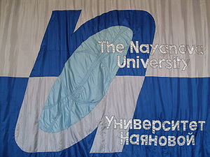
Samara state academy for gifted children
State budgetary academy of the Samara State
Distance: Approx. 2615 meters
Latitude and longitude: 53.2008,50.1059
Samara state academy for gifted children (Nayanova) previously known as Nayanova University, is a primary and secondary school in Samara, Russia. It was founded in 1988. The permanent rector of the school, from the date of its foundation, is Nayanova Marina Venediktovna.

Stalin's bunker, Samara
Distance: Approx. 1936 meters
Latitude and longitude: 53.19675,50.09805556
Stalin's bunker (Russian: Бункер Сталина) is an air raid shelter located near Samara State University of Culture in Samara (former Kuybyshev), Russia. It is a subterranean bunker complex constructed between February and October 1942. It was the alternative Supreme High Command General Headquarters of the Soviet Armed Forces intended for Joseph Stalin during World War II. Stalin's Bunker is located 37 metres (121 ft) beneath the Kuybyshev CPSU oblast Committee building (now Samara State University of Culture occupies it), 100 metres (110 yd) south-east of the Samara Academy Theater.

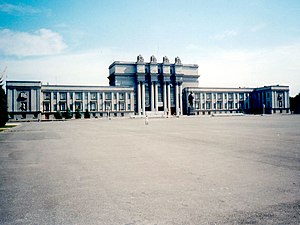
Samara railway station
Railway station in Samara, Russia
Distance: Approx. 3230 meters
Latitude and longitude: 53.18583333,50.12083333
Samara-Passazhirskaya (Russian: Самара-Пассажирская) is a major railway station of the Kuybyshev Railway in Samara, Russia.

Samara Governorate
1850–1928 unit of Russia
Distance: Approx. 2996 meters
Latitude and longitude: 53.1833,50.1167
Samara Governorate (Russian: Самарская губерния, romanized: Samarskaya guberniya) was an administrative-territorial unit (guberniya) of the Russian Empire and the Russian SFSR, located in the Volga Region. It existed from 1850 to 1928; its capital was in Samara.

Sacred Heart Church, Samara
Church in Samara, Russia
Distance: Approx. 1683 meters
Latitude and longitude: 53.1939,50.0961
The Sacred Heart Church (Russian: Храм Пресвятого Сердца Иисуса) is a Catholic church, of neogothic style located in the historic center of the city of Samara, Russia. In 1902 it was decided to expand and build a church of red brick neo-Gothic style. At a cost of 80 thousand rubles, the project was entrusted to the Polish architect Bogdanovich (or Bohdanowicz), who built the Cathedral of the Immaculate Conception in Moscow.
Kuybyshev Square
Public square in Samara, Russia
Distance: Approx. 2080 meters
Latitude and longitude: 53.1957,50.1013
Kuybyshev Square (Russian: Площадь Куйбышева, Ploshad' Kuybysheva) is a public square in Samara, Russia, located in the city's historic center between Chapaevskaya, Vilonovska, Galaktionovskaya, and Krasnoarmeyskaya streets in Leninsky District. Kuybyshev Square is one of the largest city squares in the world at fifteen hectares (150,000m²), and is the second largest public square in Russia and in Europe. The Samara State Academic Opera and Ballet Theatre and public gardens covering seven hectares are located on the square.

Monument of Glory, Samara
Monument in Slavy Square in Samara, Russia
Distance: Approx. 2999 meters
Latitude and longitude: 53.20361111,50.10972222
The Monument of Glory (Russian: Монумент славы, Monument slavy) is the focal point of Slavy Square in Samara (former Kuybyshev), Russia, overlooking the Volga river to the north-west. It is dedicated to the Kuybyshev workers of aircraft industry, who were working hard during and following the Great Patriotic War. The monument is one of the most prominent symbols of Samara.

Samara embankment
Distance: Approx. 658 meters
Latitude and longitude: 53.18969444,50.08222222
The Samara embankment (Russian: Самарская набережная; Samarskaya naberezhnaya) is a 5 km long pedestrianized street along the left bank of the Volga river in Central Samara, Russia. It spans between Lesnaya Street and Samara river port.

Strukovsky Garden
Park in Samara, Russia
Distance: Approx. 1731 meters
Latitude and longitude: 53.19738889,50.09377778
Strukovsky Garden (Russian: Струковский сад, romanized: Strukovsky sad) is a central urban park in Samara, Russia, named after Russian colonel and Active State Councillor Grigory Nikanorovich Strukov. It is the oldest park in the city. The park was established in 1849 in the city Centre.

Monument to Vasily Chapaev (Samara)
Distance: Approx. 1886 meters
Latitude and longitude: 53.197008,50.096956
Monument to Vasily Chapaev – is a monument to Vasily Ivanovich Chapaev in Samara, installed in Chapaev Square in front of the drama theatre.

Cathedral of Christ the Saviour (Samara)
Orthodox cathedral in Samara, Russia
Distance: Approx. 2079 meters
Latitude and longitude: 53.1954,50.1015
Cathedral of Christ the Saviour was a cathedral of the Samara diocese of the Russian Orthodox Church, located in Samara. The cathedral could hold 2500 people and was built in 1869-1894 in the neo-Byzantine style, which, according to some experts, became the prototype for several orthodox churches: five-domed with a high bell tower, combining the characteristic features of Byzantine and Russian architectural styles. The construction was funded by donations from the inhabitants of the province, mainly merchants, as well as the city of Samara.
Weather in this IP's area
overcast clouds
14 Celsius
12 Celsius
14 Celsius
14 Celsius
1015 hPa
49 %
1015 hPa
1012 hPa
10000 meters
3 m/s
8.63 m/s
175 degree
100 %
06:53:41
18:00:26