Country:
 Great Britain
Region:
City:
Latitude and Longitude:
Time Zone:
Postal Code:
IP information under different IP Channel
ip-api
Country
Region
City
ASN
Time Zone
ISP
Blacklist
Proxy
Latitude
Longitude
Postal
Route
IPinfo
Country
Region
City
ASN
Time Zone
ISP
Blacklist
Proxy
Latitude
Longitude
Postal
Route
MaxMind
Country
Region
City
ASN
Time Zone
ISP
Blacklist
Proxy
Latitude
Longitude
Postal
Route
Luminati
Country
GBASN
Time Zone
Europe/London
ISP
Iomart Cloud Services Limited
Latitude
Longitude
Postal
db-ip
Country
Region
City
ASN
Time Zone
ISP
Blacklist
Proxy
Latitude
Longitude
Postal
Route
ipdata
Country
Region
City
ASN
Time Zone
ISP
Blacklist
Proxy
Latitude
Longitude
Postal
Route
Popular places and events near this IP address

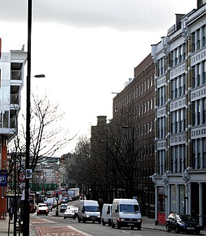
Farringdon station
National rail and London Underground station
Distance: Approx. 53 meters
Latitude and longitude: 51.52055556,-0.105
Farringdon is an interchange station located in Clerkenwell, London, England, in the London Borough of Islington, just outside the boundary of the City of London for London Underground, Elizabeth line and National Rail services. The station is served by the Underground's Circle, Hammersmith & City, and Metropolitan lines between King's Cross St Pancras and Barbican, the Elizabeth line between Tottenham Court Road and Liverpool Street, and the Thameslink route between St Pancras and City Thameslink. Opened in 1863 as the terminus of the Metropolitan Railway, the world's first underground passenger railway, Farringdon is one of the oldest surviving underground railway stations in the world.
Farringdon, London
Human settlement in England
Distance: Approx. 151 meters
Latitude and longitude: 51.520905,-0.103675
Farringdon is an area in the London Borough of Islington, situated immediately north of its border with the City of London. The term is used to describe the area around Farringdon station. Historically the district corresponded to southern Clerkenwell and the small parish of St Sepulchre Middlesex.
Farringdon Road
Distance: Approx. 25 meters
Latitude and longitude: 51.52027778,-0.10583333
Farringdon Road is a road in Clerkenwell, London.

Saffron Hill
Street in the London Borough of Camden
Distance: Approx. 71 meters
Latitude and longitude: 51.52016667,-0.10664167
Saffron Hill is a street and former ward in Holborn, in the south eastern corner of the London Borough of Camden, between Farringdon Road and Hatton Garden. The name of the street derives from the fact that it was at one time part of an estate on which saffron grew. The ecclesiastical parish was St Peter, Saffron Hill, a daughter parish of Holborn, which is now combined with St Alban (the Martyr), Holborn.

London Lesbian and Gay Centre
Distance: Approx. 147 meters
Latitude and longitude: 51.52,-0.1038
The London Lesbian and Gay Centre was a lesbian and gay community centre located at 67–69 Cowcross Street, London. It was established in 1985 by the Greater London Council (GLC), which donated three-quarters of a million pounds to its establishment. In 1984 The GLC published Changing The World – a charter of gay rights and supported a number of open meetings in the council chamber of County Hall during that summer.

The Aquarium L-13
Distance: Approx. 37 meters
Latitude and longitude: 51.5205,-0.1063
The Aquarium L-13 was a contemporary commercial art gallery run by Steve Lowe. It was originally based in a Georgian building in Bloomsbury, London, and then moved to Farringdon. It worked with artists, musicians and writers, and specialised in more unorthodox punk-based art work, including Jamie Reid, Jimmy Cauty, Billy Childish, Sexton Ming and artists associated with the indie label Stolen Recordings.

We Are With You
UK mental health and substance abuse charity
Distance: Approx. 147 meters
Latitude and longitude: 51.52,-0.1038
We Are With You (formerly known as Addaction) are a British charity founded in 1967 that support people to make positive behavioural changes, most notably with alcohol abuse, drug misuse, and mental health. The charity works extensively throughout England and Scotland, with an administrative base in Farringdon, central London. Previously named Addaction, it changed its name to We Are With You in February 2020.
L-13 Light Industrial Workshop
Art studio in London
Distance: Approx. 37 meters
Latitude and longitude: 51.5205,-0.1063
L-13 Light Industrial Workshop is a contemporary art studio and publisher that opened in May 2009 in Clerkenwell, London. Founded and operated by Steve Lowe, it is a revised incarnation of his previous galleries and small presses, ‘the aquarium’ and The Aquarium L-13, and works with a small group of artists known for their unorthodox stances, in developing, exhibiting and publishing their work.

Cowcross Street
Street in London, England
Distance: Approx. 80 meters
Latitude and longitude: 51.5198,-0.1055
Cowcross Street is a street in London. It runs east–west, from St John Street in the east, to Farringdon Road in the west.

Turnmill Street
Distance: Approx. 77 meters
Latitude and longitude: 51.521,-0.105
Turnmill Street is a street in Clerkenwell, London. It runs north–south from Clerkenwell Road in the north, to Cowcross Street in the south. One of the oldest streets in London, it has been variously known as Turnmill and Turnbull Street over its history.

The Castle, Farringdon
Grade II listed pub in London, England
Distance: Approx. 99 meters
Latitude and longitude: 51.520266,-0.10438
The Castle is a Grade II listed public house at 34-35 Cowcross Street, Farringdon, London. A public house of this name has existed on this site since at least the 18th century. Eliza, the wife of Sir John Soane, was born on the same site in 1760.

Farringdon Road drill hall
Distance: Approx. 56 meters
Latitude and longitude: 51.52055,-0.10656
The Farringdon Road drill hall is a former military installation at 57A Farringdon Road in Finsbury, London.
Weather in this IP's area
clear sky
16 Celsius
16 Celsius
15 Celsius
18 Celsius
1023 hPa
84 %
1023 hPa
1021 hPa
10000 meters
4.63 m/s
40 degree
06:42:12
19:06:08