109.164.109.57 - IP Lookup: Free IP Address Lookup, Postal Code Lookup, IP Location Lookup, IP ASN, Public IP
Country:
Region:
City:
Location:
Time Zone:
Postal Code:
IP information under different IP Channel
ip-api
Country
Region
City
ASN
Time Zone
ISP
Blacklist
Proxy
Latitude
Longitude
Postal
Route
Luminati
Country
Region
31
City
ceskebudejovice
ASN
Time Zone
Europe/Prague
ISP
STARNET, s.r.o.
Latitude
Longitude
Postal
IPinfo
Country
Region
City
ASN
Time Zone
ISP
Blacklist
Proxy
Latitude
Longitude
Postal
Route
IP2Location
109.164.109.57Country
Region
kraj vysocina
City
starec
Time Zone
Europe/Prague
ISP
Language
User-Agent
Latitude
Longitude
Postal
db-ip
Country
Region
City
ASN
Time Zone
ISP
Blacklist
Proxy
Latitude
Longitude
Postal
Route
ipdata
Country
Region
City
ASN
Time Zone
ISP
Blacklist
Proxy
Latitude
Longitude
Postal
Route
Popular places and events near this IP address

Borovina
Place in Vysočina, Czech Republic
Distance: Approx. 1734 meters
Latitude and longitude: 49.20666667,15.8475
Borovina is one of the town districts of Třebíč in the Czech Republic and it has a so-called new part and old part. In old part there are mainly family houses, then in younger part of Borovina there are many panel blocks of flats and it is near the market town of Stařeč and it was built in the seventies of twentieth century. The new part is situated in Valley of the Stařečský potok (Stařeč brook) and also there is situated Borovinský rybník (Pond of Borovina) A lot of staff working for Dukovany Nuclear Power Station live in Borovina district.

Horka Domky
Place in Vysočina, Czech Republic
Distance: Approx. 4188 meters
Latitude and longitude: 49.20861111,15.88305556
Horka-Domky is one of the districts of Třebíč in the Czech Republic. There are apartment blocks and family house here. The TEDOM company is based in this town.

Westmoravian College Třebíč
College in Třebíč
Distance: Approx. 1734 meters
Latitude and longitude: 49.20666667,15.8475
West Moravian College in Třebíč (Czech: Západomoravská vysoká škola Třebíč) was a private college located in Třebíč, Czech Republic. It was officially closed in 2019. The college was founded in 2003 in place of the elementary public school ZŠ Za rybníkem in Borovina.

Jejkov
Town district in Czech Republic
Distance: Approx. 4040 meters
Latitude and longitude: 49.2,15.88333333
Jejkov is a town district in Třebíč. Jejkov was a suburb in the past. An industrial town district, hockey stadium, football stadium, hospital and court are situated in Jejkov.
Mastník
Municipality in Vysočina, Czech Republic
Distance: Approx. 1951 meters
Latitude and longitude: 49.18027778,15.82777778
Mastník is a municipality and village in Třebíč District in the Vysočina Region of the Czech Republic. It has about 200 inhabitants.

Jewish Quarter and St Procopius' Basilica in Třebíč
UNESCO World Heritage Site in Vysočina Region, Czech Republic
Distance: Approx. 4293 meters
Latitude and longitude: 49.21722222,15.87888889
Jewish Quarter and St Procopius' Basilica in Třebíč (Czech: Židovská čtvrť a bazilika sv. Prokopa v Třebíči) is the official name of the UNESCO World Heritage site in Třebíč, Czech Republic. It consists of: the Jewish Quarter of Třebíč and the St.
Čechočovice
Municipality in Vysočina, Czech Republic
Distance: Approx. 2555 meters
Latitude and longitude: 49.20277778,15.79361111
Čechočovice is a municipality and village in Třebíč District in the Vysočina Region of the Czech Republic. It has about 300 inhabitants. Čechočovice lies approximately 7 kilometres (4 mi) west of Třebíč, 27 km (17 mi) south-east of Jihlava, and 140 km (87 mi) south-east of Prague.

Krahulov
Municipality in Vysočina, Czech Republic
Distance: Approx. 3160 meters
Latitude and longitude: 49.22305556,15.80805556
Krahulov is a municipality and village in Třebíč District in the Vysočina Region of the Czech Republic. It has about 300 inhabitants. Krahulov lies approximately 6 kilometres (4 mi) west of Třebíč, 25 km (16 mi) south-east of Jihlava, and 139 km (86 mi) south-east of Prague.

Mikulovice (Třebíč District)
Municipality in Vysočina, Czech Republic
Distance: Approx. 4248 meters
Latitude and longitude: 49.16166667,15.84666667
Mikulovice (German: Nikolowitz) is a municipality and village in Třebíč District in the Vysočina Region of the Czech Republic. It has about 200 inhabitants. Mikulovice lies approximately 7 kilometres (4 mi) south of Třebíč, 33 km (21 mi) south-east of Jihlava, and 146 km (91 mi) south-east of Prague.

Rokytnice nad Rokytnou
Market town in Vysočina, Czech Republic
Distance: Approx. 4277 meters
Latitude and longitude: 49.18444444,15.77277778
Rokytnice nad Rokytnou is a market town in Třebíč District in the Vysočina Region of the Czech Republic. It has about 800 inhabitants.

Stařeč
Market town in Vysočina, Czech Republic
Distance: Approx. 12 meters
Latitude and longitude: 49.19777778,15.82805556
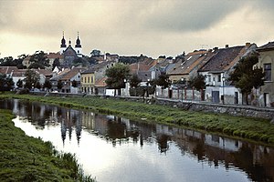
Stařeč (German: Startsch) is a market town in Třebíč District in the Vysočina Region of the Czech Republic. It has about 1,700 inhabitants.

St. Procopius Basilica in Třebíč
UNESCO World Heritage Site in Vysočina Region, Czech Republic
Distance: Approx. 3951 meters
Latitude and longitude: 49.21695278,15.87363611
St. Procopius Basilica (Czech: Bazilika svatého Prokopa) is a Romanesque-Gothic Christian church in Třebíč, Czech Republic. It was built on the site of the original Virgin Mary's Chapel of the Benedictine monastery in 1240–1280.
Weather in this IP's area
overcast clouds
-3 Celsius
-3 Celsius
-3 Celsius
-2 Celsius
1039 hPa
78 %
1039 hPa
973 hPa
10000 meters
0.45 m/s
2.24 m/s
257 degree
96 %

