109.164.108.38 - IP Lookup: Free IP Address Lookup, Postal Code Lookup, IP Location Lookup, IP ASN, Public IP
Country:
Region:
City:
Location:
Time Zone:
Postal Code:
IP information under different IP Channel
ip-api
Country
Region
City
ASN
Time Zone
ISP
Blacklist
Proxy
Latitude
Longitude
Postal
Route
Luminati
Country
Region
31
City
ceskebudejovice
ASN
Time Zone
Europe/Prague
ISP
STARNET, s.r.o.
Latitude
Longitude
Postal
IPinfo
Country
Region
City
ASN
Time Zone
ISP
Blacklist
Proxy
Latitude
Longitude
Postal
Route
IP2Location
109.164.108.38Country
Region
jihocesky kraj
City
horni plana
Time Zone
Europe/Prague
ISP
Language
User-Agent
Latitude
Longitude
Postal
db-ip
Country
Region
City
ASN
Time Zone
ISP
Blacklist
Proxy
Latitude
Longitude
Postal
Route
ipdata
Country
Region
City
ASN
Time Zone
ISP
Blacklist
Proxy
Latitude
Longitude
Postal
Route
Popular places and events near this IP address
Lipno Reservoir
Reservoir in Lipno nad Vltavou
Distance: Approx. 7909 meters
Latitude and longitude: 48.7,14.06666667
The Lipno Reservoir (Czech: přehrada Lipno) is a dam and hydroelectric plant constructed along the Vltava River in the Czech Republic. It is the largest water area in the Czech Republic.

Horní Planá
Town in South Bohemian, Czech Republic
Distance: Approx. 13 meters
Latitude and longitude: 48.7675,14.0325
Horní Planá ([ˈɦorɲiː ˈplanaː] ; German: Oberplan) is a town in Český Krumlov District in the South Bohemian Region of the Czech Republic. It has about 2,000 inhabitants.

Černá v Pošumaví
Municipality in South Bohemian, Czech Republic
Distance: Approx. 6588 meters
Latitude and longitude: 48.73805556,14.11055556
Černá v Pošumaví (until 1950 Černá; German: Schwarzbach) is a municipality and village in Český Krumlov District in the South Bohemian Region of the Czech Republic. It has about 900 inhabitants. It is a popular summer resort.

Nová Pec
Municipality in South Bohemian, Czech Republic
Distance: Approx. 7788 meters
Latitude and longitude: 48.77583333,13.92722222
Nová Pec (German: Neuofen) is a municipality and village in Prachatice District in the South Bohemian Region of the Czech Republic. It has about 500 inhabitants.

Želnava
Municipality in South Bohemian, Czech Republic
Distance: Approx. 7034 meters
Latitude and longitude: 48.81222222,13.965
Želnava (German: Salnau) is a municipality and village in Prachatice District in the South Bohemian Region of the Czech Republic. It has about 100 inhabitants. Želnava lies approximately 23 kilometres (14 mi) south of Prachatice, 42 km (26 mi) south-west of České Budějovice, and 146 km (91 mi) south of Prague.

Tajvan
Distance: Approx. 3621 meters
Latitude and longitude: 48.74166667,14.06277778
Tajvan is the largest island on Lipno Reservoir on the Vltava River in the South Bohemian Region of the Czech Republic. It is located in the territory of Horní Planá.

Hochficht
Distance: Approx. 8881 meters
Latitude and longitude: 48.73638889,13.92111111
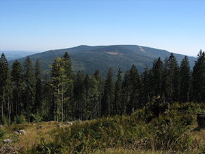
The Hochficht (Czech: Smrčina) is a mountain on the border between Austria and the Czech Republic with an elevation of 1,338 m (4,390 ft). It is situated in the Bohemian Forest mountain range. The Austrian side belongs to the Klaffer am Hochficht municipality and there is a rock outcrop with a summit cross, a ski lift station and a weather station.

Polná na Šumavě
Municipality in South Bohemian, Czech Republic
Distance: Approx. 9102 meters
Latitude and longitude: 48.79916667,14.14694444
Polná na Šumavě (German: Stein im Böhmerwald) is a municipality and village in Český Krumlov District in the South Bohemian Region of the Czech Republic. It has about 200 inhabitants.
Weather in this IP's area
clear sky
-4 Celsius
-7 Celsius
-4 Celsius
-4 Celsius
1042 hPa
75 %
1042 hPa
941 hPa
10000 meters
1.88 m/s
4.05 m/s
39 degree
6 %
