Country:
Region:
City:
Latitude and Longitude:
Time Zone:
Postal Code:
IP information under different IP Channel
ip-api
Country
Region
City
ASN
Time Zone
ISP
Blacklist
Proxy
Latitude
Longitude
Postal
Route
Luminati
Country
ASN
Time Zone
Asia/Tehran
ISP
Jahan Ruye Khat PJSC
Latitude
Longitude
Postal
IPinfo
Country
Region
City
ASN
Time Zone
ISP
Blacklist
Proxy
Latitude
Longitude
Postal
Route
db-ip
Country
Region
City
ASN
Time Zone
ISP
Blacklist
Proxy
Latitude
Longitude
Postal
Route
ipdata
Country
Region
City
ASN
Time Zone
ISP
Blacklist
Proxy
Latitude
Longitude
Postal
Route
Popular places and events near this IP address

Watson Island
Neighborhood of Miami in Miami-Dade County, Florida, United States
Distance: Approx. 1822 meters
Latitude and longitude: 25.78472222,-80.17583333
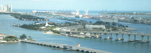
Watson Island is a neighborhood and man-made island in Biscayne Bay, in Miami, Florida. It is located Immediately east of the Central Business District and Arts & Entertainment District neighborhoods of downtown Miami and is connected to the mainland and South Beach, Miami Beach by the MacArthur Causeway.

Miami River (Florida)
River in Florida, United States
Distance: Approx. 1725 meters
Latitude and longitude: 25.7705,-80.1851
The Miami River is a river in the U.S. state of Florida that drains out of the Everglades and runs through the city of Miami, including Downtown. The 5.5-mile (8.9 km) long river flows from the terminus of the Miami Canal at Miami International Airport to Biscayne Bay. It was originally a natural river inhabited at its mouth by the Tequesta Native Americans, but it was dredged and is now polluted throughout its route through Miami-Dade County.

Royal Caribbean International
Norwegian–American cruise line
Distance: Approx. 1201 meters
Latitude and longitude: 25.7752,-80.1784
Royal Caribbean International (RCI), formerly Royal Caribbean Cruise Line (RCCL), is a cruise line founded in 1968 in Norway and organized as a wholly owned subsidiary of Royal Caribbean Group since 1997. Based in Miami, Florida, it is the largest cruise line by revenue and second largest by passengers counts. In 2018, Royal Caribbean International controlled 19.2% of the worldwide cruise market by passengers and 14.0% by revenue.

Royal Caribbean Group
Cruise holding company
Distance: Approx. 1172 meters
Latitude and longitude: 25.7753,-80.178
Royal Caribbean Group, formerly known as Royal Caribbean Cruises Ltd., is a global cruise holding company incorporated in Liberia and based in Miami, Florida. It is the world's second-largest cruise line operator, after Carnival Corporation & plc. As of March 2024, Royal Caribbean Group fully owns three cruise lines: Royal Caribbean International, Celebrity Cruises, and Silversea Cruises with 65 ships in the current fleet and 5 ships on order until 2028.

MacArthur Causeway
Bridge in Florida, United States of America
Distance: Approx. 933 meters
Latitude and longitude: 25.77777778,-80.16444444
The General Douglas MacArthur Causeway is a six-lane causeway that connects Downtown Miami to South Beach via Biscayne Bay in Miami-Dade County. The highway is the singular roadway connecting the mainland and beaches to Watson Island and the bay neighborhoods of Palm Island, Hibiscus Island, and Star Island. The MacArthur Causeway carries State Road 836 and State Road A1A over the Biscayne Bay via a girder bridge.

InterContinental Miami
Hotel in Florida, United States
Distance: Approx. 1772 meters
Latitude and longitude: 25.772419,-80.185373
The InterContinental Miami is a luxury hotel in Downtown Miami, Florida. Opened in 1983, it is owned by Strategic Hotels & Resorts and operated by IHG Hotels & Resorts as part of its InterContinental portfolio.

Tequesta Point
Distance: Approx. 1545 meters
Latitude and longitude: 25.7694,-80.1833
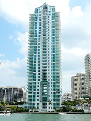
Tequesta Point is a complex of residential high-rises in Downtown Miami, Florida, United States. It consists of three skyscraper buildings located on Brickell Key, an urban island to the east of the Central Business District. Three Tequesta Point, the tallest of the three, was completed in 2001.

Brickell Key
Neighborhood of Miami in Miami-Dade County, Florida, United States
Distance: Approx. 1778 meters
Latitude and longitude: 25.766288,-80.185152
Brickell Key is a man-made island off the mainland Brickell neighborhood of Miami, Florida. Also called Claughton Island, the neighborhood is just east of Downtown Miami and the Miami River.

Palm Island (Miami Beach)
Neighborhood of Miami Beach in Miami-Dade County, Florida, United States
Distance: Approx. 1243 meters
Latitude and longitude: 25.779979,-80.162344
Palm Island is a neighborhood in the city of Miami Beach on a man-made island in Biscayne Bay, Florida, United States; just south of Hibiscus Island. It is a residential neighborhood with high property values, solely accessible by land via the MacArthur Causeway. The entire island has an area of 82 acres (33 ha).

Asia (Miami)
Residential in Florida, United States
Distance: Approx. 1779 meters
Latitude and longitude: 25.769349,-80.185631
Asia is a residential skyscraper on Brickell Key in the Brickell district of Downtown Miami, Florida, United States. The tower rises 483 feet (147 m), with 36 floors. Asia was topped out in mid-2007, and was completed structurally in January 2008.

Hibiscus Island
Neighborhood of Miami Beach in Miami-Dade County, Florida, United States
Distance: Approx. 1647 meters
Latitude and longitude: 25.783216,-80.16052
Hibiscus Island is a neighborhood in the city of Miami Beach on a man-made island in Biscayne Bay, Florida, United States. Hibiscus Island lies just north of Palm Island. It is an exclusive residential neighborhood with relatively high property values.

Dodge Island
Distance: Approx. 315 meters
Latitude and longitude: 25.77237778,-80.16620556
Dodge Island is an artificial island near downtown Miami, Florida, United States. The Port of Miami is located on, what was, Dodge, Lummus and Sam Islands, and has berths for both cruise and cargo ships. The original and much smaller Dodge Island was created during the dredging of Government Cut in the early 1900s.
Weather in this IP's area
scattered clouds
26 Celsius
27 Celsius
25 Celsius
27 Celsius
1014 hPa
83 %
1014 hPa
1013 hPa
10000 meters
6.17 m/s
100 degree
40 %
06:34:02
17:34:57