109.111.51.232 - IP Lookup: Free IP Address Lookup, Postal Code Lookup, IP Location Lookup, IP ASN, Public IP
Country:
Region:
City:
Location:
Time Zone:
Postal Code:
ISP:
ASN:
language:
User-Agent:
Proxy IP:
Blacklist:
IP information under different IP Channel
ip-api
Country
Region
City
ASN
Time Zone
ISP
Blacklist
Proxy
Latitude
Longitude
Postal
Route
db-ip
Country
Region
City
ASN
Time Zone
ISP
Blacklist
Proxy
Latitude
Longitude
Postal
Route
IPinfo
Country
Region
City
ASN
Time Zone
ISP
Blacklist
Proxy
Latitude
Longitude
Postal
Route
IP2Location
109.111.51.232Country
Region
south australia
City
prospect
Time Zone
Australia/Adelaide
ISP
Language
User-Agent
Latitude
Longitude
Postal
ipdata
Country
Region
City
ASN
Time Zone
ISP
Blacklist
Proxy
Latitude
Longitude
Postal
Route
Popular places and events near this IP address

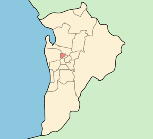
City of Prospect
Local government area in South Australia
Distance: Approx. 621 meters
Latitude and longitude: -34.88333333,138.6
City of Prospect is an inner urban local government area (LGA) in Adelaide, South Australia. The council seat is the unusually-large suburb of Prospect, which makes up almost two thirds of the tiny council area, which is less than 8 km2 (3.1 sq mi). Established in 1872, it is one of the oldest local government bodies in South Australia.

Prospect, South Australia
Suburb of Adelaide, South Australia
Distance: Approx. 189 meters
Latitude and longitude: -34.884,138.594
Prospect is the seat of the City of Prospect and an inner northern suburb of greater Adelaide. It is located 5 km (3.1 mi) north of Adelaide's centre. Surrounding suburbs include Kilburn, Fitzroy, Medindie and Devon Park.
Prescott Schools
School in Australia
Distance: Approx. 1156 meters
Latitude and longitude: -34.892312,138.597058
The Prescott Schools are a collection of independent Seventh-day Adventist co-educational primary and secondary day schools located in various suburbs in Adelaide, South Australia, Australia. Prescott Secondary College is a secondary school with year levels beginning from Year 7 through to Year 12 and is located in the Adelaide suburb of Prospect. Prescott College Southern is a primary and secondary school catering for the southern Adelaide suburbs and is located in Morphett Vale.

Dudley Park railway station
Railway station in Adelaide, South Australia
Distance: Approx. 955 meters
Latitude and longitude: -34.885,138.58333333
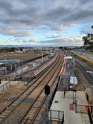
Dudley Park Railway Station is located on the Gawler line. Situated in the inner northern Adelaide suburb of Dudley Park, it is located 4.9 kilometres (3.0 mi) from Adelaide station.

Islington railway station
Railway station in Adelaide, South Australia
Distance: Approx. 1326 meters
Latitude and longitude: -34.87527778,138.58166667
Islington railway station is located on the Gawler line. Situated in the inner northern Adelaide suburb of Prospect adjacent to Regency Road, it is 6 kilometres (3.7 mi) from the Adelaide station.
Nailsworth, South Australia
Suburb of Adelaide, South Australia
Distance: Approx. 972 meters
Latitude and longitude: -34.886,138.603
Nailsworth is a suburb four km north of Adelaide, South Australia. The suburb borders Sefton Park, Prospect, Broadview, Medindie Gardens and Collinswood. The North Road Cemetery is located within the suburb and was founded by Bishop Augustus Short in 1853.
Prospect Oval
Sports venue in Prospect, South Australia
Distance: Approx. 772 meters
Latitude and longitude: -34.88555556,138.60083333
Prospect Oval is a sports stadium located at Menzies Crescent, Prospect, South Australia. The oval has a capacity of 20,000 people with seated grandstands holding approximately 2,000. An unusual feature of the oval is that it is laid out askew from the conventional orientation of Australian rules football and cricket ovals, with the goal posts located at the South-Western and the North-Eastern ends, and the cricket pitch running in the same direction.

Dudley Park, South Australia
Suburb of Adelaide, South Australia
Distance: Approx. 1244 meters
Latitude and longitude: -34.88,138.58
Dudley Park, is a suburb of Adelaide, South Australia, located approximately 3 kilometres north-west of the CBD. The suburb is bordered by Regency Road (north), Simpson Avenue (south), the Adelaide-Gawler railway line (east), and a line directly north–south from the Harrison Road-Simpson Avenue intersection to Regency Road (west). The Dudley Park Cemetery is located within the suburb at the corner of Simpson Avenue and Exeter Terrace. Two railway stations border the suburb, Islington railway station and Dudley Park railway station.
Devon Park, South Australia
Suburb of Adelaide, South Australia
Distance: Approx. 1365 meters
Latitude and longitude: -34.888,138.58
Devon Park is an inner northern suburb of Adelaide, South Australia. It is located in the cities of Port Adelaide Enfield and Charles Sturt beside the Gawler railway line near, but not meeting, the intersection of Torrens Road and Churchill Road.
North Road Cemetery
Cemetery in Nailsworth, South Australia
Distance: Approx. 621 meters
Latitude and longitude: -34.88333333,138.6
North Road Cemetery is located in the Adelaide suburb of Nailsworth, approximately 5 km north of the central business district. It is 7.3 hectares (18 acres) in size and there have been over 26,000 burials since its foundation in 1853. The original size of the cemetery was 0.8 hectare (2 acres) and was established by South Australia's first Anglican bishop, Augustus Short on land which he owned.
Electoral district of Prospect (South Australia)
Former South Australian state electoral district
Distance: Approx. 621 meters
Latitude and longitude: -34.88333333,138.6
Prospect was an electoral district of the House of Assembly in the Australian state of South Australia from 1938 to 1956. The seat of Prospect was abolished and replaced by the new seat of Enfield for the 1956 election. The current Prospect booths are marginal Labor, with the suburb represented by the marginal Liberal seat of Adelaide up to Regency Road, with the small northern remainder of Prospect represented by the fairly safe Labor seat of Enfield.
Dudley Park Cemetery
Cemetery in Adelaide, South Australia
Distance: Approx. 1031 meters
Latitude and longitude: -34.8836,138.5821
Dudley Park Cemetery is a cemetery in Dudley Park, a northern suburb of Adelaide, South Australia. The cemetery caters for various forms of burial and memorial in different areas. The Caroline Gardens area is based around the former Caroline Square in the original plan for the village of Islington.
Weather in this IP's area
broken clouds
35 Celsius
34 Celsius
33 Celsius
37 Celsius
1008 hPa
22 %
1008 hPa
996 hPa
10000 meters
1.34 m/s
3.58 m/s
177 degree
83 %
