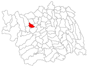
Country:
Region:
City:
Latitude and Longitude:
Time Zone:
Postal Code:
IP information under different IP Channel
ip-api
Country
Region
City
ASN
Time Zone
ISP
Blacklist
Proxy
Latitude
Longitude
Postal
Route
Luminati
Country
Region
cv
City
ghelinta
ASN
Time Zone
Europe/Bucharest
ISP
Orange Romania S.A.
Latitude
Longitude
Postal
IPinfo
Country
Region
City
ASN
Time Zone
ISP
Blacklist
Proxy
Latitude
Longitude
Postal
Route
db-ip
Country
Region
City
ASN
Time Zone
ISP
Blacklist
Proxy
Latitude
Longitude
Postal
Route
ipdata
Country
Region
City
ASN
Time Zone
ISP
Blacklist
Proxy
Latitude
Longitude
Postal
Route
Popular places and events near this IP address

Moinești
Municipality in Bacău, Romania
Distance: Approx. 4761 meters
Latitude and longitude: 46.43333333,26.48333333
Moinești (Romanian pronunciation: [mojˈneʃtʲ] ; Hungarian: Mojnest) is a city in Bacău County, Western Moldavia, Romania, with a population of 19,728 as of 2021. Its name is derived from the Romanian-language word moină, which means "fallow" or "light rain". Moinești once had a large Jewish community, and in 1899 about half of the population was Jewish; in Jewish contexts the name is often given as Mojnescht or "Monesht".

Comănești
Town in Bacău, Romania
Distance: Approx. 5770 meters
Latitude and longitude: 46.42972222,26.45
Comănești (Romanian pronunciation: [koməˈneʃtʲ]; Hungarian: Kománfalva) is a town in Bacău County, Western Moldavia, Romania, with a population of 19,996 as of 2021. It is situated on the river Trotuș, which flows between the Ciuc and the Tarcău mountains; 10 km (6 mi) of the course of the river pass through Comănești. The town administers two villages, Podei and Vermești.

Asău (Trotuș)
River in Bacău County, Romania
Distance: Approx. 7573 meters
Latitude and longitude: 46.4342,26.4058
The Asău is a left tributary of the river Trotuș in Romania. Its source is located in the Tarcău Mountains. It discharges into the Trotuș in the village Asău, near Comănești.
Urmeniș (Trotuș)
River in Bacău County, Romania
Distance: Approx. 7653 meters
Latitude and longitude: 46.4092,26.4606
The Urmeniș is a left tributary of the river Trotuș in Romania. Its source is near Moinești, at the southern end of the Tarcău Mountains. It flows into the Trotuș in Comănești.
Ruja (Tazlăul Sărat)
River in Bacău County, Romania
Distance: Approx. 8232 meters
Latitude and longitude: 46.51166667,26.57777778
The Ruja is a left tributary of the river Tazlăul Sărat in Romania. It discharges into the Tazlăul Sărat in Șesuri. Its length is 8 km (5.0 mi) and its basin size is 13 km2 (5.0 sq mi).
Zemeș (river)
River in Bacău County, Romania
Distance: Approx. 6578 meters
Latitude and longitude: 46.53444444,26.47
The Zemeș is a right tributary of the river Tazlăul Sărat in Romania. It discharges into the Tazlăul Sărat in the village Zemeș. Its length is 6 km (3.7 mi) and its basin size is 12 km2 (4.6 sq mi).

Asău
Commune in Bacău, Romania
Distance: Approx. 7038 meters
Latitude and longitude: 46.45,26.4
Asău is a commune in Bacău County, Western Moldavia, Romania. It is composed of six villages: Apa Asău, Asău, Ciobănuș, Lunca Asău, Păltiniș, and Straja.

Măgirești
Commune in Bacău, Romania
Distance: Approx. 6803 meters
Latitude and longitude: 46.51666667,26.55
Măgirești is a commune in Bacău County, Western Moldavia, Romania. It is composed of five villages: Măgirești, Prăjești, Stănești, Șesuri and Valea Arinilor.

Poduri
Commune in Bacău, Romania
Distance: Approx. 3955 meters
Latitude and longitude: 46.46666667,26.53333333
Poduri is a commune in Bacău County, Western Moldavia, Romania. It is composed of seven villages: Bucșești, Cernu, Cornet, Negreni, Poduri, Prohozești, and Valea Șoșii. The Poduri archeological site of the late Neolithic Cucuteni-Trypillian culture is significant due to its thirteen habitation levels that were constructed on top of each other over many years.

Solonț
Commune in Bacău, Romania
Distance: Approx. 8608 meters
Latitude and longitude: 46.55,26.51666667
Solonț is a commune in Bacău County, Western Moldavia, Romania. It is composed of three villages: Cucuieți, Sărata and Solonț.
Dacian fortress of Moinești
Fortified town
Distance: Approx. 326 meters
Latitude and longitude: 46.479,26.483
Moinești was a Dacian fortified town.
Weather in this IP's area
scattered clouds
-2 Celsius
-5 Celsius
-2 Celsius
-2 Celsius
1029 hPa
86 %
1029 hPa
964 hPa
10000 meters
2.18 m/s
2.26 m/s
253 degree
48 %
07:13:23
16:43:34