Country:
 Canada
Region:
City:
Latitude and Longitude:
Time Zone:
Postal Code:
IP information under different IP Channel
ip-api
Country
Region
City
ASN
Time Zone
ISP
Blacklist
Proxy
Latitude
Longitude
Postal
Route
IPinfo
Country
Region
City
ASN
Time Zone
ISP
Blacklist
Proxy
Latitude
Longitude
Postal
Route
MaxMind
Country
Region
City
ASN
Time Zone
ISP
Blacklist
Proxy
Latitude
Longitude
Postal
Route
Luminati
Country
CAASN
Time Zone
America/Toronto
ISP
RCC-RDC-AS
Latitude
Longitude
Postal
db-ip
Country
Region
City
ASN
Time Zone
ISP
Blacklist
Proxy
Latitude
Longitude
Postal
Route
ipdata
Country
Region
City
ASN
Time Zone
ISP
Blacklist
Proxy
Latitude
Longitude
Postal
Route
Popular places and events near this IP address

Bramalea City Centre
Shopping mall in Ontario, Canada
Distance: Approx. 1604 meters
Latitude and longitude: 43.716589,-79.723921
The Bramalea City Centre is a large shopping mall located in the city of Brampton, Ontario, Canada. With over a 1.5 million square feet of retail space and more than 300 outlets, it is one of Canada's largest shopping malls. Regarded as a super regional mall, the Bramalea City Centre has a market of more than 500,000 residents and attracts 16 million visitors annually.

Brampton—Springdale (federal electoral district)
Federal electoral district in Ontario, Canada
Distance: Approx. 2011 meters
Latitude and longitude: 43.71,-79.74
Brampton—Springdale was a federal electoral district in Ontario, Canada, that was represented in the House of Commons of Canada from 2004 until 2015, when it was abolished after the 2012 federal electoral redistribution.

Mississauga—Brampton South
Federal electoral district in Ontario, Canada
Distance: Approx. 1403 meters
Latitude and longitude: 43.7,-79.7
Mississauga—Brampton South was a federal electoral district in Ontario, Canada, that was represented in the House of Commons of Canada from 2004 to 2015. It consists of the parts of the cities of Mississauga and Brampton bounded by a line drawn from the intersection of Highway 401 with the northeastern limit of the City of Mississauga, south along the city limit, southwest along Burnhamthorpe Road East, northwest along Central Parkway East, southwest along Highway 403, northwest along Mavis Road; thence northwesterly along said road to Eglinton Avenue West; thence southwesterly along said avenue to Terry Fox Way; thence northwesterly along said way to Britannia Road West; thence northeasterly along said road to Mavis Road, southwest along Highway 401, northwest along Mississauga Road, northeast along the northwestern limit of the City of Mississauga, northwest along McLaughlin Road, northeast along Steeles Avenue East, southeast along Kennedy Road South, northeast along the northwestern limit of the City of Mississauga, southeast along Dixie Road, and northeast along Highway 401 to the point of commencement. Following the 2012 federal electoral boundaries redistribution, the bulk of the district will be part of the new Mississauga—Malton district, with other parts transferred to Mississauga East—Cooksville, Mississauga Centre, Mississauga—Streetsville, Brampton South, and Brampton Centre.
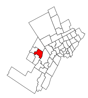
Brampton Centre (federal electoral district)
Federal electoral district in Ontario, Canada
Distance: Approx. 1075 meters
Latitude and longitude: 43.705,-79.73
Brampton Centre (French: Brampton-Centre) is a federal electoral district in Ontario, Canada, that is represented in the House of Commons of Canada. This riding was created in 1996 from parts of Brampton riding and in 2013, Elections Canada redistributed 3 ridings in the city of Brampton to bring back Brampton Centre. This was primarily due to large population increases in the Greater Toronto Area, and Peel Region in particular.
Brampton Fire and Emergency Services
Distance: Approx. 1939 meters
Latitude and longitude: 43.70111111,-79.74083333
Brampton Fire and Emergency Services provides fire protection, technical rescue services, hazardous materials response, and first responder emergency medical assistance to the City of Brampton in the Peel Region of Ontario, Canada.
Bramalea Secondary School
Public high school in Brampton, Ontario, Canada
Distance: Approx. 1547 meters
Latitude and longitude: 43.715302,-79.707693
Bramalea Secondary School (BSS) is a high school located in Bramalea, Brampton, Ontario, operating under the Peel District School Board established in 1963.
Brampton—Springdale (provincial electoral district)
Provincial electoral district in Ontario, Canada
Distance: Approx. 2011 meters
Latitude and longitude: 43.71,-79.74
Brampton—Springdale was a provincial electoral district in central Ontario, Canada. It was created for the 2007 provincial election. 83.7% of the district was created from Brampton Centre while 16.3% was carved from Bramalea—Gore—Malton—Springdale.
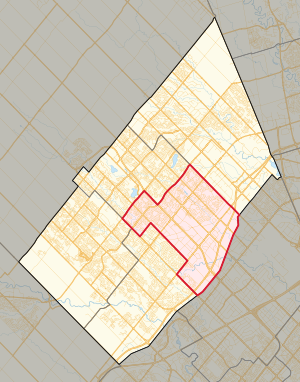
Brampton Centre (provincial electoral district)
Provincial electoral district in Ontario, Canada
Distance: Approx. 1075 meters
Latitude and longitude: 43.705,-79.73
Brampton Centre is a provincial electoral district in central Ontario, Canada that elects one Member of the Legislative Assembly of Ontario. It was originally created in 1999 from Brampton North and Brampton South. It was abolished in 2007 into Brampton West and Brampton—Springdale.

10 Peel Centre Drive
Distance: Approx. 1850 meters
Latitude and longitude: 43.71928,-79.72214
10 Peel Centre Drive is a building complex in Brampton, Ontario, Canada that serves as the seat of local government for the Regional Municipality of Peel. The building has been used for regional government offices since its completion in 1980 after relocating from the nearby historic Peel County Courthouse. The complex includes the Peel Regional Council chambers and the offices of Division 21 of the Peel Regional Police.

Bramalea Terminal
Distance: Approx. 1816 meters
Latitude and longitude: 43.71916667,-79.72083333
Bramalea Terminal is a Brampton Transit bus station serving the community of Bramalea in Brampton, Ontario, Canada. It is located at the south west corner of Peel Centre Drive and Central Park Drive on the north side of the Brampton Civic Centre. The customer service centre building is situated in the northerly of two island platform areas, which are accessed by pedestrian cross walks.
Rogers Park, Brampton
Business complex and the corporate offices of Rogers Communications in Brampton, Ontario
Distance: Approx. 61 meters
Latitude and longitude: 43.7033,-79.7162
Rogers Park, Brampton (formerly Nortel Brampton Centre and Northern Electric Brampton Works) is a business complex and the corporate offices of Rogers Communications in Brampton, Ontario. It is not the company head office, which is located in downtown Toronto. Located at 8200 Dixie Road, the building was acquired by Rogers in 2006 from Nortel, which used the building as their global headquarters since 1997.
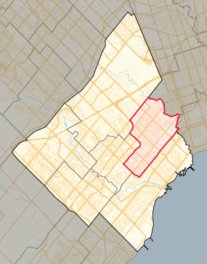
Mississauga East—Cooksville (provincial electoral district)
Provincial electoral district in Ontario, Canada
Distance: Approx. 1403 meters
Latitude and longitude: 43.7,-79.7
Mississauga East—Cooksville is a provincial electoral district in Ontario, Canada, that has been represented in the Legislative Assembly of Ontario since the 2007 provincial election.
Weather in this IP's area
few clouds
27 Celsius
27 Celsius
25 Celsius
29 Celsius
1022 hPa
45 %
1022 hPa
1000 hPa
10000 meters
3.09 m/s
170 degree
20 %
06:59:53
19:27:23