Country:
 USA
USARegion:
City:
Latitude and Longitude:
Time Zone:
Postal Code:
IP information under different IP Channel
ip-api
Country
Region
City
ASN
Time Zone
ISP
Blacklist
Proxy
Latitude
Longitude
Postal
Route
IPinfo
Country
Region
City
ASN
Time Zone
ISP
Blacklist
Proxy
Latitude
Longitude
Postal
Route
MaxMind
Country
Region
City
ASN
Time Zone
ISP
Blacklist
Proxy
Latitude
Longitude
Postal
Route
Luminati
Country
USRegion
pa
City
jeannette
ASN
Time Zone
America/New_York
ISP
UUNET
Latitude
Longitude
Postal
db-ip
Country
Region
City
ASN
Time Zone
ISP
Blacklist
Proxy
Latitude
Longitude
Postal
Route
ipdata
Country
Region
City
ASN
Time Zone
ISP
Blacklist
Proxy
Latitude
Longitude
Postal
Route
Popular places and events near this IP address
Grapeville, Pennsylvania
CDP in Pennsylvania, United States
Distance: Approx. 1558 meters
Latitude and longitude: 40.32472222,-79.60694444
Grapeville is a census-designated place (CDP) in Hempfield Township, Westmoreland County, Pennsylvania, United States. The population was 676 at the time of the 2000 census.

Harrison City, Pennsylvania
Census-designated place in Pennsylvania, United States
Distance: Approx. 3435 meters
Latitude and longitude: 40.35472222,-79.65027778
Harrison City is a census-designated place (CDP) in Westmoreland County, Pennsylvania, United States. The population was 174 at the 2020 census.

Jeannette, Pennsylvania
City in Pennsylvania, United States
Distance: Approx. 843 meters
Latitude and longitude: 40.32888889,-79.61388889
Jeannette is a city in Westmoreland County, Pennsylvania, United States. Jeannette was founded in 1888. The city got its name from one of the original city fathers, H. Sellers McKee, who wished to honor his wife by giving the new town her first name: Jeannette.

Penn, Pennsylvania
Borough in Pennsylvania, United States
Distance: Approx. 1993 meters
Latitude and longitude: 40.32888889,-79.64027778
Penn is a borough in Westmoreland County, Pennsylvania, United States. The population was 475 at the time of the 2010 census. The borough was named for Pennsylvania founder William Penn.

Penn Township, Westmoreland County, Pennsylvania
Township in Pennsylvania, United States
Distance: Approx. 3463 meters
Latitude and longitude: 40.36666667,-79.61638889
Penn Township is a township in Westmoreland County, Pennsylvania, United States.
Battle of Bushy Run
1763 North American battle
Distance: Approx. 2263 meters
Latitude and longitude: 40.35555556,-79.62361111
The Battle of Bushy Run was fought on August 5–6, 1763, in western Pennsylvania, between a British column under the command of Colonel Henry Bouquet and a combined force of Delaware, Shawnee, Mingo, and Huron warriors. This action occurred during Pontiac's Rebellion. Though the British suffered serious losses, they routed the tribesmen and successfully relieved the garrison of Fort Pitt.
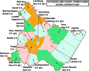
Jeannette City School District
School district in Pennsylvania
Distance: Approx. 2385 meters
Latitude and longitude: 40.31566,-79.60822
The Jeannette City School District is a small urban school district in Southwestern Pennsylvania. It is located in Westmoreland County and is surrounded by the Penn-Trafford and Hempfield Area School Districts. The district consists of two schools, McKee Elementary School (PK-6) and the Jeannette Junior-Senior High School (7-12).
Bushy Run Battlefield
United States historic place
Distance: Approx. 2194 meters
Latitude and longitude: 40.35527778,-79.62
Bushy Run Battlefield Park is a historical park operated by the Pennsylvania Historical and Museum Commission (PHMC) and the Bushy Run Battlefield Heritage Society on 218 acres (88 ha) in Penn Township, Westmoreland County, Pennsylvania in the United States. It was the site of the Battle of Bushy Run fought on August 5–6, 1763 during the Pontiac's Rebellion. The battle was a major victory for the British and enabled them to secure their control of the Ohio River Valley and what was to become the Northwest Territory.
Penn-Trafford High School
Public school in Harrison City, Allegheny, Westmoreland, Pennsylvania, United States
Distance: Approx. 3803 meters
Latitude and longitude: 40.3536,-79.6566
Penn-Trafford High School is a public high school located in Harrison City, Pennsylvania in Westmoreland County, and is the secondary school serving the Penn-Trafford School District. It is the result of several mergers of smaller school districts and entities. It is the successor of Penn Joint High School and Trafford High School.

Brush Creek Salems Church
Historic church in Pennsylvania, United States
Distance: Approx. 3844 meters
Latitude and longitude: 40.31916667,-79.65833333
Brush Creek Salems Church, now known as Irwin Brush Creek Salem United Church of Christ, is a historic Reformed church building located in Hempfield Township, Westmoreland County, Pennsylvania. It was built between 1816 and 1820, and is a two-story, brick building with a gable roof. The interior features a second floor gallery.
Claridge, Pennsylvania
Unincorporated community in Pennsylvania, United States
Distance: Approx. 3350 meters
Latitude and longitude: 40.36555556,-79.62222222
Claridge is an unincorporated community in Westmoreland County, Pennsylvania, United States. The community is 3.3 miles (5.3 km) northeast of Manor. Claridge has a post office with ZIP code 15623, which opened on January 25, 1886.

Monsour Medical Center
Hospital in Pennsylvania, United States
Distance: Approx. 2832 meters
Latitude and longitude: 40.311,-79.61
Monsour Medical Center was a 100-bed hospital when it opened in Jeannette, Pennsylvania, in 1958. There was an eleven-story circular tower added in 1971 that increased the total number of beds to 250. The hospital was founded by brothers William, Roy, Robert, and Howard Monsour who were all physicians.
Weather in this IP's area
clear sky
8 Celsius
8 Celsius
7 Celsius
9 Celsius
1019 hPa
93 %
1019 hPa
979 hPa
10000 meters
1.34 m/s
1.38 m/s
250 degree
06:53:11
19:39:08