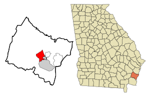
Country:
Region:
City:
Latitude and Longitude:
Time Zone:
Postal Code:
IP information under different IP Channel
ip-api
Country
Region
City
ASN
Time Zone
ISP
Blacklist
Proxy
Latitude
Longitude
Postal
Route
Luminati
Country
ASN
Time Zone
America/Chicago
ISP
SOFTLAYER
Latitude
Longitude
Postal
IPinfo
Country
Region
City
ASN
Time Zone
ISP
Blacklist
Proxy
Latitude
Longitude
Postal
Route
db-ip
Country
Region
City
ASN
Time Zone
ISP
Blacklist
Proxy
Latitude
Longitude
Postal
Route
ipdata
Country
Region
City
ASN
Time Zone
ISP
Blacklist
Proxy
Latitude
Longitude
Postal
Route
Popular places and events near this IP address

Glynn County, Georgia
County in Georgia, United States
Distance: Approx. 4553 meters
Latitude and longitude: 31.22,-81.49
Glynn County is located in the southeastern part of the U.S. state of Georgia. As of the 2020 census, the population was 84,499. The county seat is Brunswick.

Country Club Estates, Georgia
Place in Georgia, United States
Distance: Approx. 4459 meters
Latitude and longitude: 31.21138889,-81.46861111
Country Club Estates is an unincorporated community and census-designated place (CDP) in Glynn County, Georgia, United States. It is part of the Brunswick metropolitan statistical area. The population was 8,373 at the 2020 census, down from 8,545 in 2010.

Dock Junction, Georgia
Place in Georgia, United States
Distance: Approx. 7198 meters
Latitude and longitude: 31.20111111,-81.50694444
Dock Junction is an unincorporated community and census-designated place (CDP) in Glynn County, Georgia, United States. It is part of the Brunswick metropolitan statistical area. The population was 7,721 at the 2010 census, growing to 8,266 in 2020.

Fort Frederica National Monument
Distance: Approx. 6836 meters
Latitude and longitude: 31.22384,-81.39324
Fort Frederica National Monument, on St. Simons Island, Georgia, preserves the archaeological remnants of a fort and town built by James Oglethorpe between 1736 and 1748 to protect the southern boundary of the British colony of Georgia from Spanish raids. About 630 British troops were stationed at the fort.

Federal Law Enforcement Training Centers
U.S. government agency
Distance: Approx. 2110 meters
Latitude and longitude: 31.23388889,-81.46888889
The Federal Law Enforcement Training Centers (FLETC, pronounced ) serves as an interagency law enforcement training body for 105 United States government federal law enforcement agencies. The stated mission of FLETC is to "...train those who protect our homeland". Through the Rural Policing Institute (RPI) and the Office of State and Local Training, it provides tuition-free and low-cost training to state, local, campus and tribal law enforcement agencies.
Glynco, Georgia
Place in Georgia, United States
Distance: Approx. 1196 meters
Latitude and longitude: 31.25861111,-81.46611111
Glynco is an area in Glynn County, Georgia located on the northwestern edge of Brunswick, Georgia. Glynco is a portmanteau of the words "Glynn County".

Atlantic Southeast Airlines Flight 2311
1991 passenger plane crash in Brunswick, Georgia, USA
Distance: Approx. 5008 meters
Latitude and longitude: 31.25966667,-81.5095
Atlantic Southeast Airlines Flight 2311 was a regularly scheduled commuter flight in Georgia in the southeastern United States, from Hartsfield–Jackson Atlanta International Airport to Glynco Jetport (since renamed Brunswick Golden Isles Airport) in Brunswick on April 5, 1991. The flight, operating a twin-turboprop Embraer EMB 120 Brasilia, crashed north of Brunswick while approaching the airport for landing. All 23 aboard were killed, including astronaut Sonny Carter and former U.S. Senator John Tower.
Hercules 009 Landfill
Landfill site
Distance: Approx. 5715 meters
Latitude and longitude: 31.2049,-81.4858
The Hercules 009 Landfill Superfund site is a 16.5-acre (67,000 m2) property that is bordered by Georgia State Route 25 (Spur 25) on the west; an automobile dealership on the north; a juvenile slash pine forest on the east; and several homes, a church, a school, and a strip shopping center to the south/southeast of the property. Hercules Inc. was issued a permit in 1975 by the GaEPD to use 7 acres (28,000 m2) at the northern end of the property as a landfill to dispose of toxaphene-contaminated wastewater sludge generated during the manufacturing processes.

Naval Air Station Glynco
Former military air base
Distance: Approx. 1237 meters
Latitude and longitude: 31.25880833,-81.46649722
Naval Air Station Glynco, Georgia, was an operational naval air station from 1942 to 1974 with an FAA airfield identifier of NEA and an ICAO identifier of KNEA. Now known as Brunswick Golden Isles Airport (IATA: BQK, ICAO: KBQK), it was previously known as Glynco Jetport following NAS Glynco's closure. It is a public airport located 5 miles (8 km) north of the city of Brunswick, in Glynn County, Georgia, USA. The airport has a single runway and is mostly used for general aviation, but it is also served by one commercial airline.

Needwood Baptist Church and School
Historic church in Georgia, United States
Distance: Approx. 3886 meters
Latitude and longitude: 31.28206,-81.4408
Needwood Baptist Church and School are historic buildings (a church and a school) north of Brunswick, Georgia, along US 17. The oldest parts of the church date to the 1870s. The towers were added circa 1885 and contain a bell dated 1884.
Ballard School
United States historic place
Distance: Approx. 6859 meters
Latitude and longitude: 31.2046,-81.5062
Ballard School, also known as Ballard Elementary School, is a historic school building in Brunswick, Georgia. It was added to the National Register of Historic Places on October 27, 2004. It is located at 325 Old Jesup Highway.

Hofwyl-Broadfield Plantation
United States historic place
Distance: Approx. 6092 meters
Latitude and longitude: 31.305,-81.45366
The Hofwyl-Broadfield Plantation was a plantation on the Altamaha River in Glynn County, Georgia, United States. Operated as a forced-labor farm using enslaved peoples until 1865, it produced rice from 1800 until 1915, when growing rice became unprofitable. Then it was primarily a dairy farm until 1942.
Weather in this IP's area
fog
10 Celsius
10 Celsius
9 Celsius
11 Celsius
1018 hPa
95 %
1018 hPa
1018 hPa
805 meters
100 %
06:56:22
17:26:11
