Country:
Region:
City:
Latitude and Longitude:
Time Zone:
Postal Code:
IP information under different IP Channel
ip-api
Country
Region
City
ASN
Time Zone
ISP
Blacklist
Proxy
Latitude
Longitude
Postal
Route
Luminati
Country
ASN
Time Zone
America/Chicago
ISP
SINGLEHOP-LLC
Latitude
Longitude
Postal
IPinfo
Country
Region
City
ASN
Time Zone
ISP
Blacklist
Proxy
Latitude
Longitude
Postal
Route
db-ip
Country
Region
City
ASN
Time Zone
ISP
Blacklist
Proxy
Latitude
Longitude
Postal
Route
ipdata
Country
Region
City
ASN
Time Zone
ISP
Blacklist
Proxy
Latitude
Longitude
Postal
Route
Popular places and events near this IP address

Leland Grove, Illinois
City in Illinois, United States
Distance: Approx. 5503 meters
Latitude and longitude: 39.77861111,-89.68388889
Leland Grove is a city in Sangamon County, Illinois, United States, located adjacent to Springfield. It is part of the Springfield Metropolitan Statistical Area. The population was 1,503 at the 2010 census.

Curran Township, Sangamon County, Illinois
Township in Illinois, United States
Distance: Approx. 4190 meters
Latitude and longitude: 39.74222222,-89.76527778
Curran Township is a township in Sangamon County, Illinois. As of the 2010 census, its population was 1,586, and it contained 662 housing units.

Curran, Illinois
Village in Illinois, United States
Distance: Approx. 4422 meters
Latitude and longitude: 39.74222222,-89.77194444
Curran is a village in Curran Township, Sangamon County, Illinois (United States). It was incorporated in 2005 and had an estimated population of 212 in 2010. Curran is located a few miles west of Springfield and is part of the Springfield Metropolitan Statistical Area.

White Oaks Mall (Springfield, Illinois)
Shopping mall in Springfield, Illinois
Distance: Approx. 3985 meters
Latitude and longitude: 39.76723,-89.70358
White Oaks Mall is a shopping mall in Springfield, Illinois, United States. It is located at the junction of Illinois Route 4 (Veterans Parkway) and Wabash Avenue. With 928,772 square feet (86,285.7 m2) of retail space, it is the largest shopping mall in Central Illinois.
Bradfordton, Illinois
Unincorporated community in Illinois, United States
Distance: Approx. 5157 meters
Latitude and longitude: 39.82333333,-89.73944444
Bradfordton is a rural unincorporated community located in Gardner Township, Sangamon County, Illinois. It is located on Illinois Route 97, 4.5 miles (7 km) northwest of Springfield. The rural hamlet is the site of the Bradfordton Co-Op, a grain elevator.
Riddle Hill, Illinois
Unincorporated community in Illinois, United States
Distance: Approx. 1724 meters
Latitude and longitude: 39.78666667,-89.76444444
Riddle Hill is a rural unincorporated community located in Curran and Gardner townships, Sangamon County, Illinois. It is a crossroads located adjacent to where Old Jacksonville Road crosses Little Spring Creek, 6.5 miles west of Springfield.

Thomas Rees Memorial Carillon
Bell instrument in Springfield, Illinois, US
Distance: Approx. 5699 meters
Latitude and longitude: 39.7894952,-89.6834341
The Thomas Rees Memorial Carillon is a carillon located in Washington Park in Springfield, Illinois. The brutalist tower stands 132 feet and is constructed from concrete, brick and steel. It was dedicated in 1962 and designed by Bill Turley.
Archer, Illinois
Unincorporated community in Illinois, United States
Distance: Approx. 1143 meters
Latitude and longitude: 39.78138889,-89.73583333
Archer is an unincorporated community in Curran Township, Sangamon County, Illinois, United States. Archer is located on the Sangamon Valley Trail on the western border of Springfield.

Alvin S. Keys House
Historic house in Illinois, United States
Distance: Approx. 5500 meters
Latitude and longitude: 39.781944,-89.684167
The Alvin S. Keys House is a historic house located at 1600 Illini Road in Leland Grove, Illinois. The house was built in 1929-30 for Republican politician and community leader Alvin S. Keys. At the time, Leland Grove was one of the most exclusive of Springfield's developing suburbs; the Keys House had an especially desirable location, as it was across the street from the Illini Country Club.

Hugh M. Garvey House
Historic house in Illinois, United States
Distance: Approx. 5261 meters
Latitude and longitude: 39.78166667,-89.68694444
The Hugh M. Garvey House, also known as the Garvey-Ferry House, is a historic house located at 8 Fair Oaks Drive in Leland Grove, Illinois.

Dr. Charles Compton House
Historic house in Illinois, United States
Distance: Approx. 5965 meters
Latitude and longitude: 39.78638889,-89.67944444
The Dr. Charles Compton House is a historic house at 1303 South Wiggins Avenue in the Oak Knolls neighborhood of Springfield, Illinois. It was built in 1926 for Dr.

Ice Chateau
Ice arena in Illinois, United States
Distance: Approx. 4114 meters
Latitude and longitude: 39.7945,-89.7055
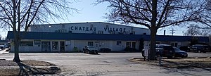
The Ice Chateau was a multi-purpose ice arena and recreational facility located in Springfield, Illinois. It was the home of the Springfield Kings of the Continental Hockey League (CnHL). The Ice Chateau was also home to several Lincoln Land High School Hockey League (LLHH) and youth ice hockey teams.
Weather in this IP's area
clear sky
7 Celsius
6 Celsius
5 Celsius
7 Celsius
1020 hPa
86 %
1020 hPa
998 hPa
10000 meters
1.79 m/s
6.26 m/s
104 degree
06:44:21
16:43:16