Country:
 Canada
Region:
City:
Latitude and Longitude:
Time Zone:
Postal Code:
IP information under different IP Channel
ip-api
Country
Region
City
ASN
Time Zone
ISP
Blacklist
Proxy
Latitude
Longitude
Postal
Route
IPinfo
Country
Region
City
ASN
Time Zone
ISP
Blacklist
Proxy
Latitude
Longitude
Postal
Route
MaxMind
Country
Region
City
ASN
Time Zone
ISP
Blacklist
Proxy
Latitude
Longitude
Postal
Route
Luminati
Country
CARegion
on
City
toronto
ASN
Time Zone
America/Toronto
ISP
ROGERS-COMMUNICATIONS
Latitude
Longitude
Postal
db-ip
Country
Region
City
ASN
Time Zone
ISP
Blacklist
Proxy
Latitude
Longitude
Postal
Route
ipdata
Country
Region
City
ASN
Time Zone
ISP
Blacklist
Proxy
Latitude
Longitude
Postal
Route
Popular places and events near this IP address

Metropolitan Toronto
Dissolved region in Ontario, Canada
Distance: Approx. 926 meters
Latitude and longitude: 43.7072,-79.3805
The Municipality of Metropolitan Toronto was an upper-tier level of municipal government in Ontario, Canada, from 1953 to 1998. It was made up of the old city of Toronto and numerous townships, towns and villages that surrounded Toronto, which were starting to urbanize rapidly after World War II. It was commonly referred to as "Metro Toronto" or "Metro". Passage of the 1997 City of Toronto Act caused the 1998 amalgamation of Metropolitan Toronto and its constituents into the current City of Toronto.

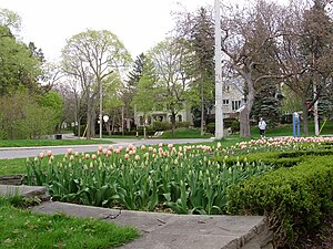
North Toronto
Dissolved municipality in Ontario, Canada
Distance: Approx. 722 meters
Latitude and longitude: 43.711,-79.389
North Toronto is a former town and informal district located in Toronto, Ontario, Canada. The Town of North Toronto was incorporated in 1890 by consolidating the villages of Bedford Park, Eglinton and Davisville. The town was annexed by Toronto in 1912.
Lawrence Park, Toronto
Neighbourhood in Toronto, Ontario, Canada
Distance: Approx. 862 meters
Latitude and longitude: 43.722,-79.388
Lawrence Park is a neighbourhood in Toronto, Ontario, Canada. It is bordered by Yonge Street to the west and Bayview Avenue to the east, and from Blythwood Ravine on the south to Lawrence Avenue on the north. Lawrence Park was one of Toronto's first planned garden suburbs.
Northern Secondary School
Secondary school in Toronto, Ontario, Canada
Distance: Approx. 819 meters
Latitude and longitude: 43.71060278,-79.39011667
Northern Secondary School is a public high school in Toronto, Ontario, Canada. It teaches grades 9 through 12. It is a part of the Toronto District School Board (TDSB).

CNIB Foundation
Organization for the blind based in Canada
Distance: Approx. 472 meters
Latitude and longitude: 43.71793056,-79.37768611
The CNIB Foundation (French: Fondation INCA) is a Canadian charitable organization and volunteer agency dedicated to assisting Canadians who are blind or living with vision loss, and to provide information about vision health for all Canadians. Founded in 1918 as the Canadian National Institute for the Blind (French: Institut national canadien pour les aveugles) to assist soldiers who had been blinded in the First World War, CNIB originally offered sheltered care and specialized employment to people with vision loss. It has since expanded to include other programs and services, including research, public education, rehabilitation counselling and training, advocacy and an alternative-format library for people living with a print disability.

First Christian Reformed Church of Toronto
Distance: Approx. 960 meters
Latitude and longitude: 43.707822,-79.388088
The First Christian Reformed Church of Toronto is a congregation of the Christian Reformed Church in North America in Toronto, Ontario, Canada. It is one of the more liberal churches in its classis and the denomination. It was the first CRC parish to call a woman minister and declared itself open to gays and lesbians in committed relationships serving as deacons and elders.

Holland Bloorview Kids Rehabilitation Hospital
Hospital in Ontario, Canada
Distance: Approx. 836 meters
Latitude and longitude: 43.718447,-79.3729
Holland Bloorview Kids Rehabilitation Hospital is Canada's largest children's rehabilitation hospital. It is located in Toronto, Ontario, Canada. It was founded in 1899, by a group of community-minded women who met in Toronto to discuss the creation of a "Home for Incurable Children".
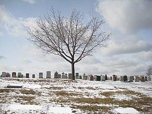
Mount Hope Catholic Cemetery
Cemetery in Toronto, Ontario, Canada
Distance: Approx. 37 meters
Latitude and longitude: 43.7151,-79.3826
Mount Hope Catholic Cemetery is a Catholic cemetery at 305 Erskine Avenue in Toronto, Ontario, Canada.

Leaside High School
High school in Toronto, Ontario, Canada
Distance: Approx. 882 meters
Latitude and longitude: 43.7112,-79.3731
Leaside High School is a school of between 900 and 1000 pupils in central-east Toronto, Ontario, Canada, at the corner of Eglinton and Bayview Avenues. The school was established in 1945 by the Leaside Board of Education and is located in the Leaside neighbourhood. Feeder schools for Leaside High School include Bessborough Public School, Bennington Heights Public School, Northlea Public School, and Rolph Road Public School.

Bridle Path–Sunnybrook–York Mills
Neighbourhood in Toronto, Ontario, Canada
Distance: Approx. 737 meters
Latitude and longitude: 43.72111111,-79.37777778
Bridle Path–Sunnybrook–York Mills is a municipal and census district in Toronto, Ontario, Canada, and it is the name officially designated by Toronto City Hall. Traditionally, Torontonians regard this area as five distinct neighbourhoods that were formerly in North York before it was amalgamated into Toronto in 1998. The area is part of the federal and provincial electoral district of Don Valley West, and Toronto electoral ward 25: Don Valley West (North).

Mount Pleasant station (Toronto)
Future underground LRT station in Canada
Distance: Approx. 1000 meters
Latitude and longitude: 43.70838889,-79.39016667
Mount Pleasant is an underground light rail transit (LRT) station under construction on Line 5 Eglinton, a new line that is part of the Toronto subway system. The station will be located in North Toronto at the intersection of Mount Pleasant Road and Eglinton Avenue. Nearby destinations include Northern Secondary School, North Toronto Collegiate Institute, and the Davisville Village neighbourhood.

Leaside station
Future underground LRT station in Toronto, Canada
Distance: Approx. 649 meters
Latitude and longitude: 43.71111111,-79.37694444
Leaside is an underground light rail transit (LRT) station under construction on Line 5 Eglinton, a new line that is part of the Toronto subway system. It is located in the Leaside neighbourhood at the intersection of Bayview Avenue and Eglinton Avenue. It is scheduled to open in 2024.
Weather in this IP's area
clear sky
15 Celsius
14 Celsius
14 Celsius
16 Celsius
1012 hPa
47 %
1012 hPa
995 hPa
10000 meters
5.14 m/s
9.26 m/s
290 degree
07:22:31
18:47:36