108.174.103.245 - IP Lookup: Free IP Address Lookup, Postal Code Lookup, IP Location Lookup, IP ASN, Public IP
Country:
Region:
City:
Location:
Time Zone:
Postal Code:
ISP:
ASN:
language:
User-Agent:
Proxy IP:
Blacklist:
IP information under different IP Channel
ip-api
Country
Region
City
ASN
Time Zone
ISP
Blacklist
Proxy
Latitude
Longitude
Postal
Route
db-ip
Country
Region
City
ASN
Time Zone
ISP
Blacklist
Proxy
Latitude
Longitude
Postal
Route
IPinfo
Country
Region
City
ASN
Time Zone
ISP
Blacklist
Proxy
Latitude
Longitude
Postal
Route
IP2Location
108.174.103.245Country
Region
tennessee
City
chattanooga
Time Zone
America/New_York
ISP
Language
User-Agent
Latitude
Longitude
Postal
ipdata
Country
Region
City
ASN
Time Zone
ISP
Blacklist
Proxy
Latitude
Longitude
Postal
Route
Popular places and events near this IP address
Fairmount, Tennessee
CDP in Tennessee, United States
Distance: Approx. 4245 meters
Latitude and longitude: 35.17611111,-85.33305556
Fairmount is a census-designated place (CDP) in Hamilton County, Tennessee, United States. The population was 2,193 at the 2020 census, down from 2,825 at the 2010 census. It is part of the Chattanooga, TN–GA Metropolitan Statistical Area.

Signal Mountain, Tennessee
Town in Tennessee, United States
Distance: Approx. 767 meters
Latitude and longitude: 35.13333333,-85.35
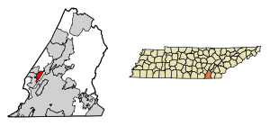
Signal Mountain is a town in Hamilton County, Tennessee, United States. The town is a suburb of Chattanooga and is located on Walden Ridge. "Signal Mountain" is used as a colloquial name for the part of Walden Ridge close to the town.

Walden, Tennessee
Town in Tennessee, United States
Distance: Approx. 4039 meters
Latitude and longitude: 35.16111111,-85.31222222
Walden is a town located in Hamilton County, Tennessee, United States. The population was 1,981 at the 2020 census and up from 1,898 at the 2010 census. It is part of the Chattanooga, Tennessee–Georgia Metropolitan Statistical Area.
WSKZ
Radio station in Chattanooga, Tennessee
Distance: Approx. 3688 meters
Latitude and longitude: 35.162,-85.318
WSKZ (106.5 FM) is a commercial radio station in Chattanooga, Tennessee. The station operates under a classic rock format and is branded as KZ106. The station is one of four stations operating in the Chattanooga broadcast area by Cumulus Media.
WJTT
Radio station in Red Bank, Tennessee
Distance: Approx. 5544 meters
Latitude and longitude: 35.126,-85.29
WJTT (94.3 FM) is a radio station serving the Chattanooga area. The station operates a mainstream urban format and is branded as Power 94. It is owned by Brewer Media and is licensed to Red Bank, Tennessee.

WMPZ
Radio station in Harrison–Chattanooga, Tennessee
Distance: Approx. 5544 meters
Latitude and longitude: 35.126,-85.29
WMPZ (93.5 FM) is a commercial radio station located in Harrison, Tennessee, broadcasting to the Chattanooga, Tennessee area. WMPZ airs an urban adult contemporary music format branded as "G93", and is owned by Brewer Media. Its studios are located just south of downtown Chattanooga, and its transmitter is located in Red Bank.
WDEF-FM
Radio station in Chattanooga, Tennessee
Distance: Approx. 2293 meters
Latitude and longitude: 35.135,-85.324
WDEF-FM (92.3 MHz "Sunny 92.3") is a commercial radio station in Chattanooga, Tennessee. The station is owned by Bahakel Communications and airs an adult contemporary radio format. WDEF-FM advertises itself as the "listening at work" station.
Signal Mountain Middle High School
Public school in Signal Mountain, Hamilton County, Tennessee, United States
Distance: Approx. 3021 meters
Latitude and longitude: 35.162,-85.368
Signal Mountain Middle High School is a public high school located in Signal Mountain, Tennessee, United States. The school serves the central west section of Hamilton County for students in grades 6-12. The school is accredited by the Southern Association of Colleges and Schools.
WOGT
Radio station in East Ridge, Tennessee
Distance: Approx. 5544 meters
Latitude and longitude: 35.126,-85.29
WOGT (107.9 FM) is a commercial radio station licensed to East Ridge, Tennessee. It is owned by Cumulus Media and serves the Chattanooga metropolitan area. The station airs a country music format.
Red Bank High School
Public school in Red Bank, Tennessee, United States
Distance: Approx. 4363 meters
Latitude and longitude: 35.1223,-85.3057
Red Bank High School is a public school located in the city of Red Bank, Tennessee, United States.
Balmoral, Tennessee
Unincorporated community in Tennessee, United States
Distance: Approx. 3663 meters
Latitude and longitude: 35.10722222,-85.34666667
Balmoral is an unincorporated community in Hamilton County, Tennessee, United States.
Nathan L. Bachman School
United States historic place
Distance: Approx. 3494 meters
Latitude and longitude: 35.16305556,-85.32222222
The Nathan L. Bachman School is a former elementary school located near Signal Mountain, Tennessee. The building was listed on the National Register of Historic Places in 2001. In 2017, it is used as the Bachman Community Center.
Weather in this IP's area
mist
3 Celsius
3 Celsius
2 Celsius
4 Celsius
1023 hPa
96 %
1023 hPa
978 hPa
2012 meters
100 %
