Country:
Region:
City:
Latitude and Longitude:
Time Zone:
Postal Code:
IP information under different IP Channel
ip-api
Country
Region
City
ASN
Time Zone
ISP
Blacklist
Proxy
Latitude
Longitude
Postal
Route
Luminati
Country
Region
qc
City
salaberrydevalleyfield
ASN
Time Zone
America/Toronto
ISP
CC-3272
Latitude
Longitude
Postal
IPinfo
Country
Region
City
ASN
Time Zone
ISP
Blacklist
Proxy
Latitude
Longitude
Postal
Route
db-ip
Country
Region
City
ASN
Time Zone
ISP
Blacklist
Proxy
Latitude
Longitude
Postal
Route
ipdata
Country
Region
City
ASN
Time Zone
ISP
Blacklist
Proxy
Latitude
Longitude
Postal
Route
Popular places and events near this IP address
Salaberry-de-Valleyfield
City in Quebec, Canada
Distance: Approx. 1584 meters
Latitude and longitude: 45.25,-74.13
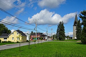
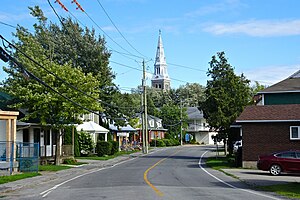
Salaberry-de-Valleyfield is a city in southwestern Quebec, Canada, in the Regional County Municipality of Beauharnois-Salaberry. The population as of 2021 was 42,410. The historic downtown is a major touristic centre for the area.
Salaberry-de-Valleyfield Aerodrome
Airport in Saint-Stanislas-de-Kostka, Quebec
Distance: Approx. 4388 meters
Latitude and longitude: 45.20833333,-74.14138889
Salaberry-de-Valleyfield Aerodrome (TC LID: CSD3) is located 2.5 nautical miles (4.6 km; 2.9 mi) southwest of Salaberry-de-Valleyfield, Quebec, Canada.
CKOD-FM
Radio station in Salaberry-de-Valleyfield, Quebec
Distance: Approx. 3225 meters
Latitude and longitude: 45.26888889,-74.09666667
CKOD-FM is a French language Canadian radio station located in Salaberry-de-Valleyfield, Quebec, approximately 50 kilometres (30 miles) southwest of Montreal, Quebec, Canada. The station is owned by Torres Media, a company that owns two other radio stations namely, CIUX 105.5 Hits FM in Uxbridge, Ontario and CIDG Rebel 101.7, in Ottawa. The station broadcasts on 103.1 MHz with an effective radiated power of 3,000 watts (class A) using an omnidirectional antenna.

Grande-Île, Quebec
Former municipality in Quebec, Canada
Distance: Approx. 4105 meters
Latitude and longitude: 45.27916667,-74.11388889
Grande-Île is an island in the St. Lawrence River in Quebec, Canada. The island is mostly occupied by the city Salaberry-de-Valleyfield.
Salaberry-Soulanges
Provincial electoral district in Quebec, Canada
Distance: Approx. 3452 meters
Latitude and longitude: 45.249,-74.156
Salaberry-Soulanges was a former provincial electoral district in the Montérégie region of Quebec, Canada. It was located to the southwest of the island of Montreal. It was created for the 1989 election from parts of the former Vaudreuil-Soulanges and Beauharnois electoral districts.

Coteau-du-Lac canal
18th-century military canal in Canada
Distance: Approx. 7122 meters
Latitude and longitude: 45.2878,-74.1769
Coteau-du-Lac Canal is an 18th-century military canal in Canada located at the junction of the Delisle and Saint Lawrence Rivers in Quebec. The canal was the first work of its kind in North America, and is a National Historic Site of Canada, which also includes the remains of a fort and reconstructed blockhouse. It is located in the town of Coteau-du-Lac in Vaudreuil-Soulanges Regional County Municipality.
Les Cèdres, Quebec
Municipality in Quebec, Canada
Distance: Approx. 8100 meters
Latitude and longitude: 45.3,-74.05
Les Cèdres is a municipality located north of the Saint Lawrence River in the Montérégie of Quebec, Canada, near Vaudreuil-Dorion. The population as of the Canada 2021 Census was 7,184. The name means "The Cedars" in French.
Saint-Timothée, Quebec
Former city in Quebec, Canada
Distance: Approx. 7741 meters
Latitude and longitude: 45.29,-74.04111111
Saint-Timothée is a former city located in the Montérégie region of Quebec, Canada, on Île-de-Salaberry in the St. Lawrence River. It occupied the middle third and largest area of the island, which is part of the Hochelaga Archipelago.

Saint-Stanislas-de-Kostka
Municipality in Quebec, Canada
Distance: Approx. 7062 meters
Latitude and longitude: 45.18,-74.13
Saint-Stanislas-de-Kostka is a municipality of Quebec, Canada, located within the Beauharnois-Salaberry Regional County Municipality in the Montérégie administrative region. The population as of the Canada 2021 Census was 1,852.

Basilica Cathedral of St. Cecilia
Church in Quebec, Canada
Distance: Approx. 2210 meters
Latitude and longitude: 45.25463,-74.1351
The Basilica Cathedral of St. Cecilia (Basilique-Cathédrale Sainte-Cécile in French) is a Roman Catholic minor basilica and a cathedral dedicated to St. Cecilia located in Salaberry-de-Valleyfield, Quebec, Canada.
Saint Charles River (Valleyfield)
River in Quebec, Canada
Distance: Approx. 2754 meters
Latitude and longitude: 45.26388889,-74.09583333
The Saint Charles River (French: Rivière Saint-Charles) is a branch of the Saint Lawrence River that starts in Salaberry-de-Valleyfield, Quebec, Canada. The river divides the Grande-Île and the Island of Salaberry, which are located approximately 50 km east of Montreal. The river is 8 km long, and drops 24m over its course from Lake Saint Francis east to Lake Saint-Louis.
Micocoulier Ecological Reserve
Distance: Approx. 6666 meters
Latitude and longitude: 45.2833,-74.175
Micocoulier Ecological Reserve is an ecological reserve in Quebec, Canada. It was established on January 7, 1981.
Weather in this IP's area
clear sky
3 Celsius
1 Celsius
2 Celsius
3 Celsius
1033 hPa
64 %
1033 hPa
1028 hPa
10000 meters
1.54 m/s
250 degree
06:38:47
16:41:11


