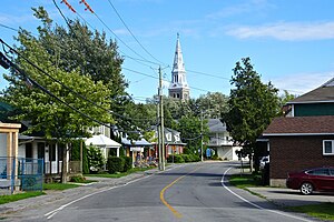
Country:
Region:
City:
Latitude and Longitude:
Time Zone:
Postal Code:
IP information under different IP Channel
ip-api
Country
Region
City
ASN
Time Zone
ISP
Blacklist
Proxy
Latitude
Longitude
Postal
Route
Luminati
Country
Region
qc
City
salaberrydevalleyfield
ASN
Time Zone
America/Toronto
ISP
CC-3272
Latitude
Longitude
Postal
IPinfo
Country
Region
City
ASN
Time Zone
ISP
Blacklist
Proxy
Latitude
Longitude
Postal
Route
db-ip
Country
Region
City
ASN
Time Zone
ISP
Blacklist
Proxy
Latitude
Longitude
Postal
Route
ipdata
Country
Region
City
ASN
Time Zone
ISP
Blacklist
Proxy
Latitude
Longitude
Postal
Route
Popular places and events near this IP address
Salaberry-de-Valleyfield
City in Quebec, Canada
Distance: Approx. 6504 meters
Latitude and longitude: 45.25,-74.13
Salaberry-de-Valleyfield is a city in southwestern Quebec, Canada, in the Regional County Municipality of Beauharnois-Salaberry. The population as of 2021 was 42,410. The historic downtown is a major touristic centre for the area.

Battle of the Cedars
1776 skirmishes of the American Revolutionary War
Distance: Approx. 4707 meters
Latitude and longitude: 45.3099,-74.0353
The Battle of the Cedars (French: Bataille des Cèdres) was a series of military confrontations in the early stages of the American Revolutionary War that occurred during the Continental Army's invasion of Quebec, which began in September 1775. These skirmishes, which involved limited combat, occurred in May 1776 at and around the Cedars, 45 km (28 mi) west of Montreal, Quebec. Continental Army units were opposed by a small British Army detachment leading a larger force of Haudenosaunee warriors and Canadian Militia.
Beauharnois (federal electoral district)
Former federal electoral district in Quebec, Canada
Distance: Approx. 5467 meters
Latitude and longitude: 45.249,-73.988
Beauharnois (also known as Beauharnois—Salaberry) was a federal electoral district in Quebec, Canada, that was represented in the House of Commons of Canada from 1867 to 1935, from 1949 to 1953, and from 1968 to 1972. Beauharnois riding was created in the British North America Act of 1867. It was merged into Beauharnois—Laprairie riding in 1933.

Beauharnois Canal
Distance: Approx. 8342 meters
Latitude and longitude: 45.27197222,-73.94519444
The Beauharnois Canal is located in southwestern Quebec, Canada. The canal is part of the Saint Lawrence Seaway. Located in Beauharnois-Salaberry Regional County Municipality within the cities of Salaberry-de-Valleyfield, Beauharnois, Saint-Louis-de-Gonzague, and Saint-Stanislas-de-Kostka, the canal connects Lake Saint-Francis to the west (upstream) with Lake Saint-Louis to the northeast (downstream), bypassing a series of rapids on the Saint Lawrence River.
CKOD-FM
Radio station in Salaberry-de-Valleyfield, Quebec
Distance: Approx. 3531 meters
Latitude and longitude: 45.26888889,-74.09666667
CKOD-FM is a French language Canadian radio station located in Salaberry-de-Valleyfield, Quebec, approximately 50 kilometres (30 miles) southwest of Montreal, Quebec, Canada. The station is owned by Torres Media, a company that owns two other radio stations namely, CIUX 105.5 Hits FM in Uxbridge, Ontario and CIDG Rebel 101.7, in Ottawa. The station broadcasts on 103.1 MHz with an effective radiated power of 3,000 watts (class A) using an omnidirectional antenna.
Beauharnois (provincial electoral district)
Provincial electoral district in Quebec, Canada
Distance: Approx. 5467 meters
Latitude and longitude: 45.249,-73.988
Beauharnois is a provincial electoral district in the Montérégie region of Quebec, Canada that elects members to the National Assembly of Quebec. The district notably include the city of Salaberry-de-Valleyfield. It was created in 2001 from parts of Beauharnois-Huntingdon, Châteauguay and Salaberry-Soulanges.

Grande-Île, Quebec
Former municipality in Quebec, Canada
Distance: Approx. 5004 meters
Latitude and longitude: 45.27916667,-74.11388889
Grande-Île is an island in the St. Lawrence River in Quebec, Canada. The island is mostly occupied by the city Salaberry-de-Valleyfield.
Les Cèdres, Quebec
Municipality in Quebec, Canada
Distance: Approx. 3431 meters
Latitude and longitude: 45.3,-74.05
Les Cèdres is a municipality located north of the Saint Lawrence River in the Montérégie of Quebec, Canada, near Vaudreuil-Dorion. The population as of the Canada 2021 Census was 7,184. The name means "The Cedars" in French.
Saint-Timothée, Quebec
Former city in Quebec, Canada
Distance: Approx. 2457 meters
Latitude and longitude: 45.29,-74.04111111
Saint-Timothée is a former city located in the Montérégie region of Quebec, Canada, on Île-de-Salaberry in the St. Lawrence River. It occupied the middle third and largest area of the island, which is part of the Hochelaga Archipelago.

Basilica Cathedral of St. Cecilia
Church in Quebec, Canada
Distance: Approx. 6741 meters
Latitude and longitude: 45.25463,-74.1351
The Basilica Cathedral of St. Cecilia (Basilique-Cathédrale Sainte-Cécile in French) is a Roman Catholic minor basilica and a cathedral dedicated to St. Cecilia located in Salaberry-de-Valleyfield, Quebec, Canada.
Saint Charles River (Valleyfield)
River in Quebec, Canada
Distance: Approx. 3516 meters
Latitude and longitude: 45.26388889,-74.09583333
The Saint Charles River (French: Rivière Saint-Charles) is a branch of the Saint Lawrence River that starts in Salaberry-de-Valleyfield, Quebec, Canada. The river divides the Grande-Île and the Island of Salaberry, which are located approximately 50 km east of Montreal. The river is 8 km long, and drops 24m over its course from Lake Saint Francis east to Lake Saint-Louis.
Beauharnois (Province of Canada electoral district)
Electoral district in former Province of Canada
Distance: Approx. 5467 meters
Latitude and longitude: 45.249,-73.988
Beauharnois was an electoral district of the Legislative Assembly of the Parliament of the Province of Canada, in Canada East, in a rural area south of Montreal. It was created for the first Parliament in 1841 and was based on the previous electoral district of the same name for the Legislative Assembly of Lower Canada. It was represented by one member in the Legislative Assembly.
Weather in this IP's area
clear sky
3 Celsius
3 Celsius
2 Celsius
3 Celsius
1033 hPa
62 %
1033 hPa
1027 hPa
10000 meters
0.51 m/s
310 degree
06:38:36
16:40:53


