108.161.200.184 - IP Lookup: Free IP Address Lookup, Postal Code Lookup, IP Location Lookup, IP ASN, Public IP
Country:
Region:
City:
Location:
Time Zone:
Postal Code:
ISP:
ASN:
language:
User-Agent:
Proxy IP:
Blacklist:
IP information under different IP Channel
ip-api
Country
Region
City
ASN
Time Zone
ISP
Blacklist
Proxy
Latitude
Longitude
Postal
Route
db-ip
Country
Region
City
ASN
Time Zone
ISP
Blacklist
Proxy
Latitude
Longitude
Postal
Route
IPinfo
Country
Region
City
ASN
Time Zone
ISP
Blacklist
Proxy
Latitude
Longitude
Postal
Route
IP2Location
108.161.200.184Country
Region
north carolina
City
powellsville
Time Zone
ISP
Language
User-Agent
Latitude
Longitude
Postal
ipdata
Country
Region
City
ASN
Time Zone
ISP
Blacklist
Proxy
Latitude
Longitude
Postal
Route
Popular places and events near this IP address
Powellsville, North Carolina
Town in North Carolina, United States
Distance: Approx. 61 meters
Latitude and longitude: 36.22527778,-76.93166667
Powellsville is a town in Bertie County, North Carolina, United States. The population was 276 at the 2010 census.

Ahoskie, North Carolina
Town in North Carolina, United States
Distance: Approx. 8413 meters
Latitude and longitude: 36.28416667,-76.99
Ahoskie (ah-HOSS-kee ) is a town in Hertford County, North Carolina, United States. The population was 4,891 at the 2020 census. Ahoskie is located in North Carolina's Inner Banks region.
Garrett White House
Historic house in North Carolina, United States
Distance: Approx. 4626 meters
Latitude and longitude: 36.21248611,-76.88280833
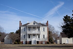
The Garrett White House, sometimes referred to as the Garrett-White House, is a historic structure in Colerain, Bertie County, North Carolina. The house is listed in the National Register of Historic Places as constructed in 1785, though some other sources give the date of construction as 1780.

Hope Plantation
Historic house in North Carolina, United States
Distance: Approx. 9436 meters
Latitude and longitude: 36.1775,-77.01916667
Hope Plantation, built in 1803, is an early house built in the Palladian mode of the Federal style, located on the Carolina Coastal Plain, near Windsor, North Carolina, in the United States. The plantation house was built by David Stone, a member of the coastal Carolina planter class, later Governor of North Carolina and a United States senator. One of the finest examples of Palladian design built in timber, the manor house is slightly modified by neo-classical elements.
ECU Health Roanoke-Chowan Hospital
Hospital in Ahoskie, North Carolina.
Distance: Approx. 8778 meters
Latitude and longitude: 36.2851667,-76.9949073
Roanoke-Chowan Hospital is a hospital located in Ahoskie, North Carolina. It is a part of the ECU Health System. In the 1930s, James David Early of nearby Early's Station community was a major supporter of building a hospital in Ahoskie and committed land for the project.

Ahoskie Downtown Historic District
Historic district in North Carolina, United States
Distance: Approx. 8421 meters
Latitude and longitude: 36.28611111,-76.98694444
Ahoskie Downtown Historic District is a national historic district located at Ahoskie, Hertford County, North Carolina. The district encompasses 14 contributing buildings in the central business district of Ahoskie. The commercial and governmental buildings include notable examples of Classical Revival and Colonial Revival architecture dated between 1901 and the late 1930s.

Ahoskie Historic District
Historic district in North Carolina, United States
Distance: Approx. 8407 meters
Latitude and longitude: 36.28722222,-76.98472222
Ahoskie Historic District is a national historic district located at Ahoskie, Hertford County, North Carolina. The district encompasses 604 contributing buildings, 1 contributing site, and 2 contributing structures in the central business district and surrounding residential sections of Ahoskie. The buildings include notable examples of Classical Revival, Colonial Revival, Late Gothic Revival, Tudor Revival, and Bungalow / American Craftsman architecture.
East End Historic District (Ahoskie, North Carolina)
Historic district in North Carolina, United States
Distance: Approx. 8533 meters
Latitude and longitude: 36.29361111,-76.97388889
East End Historic District is a national historic district located at Ahoskie, Hertford County, North Carolina. The district encompasses 27 contributing buildings and 1 contributing structure in a predominantly African-American residential section of Ahoskie. The buildings include notable examples of Colonial Revival architecture.

Roberts H. Jernigan House
Historic house in North Carolina, United States
Distance: Approx. 7542 meters
Latitude and longitude: 36.28055556,-76.97972222
Roberts H. Jernigan House is a historic home located at Ahoskie, Hertford County, North Carolina. It was built in 1917–1918, and is a two-story, Southern Colonial style frame dwelling with a truncated hip roof. It is sheathed in weatherboard and features a two-story, pedimented portico flanked by one-story porches extending to sides.

Ahoskie School
Historic school building in North Carolina, United States
Distance: Approx. 8891 meters
Latitude and longitude: 36.28888889,-76.99111111
Ahoskie School is a historic school complex located at Ahoskie, Hertford County, North Carolina. The main school building was designed by architect Leslie Boney and built in 1929. It is a two-story, Classical Revival-style brick building.
Weather in this IP's area
overcast clouds
0 Celsius
0 Celsius
-0 Celsius
0 Celsius
1024 hPa
63 %
1024 hPa
1021 hPa
10000 meters
1.25 m/s
1.26 m/s
257 degree
100 %