Country:
 USA
USARegion:
City:
Latitude and Longitude:
Time Zone:
Postal Code:
IP information under different IP Channel
ip-api
Country
Region
City
ASN
Time Zone
ISP
Blacklist
Proxy
Latitude
Longitude
Postal
Route
IPinfo
Country
Region
City
ASN
Time Zone
ISP
Blacklist
Proxy
Latitude
Longitude
Postal
Route
MaxMind
Country
Region
City
ASN
Time Zone
ISP
Blacklist
Proxy
Latitude
Longitude
Postal
Route
Luminati
Country
USRegion
nj
City
capemaycourthouse
ASN
Time Zone
America/New_York
ISP
UUNET
Latitude
Longitude
Postal
db-ip
Country
Region
City
ASN
Time Zone
ISP
Blacklist
Proxy
Latitude
Longitude
Postal
Route
ipdata
Country
Region
City
ASN
Time Zone
ISP
Blacklist
Proxy
Latitude
Longitude
Postal
Route
Popular places and events near this IP address
Leaming's Run Gardens
Flower garden in New Jersey, US
Distance: Approx. 2340 meters
Latitude and longitude: 39.1432,-74.7675
Leaming's Run Gardens (30 acres) were flower gardens located at 1845 US Route 9 North, Swainton, in Middle Township, New Jersey. The gardens are now indefinitely closed. The gardens were designed and created by Jack and Emily Aprill and children, and opened to the public in 1977.

Cape May National Wildlife Refuge
Wildlife habitat in New Jersey, US
Distance: Approx. 3113 meters
Latitude and longitude: 39.15833333,-74.825
The Cape May National Wildlife Refuge is a protected area on the Cape May Peninsula in Cape May County, New Jersey. It is part of the National Wildlife Refuge System and managed by the United States Fish and Wildlife Service. Established in January 1989 with 90 acres (0.36 km2) acquired from the Nature Conservancy, it has since grown to more than 11,000 acres (45 km2) in size, and plans call for its further expansion to more than 21,200 acres (86 km2).
WZXL
Radio station in Wildwood, New Jersey
Distance: Approx. 3288 meters
Latitude and longitude: 39.12455556,-74.76516667
WZXL (100.7 FM, "100.7 ZXL") is a radio station also known as "South Jersey's Rock Station", playing mainstream rock. WZXL is licensed to Wildwood, New Jersey. Operating with 38,000 watts, WZXL serves the greater South Jersey area including Atlantic City, Cape May, Long Beach Island, and Cumberland County.
Dennis Township Public Schools
School district in Cape May County, New Jersey, US
Distance: Approx. 3019 meters
Latitude and longitude: 39.170424,-74.794649
The Dennis Township School District, or Dennis Township Public Schools, are a community public school district that serves students in pre-kindergarten through eighth grade from Dennis Township, in Cape May County, in the U.S. state of New Jersey. As of the 2020–21 school year, the district, comprising two schools, had an enrollment of 615 students and 62.4 classroom teachers (on an FTE basis), for a student–teacher ratio of 9.9:1. The district is classified by the New Jersey Department of Education as being in District Factor Group "CD", the sixth-highest of eight groupings.
New Jersey Coastal Heritage Trail Route
300-mile trail along the eastern and southern coast of New Jersey
Distance: Approx. 2333 meters
Latitude and longitude: 39.1343,-74.7702
The New Jersey Coastal Heritage Trail Route extends along eastern and southern coast of New Jersey for nearly 300 miles (480 km). It travels along the Raritan Bay from Perth Amboy to Sandy Hook, along Jersey Shore at the Atlantic Ocean to Cape May, and along the Delaware Bay to the Delaware Memorial Bridge. The trail encompasses a variety of New Jersey state parks along with facilities under the jurisdiction of the National Park Service.
WJPG
Radio station in Cape May Court House, New Jersey
Distance: Approx. 2783 meters
Latitude and longitude: 39.12972222,-74.82166667
WJPG (88.1 FM) is a radio station broadcasting a Contemporary Christian format. Licensed to the Cape May Court House, section of Middle Township, Cape May County, New Jersey, United States. The station is currently owned by Maranatha Ministries and features programming from Salem Communications.
WKOE
Radio station in New Jersey, United States
Distance: Approx. 1598 meters
Latitude and longitude: 39.12994444,-74.78780556
WKOE (106.3 FM, "106.3 Coast Country") is a radio station broadcasting a country music format. Licensed to the North Cape May section of Lower Township, Cape May County, New Jersey, United States, the station serves the Cape May–Atlantic City radio market. WKOE also serves coastal Delaware and the Ocean City, Maryland, area as a secondary market.
Swainton, New Jersey
Populated place in Cape May County, New Jersey, US
Distance: Approx. 1984 meters
Latitude and longitude: 39.13138889,-74.7775
Swainton is an unincorporated community located within Middle Township in Cape May County, in the U.S. state of New Jersey. U.S. Route 9 and the Garden State Parkway are major roads of Swainton. Avalon is a coastal community directly across from Swainton, connected by Avalon Boulevard.

New Asbury Methodist Episcopal Meeting House
Historic church in New Jersey, United States
Distance: Approx. 2198 meters
Latitude and longitude: 39.14027778,-74.76944444
The New Asbury Methodist Episcopal Meeting House, also known as the Asbury United Methodist Church, is a historic church located on Shore Road (U.S. Route 9) in Middle Township of Cape May County, New Jersey, about six miles north of Cape May Court House. It was built in 1852 and added to the National Register of Historic Places on September 17, 1980, for its significance in architecture and religion. It was documented by the Historic American Buildings Survey (HABS) in 1992.

Thomas Ludlam Jr. House
Historic house in New Jersey, United States
Distance: Approx. 3912 meters
Latitude and longitude: 39.16916667,-74.82527778
Thomas Ludlam Jr. House is located in Dennis Township, Cape May County, New Jersey, United States. The house was built in 1790 and was added to the National Register of Historic Places on November 26, 2004.
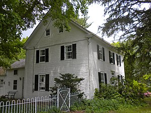
Thomas Leaming House
Historic house in New Jersey, United States
Distance: Approx. 2395 meters
Latitude and longitude: 39.14166667,-74.76694444
Thomas Leaming House is located in Middle Township, Cape May County, New Jersey, United States. The house was built in 1706 and was added to the National Register of Historic Places on August 1, 1997. Leaming was a member the fifth session (June–August 1776) of the Provincial Congress of New Jersey which ordered the arrest of the colony's last royal governor William Franklin, approved the Declaration of Independence and wrote New Jersey's first state constitution (1776).
Clermont, Cape May County, New Jersey
Populated place in Cape May County, New Jersey, US
Distance: Approx. 2882 meters
Latitude and longitude: 39.15111111,-74.76277778
Clermont is an unincorporated community located within Dennis Township in Cape May County, in the U.S. state of New Jersey. A post office was established in 1886, with Chester Todd as the first postmaster.
Weather in this IP's area
scattered clouds
15 Celsius
14 Celsius
12 Celsius
16 Celsius
1013 hPa
89 %
1013 hPa
1013 hPa
10000 meters
4.47 m/s
5.81 m/s
326 degree
45 %
06:34:44
19:19:00