Country:
Region:
City:
Latitude and Longitude:
Time Zone:
Postal Code:
IP information under different IP Channel
ip-api
Country
Region
City
ASN
Time Zone
ISP
Blacklist
Proxy
Latitude
Longitude
Postal
Route
IPinfo
Country
Region
City
ASN
Time Zone
ISP
Blacklist
Proxy
Latitude
Longitude
Postal
Route
MaxMind
Country
Region
City
ASN
Time Zone
ISP
Blacklist
Proxy
Latitude
Longitude
Postal
Route
Luminati
Country
Region
va
City
newportnews
ASN
Time Zone
America/New_York
ISP
UUNET
Latitude
Longitude
Postal
db-ip
Country
Region
City
ASN
Time Zone
ISP
Blacklist
Proxy
Latitude
Longitude
Postal
Route
ipdata
Country
Region
City
ASN
Time Zone
ISP
Blacklist
Proxy
Latitude
Longitude
Postal
Route
Popular places and events near this IP address
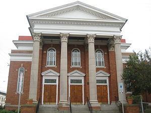
Collis P. Huntington High School
Former African-American high school during the racial segregation era
Distance: Approx. 120 meters
Latitude and longitude: 36.98944444,-76.41513889
Collis P. Huntington High School, commonly referred to as just Huntington High School (opened in 1927) was a black high school located in the East End section of Newport News, Virginia, US, during the era of racial segregation. After desegregation, it became an integrated intermediate school (eighth and ninth grades), and in 1981 was converted to a middle school (sixth through eighth grades). The school was named after the shipping and railroad pioneer, Collis P. Huntington, who founded the local shipyards, the Newport News Shipbuilding & Dry Dock Company, at one time the largest shipbuilding concern in the world.
The Apprentice School
Shipbuilding vocational school in Virginia, U.S.
Distance: Approx. 1659 meters
Latitude and longitude: 36.99069444,-76.43277778
The Apprentice School is a four to eight-year apprenticeship vocational school founded in 1919 and operated by Newport News Shipbuilding & Dry Dock Company in Newport News in the U.S. state of Virginia. The school trains students for careers in the shipbuilding industry. The school announced in April 2021 that it would begin awarding associate degrees in twenty-six maritime programs to its students beginning in 2023.
Newport News High School
Distance: Approx. 1537 meters
Latitude and longitude: 36.98272222,-76.42994444
Newport News High School was a high school located in Newport News, Virginia, United States. It was located at 3100 Huntington Avenue and operated by Newport News Public Schools.
East End (Newport News, Virginia)
Distance: Approx. 1492 meters
Latitude and longitude: 36.97666667,-76.40666667
The East End is an area of the independent city of Newport News, Virginia, located in the older portion of the port city near the harbor of Hampton Roads.

Greenlawn Memorial Park (Newport News, Virginia)
Historic cemetery in Virginia, United States
Distance: Approx. 1316 meters
Latitude and longitude: 36.99722222,-76.40416667
Greenlawn Memorial Park, also known as Greenlawn Cemetery, is located at 2700 Parish Avenue, Newport News, Virginia. Greenlawn Memorial Park is a 50-acre (200,000 m2) cemetery located where two natural streams, Mill Dam Creek and Salters Creek, come together. The cemetery has been in continuous operation, serving the Newport News and Hampton, Virginia, since 1888.

J. Thomas Newsome House
Historic home, museum, and cultural center
Distance: Approx. 836 meters
Latitude and longitude: 36.98972222,-76.405
J. Thomas Newsome House is a historic home located at Newport News, Virginia. It was built in 1898, and is a 2+1⁄2-story, seven-bay, asymmetrical, frame Queen Anne style dwelling. It features a steeply pitched irregularly composed roof, three sided bay, front Palladian window, and corner tower.

James A. Fields House
Historic house
Distance: Approx. 805 meters
Latitude and longitude: 36.98472222,-76.42194444
James A. Fields House is a historic home located in the Brookville Heights neighborhood in the East End of Newport News, Virginia. It was built in 1897, and is a two-story, Italianate style red brick dwelling on a raised basement. It features an entrance tower with a low pitched hipped roof and two ten-foot tall two-over-two windows on the first floor.
Smith's Pharmacy
Historic commercial building
Distance: Approx. 674 meters
Latitude and longitude: 36.99305556,-76.40916667
Smith's Pharmacy is a historic commercial building located in the East End section of Newport News, Virginia. It is a two-story brick building. The first floor was built in 1946 to house the pharmacy with the second floor being added in 1952 to serve as office space.
St. Vincent de Paul Catholic Church (Newport News, Virginia)
Historic church in Virginia, United States
Distance: Approx. 1709 meters
Latitude and longitude: 36.98305556,-76.43222222
St. Vincent de Paul Catholic Church is a historic Catholic church complex in Newport News, Virginia, United States. It was built 1916–1917 and is a 1+1⁄2-story, brick, Classical Revival style longitudinal-plan church.
Noland Company Building
Historic commercial building in Virginia, United States
Distance: Approx. 1309 meters
Latitude and longitude: 36.98222222,-76.42666667
Noland Company Building is a historic building located at Newport News, Virginia. The original section was built in 1920, and is three stories in height and is a cast-in-place concrete and brick structure. Later additions are a four-story brick addition and two-story brick addition parallel to the four-story section to create a "U" shape.
Whittaker Memorial Hospital
Hospital in Newport News, Virginia, United States
Distance: Approx. 186 meters
Latitude and longitude: 36.98944444,-76.4125
Whittaker Memorial Hospital is a historic hospital building located in the Brookville Heights neighborhood in the East End of Newport News, Virginia. The original section was built in 1943 with additions in 1957 and 1966. It was listed on the National Register of Historic Places in 2009.
Virginia School for the Deaf, Blind and Multi-Disabled at Hampton
Defunct school in Virginia, United States
Distance: Approx. 1796 meters
Latitude and longitude: 37,-76.4
Virginia School for the Deaf, Blind and Multi-Disabled at Hampton (VSDBM-H), also known as the Virginia School for the Deaf and the Blind-Hampton Campus (VSDB-Hampton) was a school for deaf and blind children in Hampton, Virginia. It was operated by the Commonwealth of Virginia.
Weather in this IP's area
clear sky
18 Celsius
18 Celsius
15 Celsius
19 Celsius
1015 hPa
72 %
1015 hPa
1014 hPa
10000 meters
7.13 m/s
11.75 m/s
353 degree
06:42:40
19:24:01


