Country:
Region:
City:
Latitude and Longitude:
Time Zone:
Postal Code:
IP information under different IP Channel
ip-api
Country
Region
City
ASN
Time Zone
ISP
Blacklist
Proxy
Latitude
Longitude
Postal
Route
Luminati
Country
Region
ga
City
alpharetta
ASN
Time Zone
America/New_York
ISP
ATT-INTERNET4
Latitude
Longitude
Postal
IPinfo
Country
Region
City
ASN
Time Zone
ISP
Blacklist
Proxy
Latitude
Longitude
Postal
Route
db-ip
Country
Region
City
ASN
Time Zone
ISP
Blacklist
Proxy
Latitude
Longitude
Postal
Route
ipdata
Country
Region
City
ASN
Time Zone
ISP
Blacklist
Proxy
Latitude
Longitude
Postal
Route
Popular places and events near this IP address

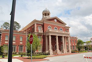
Alpharetta, Georgia
City in Georgia, United States
Distance: Approx. 418 meters
Latitude and longitude: 34.07527778,-84.29416667
Alpharetta is a city in northern Fulton County, Georgia, United States, and part of the Atlanta metropolitan area. As of the 2020 U.S. census, Alpharetta's population was 65,818; in 2010, the population had been 57,551.
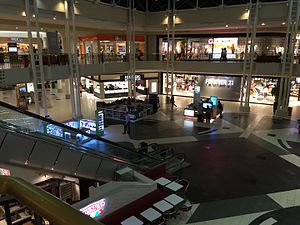
North Point Mall
Shopping mall in Georgia, United States
Distance: Approx. 3049 meters
Latitude and longitude: 34.048012,-84.294738
North Point Mall is a shopping mall, located in Alpharetta, Georgia (a suburb of Atlanta). The mall opened on October 20, 1993 as one of the largest shopping malls in the country. The mall was the second to last property built by Homart Development Company.

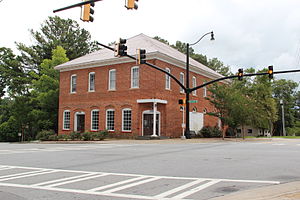
Independence High School (Georgia)
Alternative school in Alpharetta, Georgia, United States
Distance: Approx. 394 meters
Latitude and longitude: 34.07812,-84.30111
Independence High School was an alternative high school in the historic district of Roswell, Georgia, United States. It was located on the old Milton High School campus.
Crabapple, Georgia
Distance: Approx. 4032 meters
Latitude and longitude: 34.09,-84.33861111
Centered today at the crossroads of Georgia Highways 140 and 372 (also known as "the Silos area"), Crabapple, Georgia, is one of the oldest parts of Fulton County, Georgia. Originally part of Cherokee County, Georgia, (created 1832), Crabapple was part of the land contributed in 1857 to form Milton County, Georgia. The first permanent settlement at Crabapple was made in 1874, with the community taking its name from a crabapple tree near the original town site.
Alpharetta High School
High school in Georgia, United States
Distance: Approx. 3949 meters
Latitude and longitude: 34.078,-84.256
Alpharetta High School is a public high school located in Alpharetta, Georgia, United States within the Fulton County School System. Atlanta Magazine named Alpharetta High School one of the metro Atlanta area's best all-around high schools. In 2020, the U.S. News & World Report ranked the school #7 in Georgia and #281 nationally.

Ameris Bank Amphitheatre
Amphitheater in Georgia, USA
Distance: Approx. 2429 meters
Latitude and longitude: 34.054499,-84.307033
The Ameris Bank Amphitheatre (formerly Verizon Amphitheatre) is a contemporary amphitheatre, located in the northern Atlanta suburb of Alpharetta, Georgia, United States. The amphitheatre mainly hosts shows by popular music artists, comedians and themed symphony concerts by the Atlanta Symphony Orchestra, the latter opened the venue with a performance on May 10, 2008. The venue opened as Verizon Wireless Amphitheatre at Encore Park in 2008.
Lionheart School
Independent school, special education school in Alpharetta, Georgia, United States
Distance: Approx. 640 meters
Latitude and longitude: 34.07052,-84.30273
The Lionheart School is a 501(c)(3) non-profit independent school for children ages 5 to 21 with autism or other disorders of relating and communicating. The school was established in 2000 and is located in Alpharetta, Georgia, United States. Lionheart was awarded SACS/SAIS (Southern Association of Colleges and Schools/ Southern Association of Independent Schools) Accreditation in 2008.
Foe Killer Creek
Stream in Fulton County, Georgia, USA
Distance: Approx. 3443 meters
Latitude and longitude: 34.05638889,-84.32833333
Foe Killer Creek is a stream located in Fulton County, Georgia
Taste of Alpharetta
Distance: Approx. 397 meters
Latitude and longitude: 34.0753,-84.2944
Taste of Alpharetta is a festival/event where over 60 restaurants offer a wide range of foods. Established in 1991, it's located in Alpharetta, Georgia and drew over 60,000 people one year. Restaurants typically sell small "tasting" size portions which are typical of the restaurants' offerings from tables and tents.

Avalon (Alpharetta, Georgia)
Distance: Approx. 2039 meters
Latitude and longitude: 34.0706,-84.2773
Avalon is a mixed-use development in Alpharetta, Georgia. Phase I of the 86-acre (35 ha) site includes 500,000 square feet (46,000 m2) of retail space, a 12-screen Regal Cinemas theater, 105,000 square foot of Class A office space over retail, 101 single-family residences and 250 luxury rental homes. Phase I opened In October 2014 drawing shoppers away from North Point Mall.

National Christian Foundation
Organization
Distance: Approx. 1597 meters
Latitude and longitude: 34.063635,-84.288454
National Christian Foundation (NCF) is a US non-profit organization that assists donors in donating to charitable causes. NCF accepts non-cash assets and is the nation's largest provider of donor-advised funds focused primarily on Christian donors. Since 1982, NCF has granted over $14.5 billion to causes and charities.
Wellstar North Fulton Hospital
Hospital in Georgia, United States
Distance: Approx. 2412 meters
Latitude and longitude: 34.06328,-84.320548
Wellstar North Fulton Hospital (formerly North Fulton Medical Center and North Fulton Regional Hospital) is a major hospital located in Roswell, the ninth-largest city in Georgia. The hospital serves most of north Fulton County, Georgia, as well as neighboring Cherokee, Cobb, Forsyth and Gwinnett counties. Wellstar North Fulton Hospital is the third largest employer in the city of Roswell and is considered the epicenter of the city's growing healthcare industry.
Weather in this IP's area
broken clouds
17 Celsius
17 Celsius
16 Celsius
18 Celsius
1025 hPa
94 %
1025 hPa
984 hPa
10000 meters
0.45 m/s
1.79 m/s
68 degree
81 %
06:59:04
17:42:23


