Country:
Region:
City:
Latitude and Longitude:
Time Zone:
Postal Code:
IP information under different IP Channel
ip-api
Country
Region
City
ASN
Time Zone
ISP
Blacklist
Proxy
Latitude
Longitude
Postal
Route
Luminati
Country
Region
13
ASN
Time Zone
Asia/Tokyo
ISP
AS-VULTR
Latitude
Longitude
Postal
IPinfo
Country
Region
City
ASN
Time Zone
ISP
Blacklist
Proxy
Latitude
Longitude
Postal
Route
db-ip
Country
Region
City
ASN
Time Zone
ISP
Blacklist
Proxy
Latitude
Longitude
Postal
Route
ipdata
Country
Region
City
ASN
Time Zone
ISP
Blacklist
Proxy
Latitude
Longitude
Postal
Route
Popular places and events near this IP address

Yamate
District in Yokohama, Japan
Distance: Approx. 634 meters
Latitude and longitude: 35.4381994,139.6535468
Yamate (山手) is the name of a historic neighbourhood in Naka-ku, Yokohama often referred to in English as The Bluff. The neighbourhood is famous as having been a foreigners' residential area in the Bakumatsu, Meiji and Taishō periods. While still dominantly residential in character, with views over downtown Yokohama, historic residential properties, ornamental gardens and public parks, the area is also a popular visitor destination.
Bluff Hospital
Hospital in Yokohama, Japan
Distance: Approx. 444 meters
Latitude and longitude: 35.43711111,139.65144444
Bluff Hospital is a hospital and clinic active in the medical care of foreign residents of Yokohama, Japan.

Ishikawachō Station
Railway station in Yokohama, Japan
Distance: Approx. 842 meters
Latitude and longitude: 35.43833333,139.64305556
Ishikawachō Station (石川町駅, Ishikawachō-eki) is a passenger railway station located in Naka-ku, Yokohama, Japan, operated by East Japan Railway Company (JR East).

Yamate Station
Railway station in Yokohama, Japan
Distance: Approx. 789 meters
Latitude and longitude: 35.427,139.646
Yamate Station (山手駅, Yamate-eki) is a passenger railway station located in Naka-ku, Yokohama, Kanagawa Prefecture, Japan, operated by the East Japan Railway Company (JR East).
Motomachi, Yokohama
Distance: Approx. 800 meters
Latitude and longitude: 35.4403,139.648
Motomachi (元町) is a district on Naka Ward in Yokohama, Japan, located immediately west of Yamate and east of Chinatown. It consists of the Motomachi Shopping Street, a five-block long stretch of boutiques and shops, and is well known in Japan for its cosmopolitan atmosphere, original fashion, and Western influence.

Sacred Heart Cathedral, Yokohama
Distance: Approx. 426 meters
Latitude and longitude: 35.43638889,139.64722222
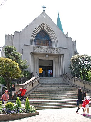
Sacred Heart Cathedral (Japanese: カトリック山手教会) is the seat of the bishop of the Roman Catholic Diocese of Yokohama, Japan. The Yokohama diocese includes Kanagawa, Shizuoka, Nagano, and Yamanashi prefectures. As it is located at 44 Yamate-cho, Naka-ku, the cathedral is commonly known locally as Yamate Catholic Church (カトリック山手教会, Katorikku Yamate Kyōkai).
Saint Maur International School
Private day college-prep school in Naka-ku, Yokohama, Kanagawa, Japan
Distance: Approx. 317 meters
Latitude and longitude: 35.43527778,139.6525
Saint Maur International School, established in 1872 in Yokohama within the Greater Tokyo Area, is the oldest international school in Japan. The school, which is co-educational, caters to students of all nationalities and faiths from ages 2½ through high school age. Saint Maur International School is located in a historically international district in Yokohama, Japan, one of the few places where foreigners were allowed entrance into the country during the closed – country policy of the late Edo period.
Museum of Tin Toys
Toy museum in Yokohama, Japan
Distance: Approx. 686 meters
Latitude and longitude: 35.43831389,139.65439444
Museum of Tin Toys (ブリキのおもちゃ博物館, Buriki no Omocha Hakubutsukan) is a museum in Yokohama, Kanagawa Prefecture, Japan.
Ferris University
Japanese private women's college
Distance: Approx. 576 meters
Latitude and longitude: 35.43805556,139.6475
Ferris University (フェリス女学院大学, Ferisu Jogakuin Daigaku, "Ferris Women's University") is a private women's college in Yokohama, Kanagawa, Japan. It is a part of Ferris Jogakuin (学校法人フェリス女学院). The predecessor of the school was founded by American Presbyterian missionaries in 1870 with the assistance of James Curtis Hepburn, primarily to teach the English language and western cultural values to women.

Christ Church, Yokohama
Church in Yokohama, Japan
Distance: Approx. 579 meters
Latitude and longitude: 35.438103,139.6524474
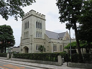
Christ Church, Yokohama (横浜山手聖公会 Yokohama Yamate Seikokai), is a historic Anglican church located in Yamate, Yokohama, Japan. Providing a center of worship for both Japanese and English-language congregations the church traces its foundation to shortly after the formal opening of the treaty port of Yokohama in 1859. The church building has been rebuilt and refurbished on several occasions as a result of fires, earthquakes and the incendiary bombing experienced during the later stages of the Second World War.

Ferris Girls' Junior & Senior High School
High school in Yokohama, Japan
Distance: Approx. 566 meters
Latitude and longitude: 35.438,139.6476
Ferris Girls' Junior & Senior High School (フェリス女学院中学校・高等学校 Ferisu Jogakuin Chūgakkō Kōtōgakkō) is a junior and senior high school for girls in Yokohama. It is a part of Ferris Jogakuin (学校法人フェリス女学院).

Harbor View Park (Yokohama)
Public park in Naka-ku, Yokohama, Japan
Distance: Approx. 863 meters
Latitude and longitude: 35.43988889,139.655
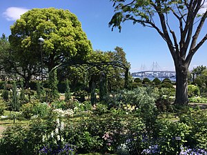
Harbor View Hill Park (Japanese: 港の見える丘公園 = Minato no mieru oka koen), or Harbor View Park as it is usually called in English, is a public park on the Bluff, Naka-ku, Yokohama, Japan, looking over the Port of Yokohama.
Weather in this IP's area
broken clouds
19 Celsius
18 Celsius
18 Celsius
19 Celsius
1020 hPa
70 %
1020 hPa
1018 hPa
10000 meters
4.12 m/s
360 degree
75 %
06:17:45
16:34:49


