Country:
 USA
USARegion:
City:
Latitude and Longitude:
Time Zone:
Postal Code:
IP information under different IP Channel
ip-api
Country
Region
City
ASN
Time Zone
ISP
Blacklist
Proxy
Latitude
Longitude
Postal
Route
IPinfo
Country
Region
City
ASN
Time Zone
ISP
Blacklist
Proxy
Latitude
Longitude
Postal
Route
MaxMind
Country
Region
City
ASN
Time Zone
ISP
Blacklist
Proxy
Latitude
Longitude
Postal
Route
Luminati
Country
USASN
Time Zone
America/Chicago
Latitude
Longitude
Postal
db-ip
Country
Region
City
ASN
Time Zone
ISP
Blacklist
Proxy
Latitude
Longitude
Postal
Route
ipdata
Country
Region
City
ASN
Time Zone
ISP
Blacklist
Proxy
Latitude
Longitude
Postal
Route
Popular places and events near this IP address

AMD
American multinational semiconductor company
Distance: Approx. 1363 meters
Latitude and longitude: 37.38222222,-121.97083333
Advanced Micro Devices, Inc. (AMD) is an American multinational corporation and fabless semiconductor company based in Santa Clara, California, that designs, develops and sells computer processors and related technologies for business and consumer markets. AMD's main products include microprocessors, motherboard chipsets, embedded processors, and graphics processors for servers, workstations, personal computers, and embedded system applications.

Intel
American multinational technology company
Distance: Approx. 1196 meters
Latitude and longitude: 37.38777778,-121.96361111
Intel Corporation is an American multinational corporation and technology company headquartered in Santa Clara, California, and incorporated in Delaware. Intel designs, manufactures and sells computer components and related products for business and consumer markets. It is considered one of the world's largest semiconductor chip manufacturers by revenue and ranked in the Fortune 500 list of the largest United States corporations by revenue for nearly a decade, from 2007 to 2016 fiscal years, until it was removed from the ranking in 2018.

Agnews Developmental Center
United States historic place
Distance: Approx. 1693 meters
Latitude and longitude: 37.39388889,-121.95277778
Agnews Developmental Center were two psychiatric and medical care facilities, located in Santa Clara, California and San Jose, California respectively.

Rivermark of Santa Clara
Planned community in Santa Clara
Distance: Approx. 2162 meters
Latitude and longitude: 37.39805556,-121.95194444
Rivermark of Santa Clara is a master-planned community in Santa Clara, California, built on a 152-acre (0.62 km2) parcel formerly owned by the State of California and previously used by Agnews Developmental Center. The community comprises retail space, parks, school, library, apartments, condominiums, townhouses, and houses (detached single-family homes). The Rivermark neighborhood has been described as "upscale," with many young professionals and families as residents.
Golden State Baptist College
College in Santa Clara, California
Distance: Approx. 1355 meters
Latitude and longitude: 37.3872,-121.9448
Golden State Baptist College (GSBC) is an unaccredited independent Baptist Bible college in Santa Clara, California, offering bachelor's degrees and master's degree programs in fields related to Christian ministry.
Granada Islamic School
Private school
Distance: Approx. 413 meters
Latitude and longitude: 37.37669,-121.95975
Granada Islamic School is a K-12 school in Santa Clara, California established in 1988 by the Muslim Community Association. Granada Islamic school is the largest Islamic school in the San Francisco Bay Area, and is accredited by the Western Association of Schools & Colleges. Granada Islamic School (GIS) was founded in 1988 in Santa Clara, California, in memory of Granada, Spain (Andalusia) - the beacon of Islamic civilization in the West.

Agnew's Village, California
Distance: Approx. 1690 meters
Latitude and longitude: 37.394,-121.958
Agnew's Village (or Agnew) was a small unincorporated village in what is now Santa Clara, California. It was named for Abram Agnew, a Santa Clara Valley pioneer from Ohio who settled there around 1873. Agnew donated 4 acres (1.6 ha) of land for a South Pacific Coast Railroad station and laid out the town, causing the station and town to be referred to as "Agnew's".
San Tomas Aquino Creek
River in California, United States
Distance: Approx. 1575 meters
Latitude and longitude: 37.38888889,-121.96861111
San Tomas Aquinas Creek, known locally as San Tomas Aquino Creek, is a 16.5-mile-long (26.6 km) stream that heads on El Sereno mountain in El Sereno Open Space Preserve in Saratoga, California in Santa Clara County, California, United States. It flows north through the cities of Saratoga, Monte Sereno, Los Gatos, Campbell, Santa Clara and San Jose before its confluence with the Guadalupe Slough in south San Francisco Bay.

The Grizzly
Wooden roller coaster in California
Distance: Approx. 2076 meters
Latitude and longitude: 37.39299444,-121.97137222
The Grizzly is a wooden roller coaster located at California's Great America in Santa Clara, California. The ride was designed by Curtis D. Summers and manufactured by Kings Island Construction. It uses traditional tracks with steel wheels on the cars, and, therefore, is designed to maintain positive-g loading on the cars and riders throughout its course.

Donald Von Raesfeld Power Plant
Distance: Approx. 484 meters
Latitude and longitude: 37.37694444,-121.95111111
The Donald Von Raesfeld Power Plant (DVRPP) is a natural gas power plant in Santa Clara, California, operated by Silicon Valley Power. Located near the San Jose International Airport it began operations in 2005 with a peak capacity of 147 megawatts. DVRPP is a two-on-one combined cycle power plant, combining the output of two 50 MW combustion turbines with one 22MW steam turbine.
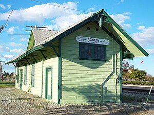
Agnew station
Distance: Approx. 1640 meters
Latitude and longitude: 37.39353056,-121.95817222
Agnew station is a former railway station in Santa Clara County, California, in what is now the city of Santa Clara. The station was built in 1877 and originally served the narrow-gauge South Pacific Coast Railroad. Landowner Abram Agnew donated 4 acres (1.6 ha) to the railroad to build a station and laid out the settlement that would become known as Agnew's Village.

Memorial Cross Park
Template for California Historical Landmarks in Santa Clara County.
Distance: Approx. 1705 meters
Latitude and longitude: 37.36944444,-121.94083333
Memorial Cross Park, also known as Mission Cross Park, is a small 0.34-acre (0.14 ha) city park in Santa Clara, California which was the second, temporary site of the Mission Santa Clara de Asís, from 1779 to 1784. A large granite cross was donated to the city by a local Lions Club in 1953 and stood there until it was removed in late 2016 following a federal lawsuit filed by the Freedom from Religion Foundation.
Weather in this IP's area
clear sky
19 Celsius
19 Celsius
16 Celsius
20 Celsius
1010 hPa
78 %
1010 hPa
1009 hPa
10000 meters
5.66 m/s
340 degree
06:52:50
19:10:48