107.161.4.19 - IP Lookup: Free IP Address Lookup, Postal Code Lookup, IP Location Lookup, IP ASN, Public IP
Country:
Region:
City:
Location:
Time Zone:
Postal Code:
ISP:
ASN:
language:
User-Agent:
Proxy IP:
Blacklist:
IP information under different IP Channel
ip-api
Country
Region
City
ASN
Time Zone
ISP
Blacklist
Proxy
Latitude
Longitude
Postal
Route
db-ip
Country
Region
City
ASN
Time Zone
ISP
Blacklist
Proxy
Latitude
Longitude
Postal
Route
IPinfo
Country
Region
City
ASN
Time Zone
ISP
Blacklist
Proxy
Latitude
Longitude
Postal
Route
IP2Location
107.161.4.19Country
Region
ontario
City
greater napanee
Time Zone
America/Toronto
ISP
Language
User-Agent
Latitude
Longitude
Postal
ipdata
Country
Region
City
ASN
Time Zone
ISP
Blacklist
Proxy
Latitude
Longitude
Postal
Route
Popular places and events near this IP address
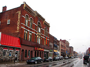
Greater Napanee
Town in Ontario, Canada
Distance: Approx. 0 meters
Latitude and longitude: 44.25,-76.95
Greater Napanee is a town in southeastern Ontario, Canada, approximately 45 kilometres (28 mi) west of Kingston and the county seat of Lennox and Addington County. It is located on the eastern end of the Bay of Quinte. Greater Napanee municipality was created by amalgamating the old Town of Napanee with the townships of Adolphustown, North and South Fredericksburg, and Richmond in 1999.
Napanee River
River in Ontario, Canada
Distance: Approx. 8347 meters
Latitude and longitude: 44.19555556,-77.02194444
The Napanee River is a river in Lennox and Addington County and Frontenac County in Eastern Ontario, Canada. It is in the Great Lakes Basin and flows from its source at Camden Lake to its mouth at the Bay of Quinte on Lake Ontario at Napanee. It flows through a valley of preglacial origin.
Lennox (federal electoral district)
Former federal electoral district in Ontario, Canada
Distance: Approx. 6476 meters
Latitude and longitude: 44.24,-76.87
Lennox was a federal electoral district represented in the House of Commons of Canada from 1867 to 1904. It was located in the province of Ontario. It was created by the British North America Act of 1867.
Algonquin and Lakeshore Catholic District School Board
Roman Catholic school board in Ontario, Canada
Distance: Approx. 598 meters
Latitude and longitude: 44.25527778,-76.94861111
Algonquin and Lakeshore Catholic District School Board (ALCDSB) is a separate school board in Ontario, Canada. The school board is the school district administrator for Roman Catholic schools in the western portions of Eastern Ontario, including Napanee, Kingston, Belleville and Quinte West.

Napanee station
Railway station in Ontario, Canada
Distance: Approx. 536 meters
Latitude and longitude: 44.25369444,-76.95430556
Napanee station in Napanee, Ontario, Canada is served by Via Rail trains running from Toronto to Ottawa. The 1856 limestone railway station was an unstaffed but heated shelter with telephones and washrooms, which would open at least half an hour before a train arrives. The platform is wheelchair-accessible.
Deseronto
Town in Ontario, Canada
Distance: Approx. 9727 meters
Latitude and longitude: 44.2,-77.05
Deseronto is a town in the Canadian province of Ontario, in Hastings County, located at the mouth of the Napanee River on the shore of the Bay of Quinte, on the northern side of Lake Ontario. The town was named for Captain John Deseronto, a native Mohawk leader who was a captain in the British Military Forces during the American Revolutionary War. More extensive development began with sale of village tracts by Deseronto's grandson John Culbertson in 1837.
Napanee District Secondary School
School in Napanee, Ontario, Canada
Distance: Approx. 755 meters
Latitude and longitude: 44.24917,-76.9594
Napanee District Secondary School colloquially known as NDSS is a Canadian public, comprehensive school located in Napanee, Ontario, Canada. The town is in the Eastern Ontario county of Lennox and Addington approximately 40 kilometres west of the city of Kingston, Ontario. The school offers classes for students in grades nine through twelve and is a member school of the Limestone District School Board.
CKYM-FM
Radio station in Kingston, Ontario
Distance: Approx. 189 meters
Latitude and longitude: 44.24849,-76.95109
CKYM-FM is the call sign of a radio station located in Napanee, Ontario on the FM band at 88.7 MHz. Owned by My Broadcasting Corporation, the station airs an adult contemporary format branded as 88.7 myFM, serving the Kingston radio market. The station was licensed by the Canadian Radio-television and Telecommunications Commission in 2006, and launched in August 2007.
Mount Pleasant, Lennox and Addington County, Ontario
Distance: Approx. 6383 meters
Latitude and longitude: 44.252,-77.03
Mount Pleasant is a small community in Lennox and Addington County, Ontario, Canada, situated west of Napanee.
Strathcona Paper Centre
Sports and entertainment facility in Napanee, Ontario, Canada
Distance: Approx. 2116 meters
Latitude and longitude: 44.2598,-76.97274
The Strathcona Paper Centre (SPC) is a sports and entertainment facility located on 16 McPherson Drive in Napanee, Ontario, Canada. The facility hosts national and provincial ice hockey championships, curling, concerts and trade fairs. The SPC is the home arena of the Napanee Raiders, a Junior ice hockey team.
Weather in this IP's area
broken clouds
-5 Celsius
-11 Celsius
-5 Celsius
-5 Celsius
1022 hPa
86 %
1022 hPa
1007 hPa
10000 meters
4.21 m/s
9.13 m/s
261 degree
66 %


