Country:
Region:
City:
Latitude and Longitude:
Time Zone:
Postal Code:
IP information under different IP Channel
ip-api
Country
Region
City
ASN
Time Zone
ISP
Blacklist
Proxy
Latitude
Longitude
Postal
Route
Luminati
Country
Region
qc
City
montreal
ASN
Time Zone
America/Toronto
ISP
EBOX
Latitude
Longitude
Postal
IPinfo
Country
Region
City
ASN
Time Zone
ISP
Blacklist
Proxy
Latitude
Longitude
Postal
Route
db-ip
Country
Region
City
ASN
Time Zone
ISP
Blacklist
Proxy
Latitude
Longitude
Postal
Route
ipdata
Country
Region
City
ASN
Time Zone
ISP
Blacklist
Proxy
Latitude
Longitude
Postal
Route
Popular places and events near this IP address

Ahuntsic (federal electoral district)
Federal electoral district in Quebec, Canada
Distance: Approx. 881 meters
Latitude and longitude: 45.55,-73.67
Ahuntsic was a federal electoral district in Quebec, Canada, that was represented in the House of Commons of Canada from 1968 to 1979 and from 1988 to 2015.

Ahuntsic
Neighbourhood in Montreal, Quebec, Canada
Distance: Approx. 894 meters
Latitude and longitude: 45.55488889,-73.67013889
Ahuntsic (; Canadian French pronunciation [aɔntsɪk], colloquially [ɔntsɪk]) is a district in the northern part of Montreal, Quebec, Canada. Originally an independent village, Ahuntsic was first annexed by Montreal in 1910, then merged into the borough of Ahuntsic-Cartierville in 2002. It is home to Collège Ahuntsic and Complexe sportif Claude-Robillard.

Henri-Bourassa station
Montreal Metro station
Distance: Approx. 993 meters
Latitude and longitude: 45.55444444,-73.66861111
Henri-Bourassa station is a Montreal Metro station in the borough of Ahuntsic-Cartierville in Montreal, Quebec, Canada. It is operated by the Société de transport de Montréal (STM) and serves the Orange Line. It is located in the Ahuntsic district.

Cartier station (Montreal Metro)
Montreal Metro station
Distance: Approx. 914 meters
Latitude and longitude: 45.56027778,-73.68194444
Cartier station is a Montreal Metro station in Laval, Quebec, Canada. It is operated by the Société de transport de Montréal (STM) and serves the Orange Line. Located in the Pont-Viau district, it is part of an extension into Laval, and opened on April 28, 2007.
Pont-Viau, Quebec
Distance: Approx. 974 meters
Latitude and longitude: 45.56083333,-73.68166667
Pont-Viau, Quebec is a district in the southern part of Laval, Quebec, Canada. It was a town before August 6, 1965. It was named after Viau Bridge, which links it to Ahuntsic-Cartierville in Montreal, Quebec.
Ahuntsic (provincial electoral district)
Provincial electoral district in Quebec, Canada
Distance: Approx. 881 meters
Latitude and longitude: 45.55,-73.67
Ahuntsic was a former provincial electoral district in Quebec, Canada, which elected members to the National Assembly of Quebec (known as the Legislative Assembly of Quebec until December 1968). It was located in and around the Ahuntsic district of Montreal. It was created for the 1966 election from parts of the now-defunct Laval district.
Nouveau-Bordeaux
Neighbourhood in Montreal, Quebec, Canada
Distance: Approx. 661 meters
Latitude and longitude: 45.546817,-73.677017
Nouveau-Bordeaux (French pronunciation: [nuvo bɔʁdo], lit. 'New Bordeaux') originally known as Bordeaux, is a neighbourhood in north end Montreal, Quebec, Canada located in the borough of Ahuntsic-Cartierville. Nouveau-Bordeaux is bordered on the north by Rivière des Prairies, to the northeast by Ahuntsic, to the southeast by the borough of Saint-Laurent and to the southwest by the neighbourhood of Cartierville. Formerly an independent city, Bordeaux was annexed by the much larger city of Montreal in the year 1910, at the same time as neighboring Ahuntsic.

Bois-de-Boulogne station
Railway station in Montreal, Quebec, Canada
Distance: Approx. 1347 meters
Latitude and longitude: 45.54027778,-73.67722222
Bois-de-Boulogne station is a commuter rail station operated by Exo in Montreal, Quebec, Canada. It is served by the Saint-Jérôme line.
Gouin Boulevard
Street in Montreal, Canada
Distance: Approx. 636 meters
Latitude and longitude: 45.553842,-73.67313
Gouin Boulevard (officially in French: boulevard Gouin) is the longest street on the Island of Montreal, stretching 57.6 kilometres (35.8 mi) across the north side of the island from Senneville in the west to Pointe-aux-Trembles in the east, where it intersects with Sherbrooke Street (Quebec Route 138).

Henri Bourassa Boulevard
Thoroughfare in Montreal, Canada
Distance: Approx. 819 meters
Latitude and longitude: 45.55083333,-73.67055556
Henri Bourassa Boulevard (officially in French: Boulevard Henri-Bourassa) is a major east–west street located in Montreal, Quebec, Canada. Located in the north of the island of Montreal, it runs parallel to Gouin Boulevard. Spanning 29 kilometres (18 miles) in length, it links the borough of Rivière-des-Prairies–Pointe-aux-Trembles in the east to a junction with Autoroute 13 and Alfred Nobel Boulevard in Saint-Laurent in the west.
Bordeaux Prison
Prison in Canada
Distance: Approx. 885 meters
Latitude and longitude: 45.545,-73.686
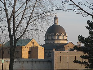
The Bordeaux Prison (French: Prison de Bordeaux), also known as the Montreal Detention Centre, is a provincial prison in Montreal, Quebec, Canada. It is located at 800 Gouin Boulevard West in the borough of Ahuntsic-Cartierville. The prison was built between 1908 and 1912 by architect Jean-Omer Marchand to replace the aged Pied-du-Courant Prison.

Ahuntsic-Cartierville (electoral district)
Federal electoral district in Quebec, Canada
Distance: Approx. 1160 meters
Latitude and longitude: 45.545,-73.67
Ahuntsic-Cartierville is a federal electoral district in Quebec, Canada, that has been represented in the House of Commons of Canada since 2015. Ahuntsic-Cartierville was created by the 2012 federal electoral boundaries redistribution and was legally defined in the 2013 representation order. It came into effect upon the call of the 42nd Canadian federal election, scheduled for 19 October 2015.
Weather in this IP's area
scattered clouds
5 Celsius
1 Celsius
4 Celsius
6 Celsius
1025 hPa
46 %
1025 hPa
1023 hPa
10000 meters
7.2 m/s
11.83 m/s
350 degree
40 %
06:50:29
16:27:33

