107.14.64.65 - IP Lookup: Free IP Address Lookup, Postal Code Lookup, IP Location Lookup, IP ASN, Public IP
Country:
Region:
City:
Location:
Time Zone:
Postal Code:
IP information under different IP Channel
ip-api
Country
Region
City
ASN
Time Zone
ISP
Blacklist
Proxy
Latitude
Longitude
Postal
Route
Luminati
Country
ASN
Time Zone
America/Chicago
ISP
TWC-7843-BB
Latitude
Longitude
Postal
IPinfo
Country
Region
City
ASN
Time Zone
ISP
Blacklist
Proxy
Latitude
Longitude
Postal
Route
IP2Location
107.14.64.65Country
Region
colorado
City
denver
Time Zone
America/Denver
ISP
Language
User-Agent
Latitude
Longitude
Postal
db-ip
Country
Region
City
ASN
Time Zone
ISP
Blacklist
Proxy
Latitude
Longitude
Postal
Route
ipdata
Country
Region
City
ASN
Time Zone
ISP
Blacklist
Proxy
Latitude
Longitude
Postal
Route
Popular places and events near this IP address

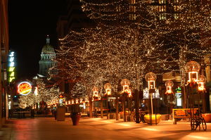
Denver
Capital of Colorado, United States
Distance: Approx. 113 meters
Latitude and longitude: 39.7392,-104.9849
Denver ( DEN-vər) is a consolidated city and county, the capital, and most populous city of the U.S. state of Colorado. It is located in the western United States, in the South Platte River Valley on the western edge of the High Plains east of the Front Range of the Rocky Mountains. With a population of 715,522 as of the 2020 census, a 19.22% increase since 2010, Denver is the 19th most populous city in the United States and the fifth most populous state capital.

Colorado General Assembly
Legislative branch of the state government of Colorado
Distance: Approx. 105 meters
Latitude and longitude: 39.7392,-104.9848
The Colorado General Assembly is the state legislature of the State of Colorado. It is a bicameral legislature consisting of the Senate and House of Representatives that was created by the 1876 state constitution. Its statutes are codified in the Colorado Revised Statutes (C.R.S.).

Colorado House of Representatives
Lower house of the state legislature of Colorado, US
Distance: Approx. 105 meters
Latitude and longitude: 39.7392,-104.9848
The Colorado House of Representatives is the lower house of the Colorado General Assembly, the state legislature of the U.S. state of Colorado. The House is composed of 65 members from an equal number of constituent districts, with each district having roughly 80 thousand people. Representatives are elected to two-year terms, and are limited to four consecutive terms in office, but can run again after a four-year respite.

Colorado Senate
Upper house of Colorado General Assembly
Distance: Approx. 105 meters
Latitude and longitude: 39.7392,-104.9848
The Colorado State Senate is the upper house of the Colorado General Assembly, the state legislature of the US state of Colorado. It is composed of 35 members elected from single-member districts, with each district having a population of about 123,000 as of the 2000 census. Senators are elected to four-year terms, and are limited to two consecutive terms in office.
Colorado State Capitol
State capitol building of the U.S. state of Colorado
Distance: Approx. 110 meters
Latitude and longitude: 39.7392321,-104.9848677
The Colorado State Capitol Building, located at 200 East Colfax Avenue in Denver, Colorado, United States, is the home of the Colorado General Assembly and the offices of the Governor of Colorado, Lieutenant Governor of Colorado, and the Colorado State Treasurer.

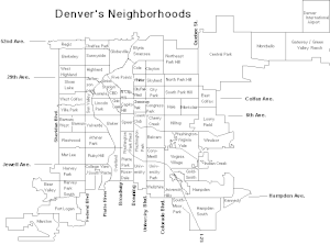
List of neighborhoods in Denver
List of neighborhoods in the City and County of Denver, Colorado, United States
Distance: Approx. 113 meters
Latitude and longitude: 39.7392,-104.9849
The City and County of Denver, capital of the U.S. state of Colorado, has 78 official neighborhoods used for planning and administration. The system of neighborhood boundaries and names dates to 1970 when city planners divided the city into 73 groups of one to four census tracts, called "statistical neighborhoods," most of which are unchanged since then. Unlike some other cities, such as Chicago, Denver does not have official larger area designations.

National Register of Historic Places listings in Denver
List of National Register of Historic Places in Denver, Colorado, United States
Distance: Approx. 113 meters
Latitude and longitude: 39.7392,-104.9849
There are more than 300 properties and districts listed on the National Register of Historic Places in the City and County of Denver, the capital of the U.S. State of Colorado. This National Park Service list is complete through NPS recent listings posted December 20, 2024.

National Register of Historic Places listings in west Denver
List of National Register of Historic Places in west Denver, Colorado, United States
Distance: Approx. 113 meters
Latitude and longitude: 39.7392,-104.9849
This is a list of the National Register of Historic Places listings in West Denver, Colorado. This is intended to be a complete list of the properties and districts on the National Register of Historic Places in western Denver, Colorado, United States. West Denver is defined as being all of the city west of the South Platte River.

National Register of Historic Places listings in downtown Denver
List of National Register of Historic Places in downtown Denver, Colorado, United States
Distance: Approx. 113 meters
Latitude and longitude: 39.7392,-104.9849
This is a list of the National Register of Historic Places listings in Downtown Denver, Colorado. This is intended to be a complete list of the properties and districts on the National Register of Historic Places in downtown Denver, Colorado, United States. Downtown Denver is defined as being the neighborhoods of Capitol Hill, Central Business District, Civic Center, Five Points, North Capitol Hill, and Union Station.
Timeline of Denver
Distance: Approx. 99 meters
Latitude and longitude: 39.739167,-104.984722
The following is a timeline of the history of the city of Denver, Colorado, United States, from its founding in 1858 to the present.

Armenian Khachkar
Sculpture in Denver, Colorado, U.S.
Distance: Approx. 82 meters
Latitude and longitude: 39.73944444,-104.98455556
The Armenian Khachkar is a khachkar and monument dedicated to the victims of genocide, installed outside the Colorado State Capitol, in Denver. The memorial was dedicated in 2015. It was defaced in May 2020 as part of the George Floyd protests.
The Closing Era
Statue in Denver, Colorado, U.S.
Distance: Approx. 38 meters
Latitude and longitude: 39.739235,-104.983983
The Closing Era is a bronze sculpture of a Native American hunter standing over a dying bison, installed on the East side of the Colorado State Capitol in Denver. The statue was created by Preston Powers, the son of famous sculptor Hiram Powers and "represents the end of the traditional lifestyle of Native Americans in Colorado". It was originally created in 1893 for the World's Columbian Exposition in Chicago and subsequently donated to the state of Colorado and erected on a granite base.
Weather in this IP's area
broken clouds
7 Celsius
7 Celsius
5 Celsius
10 Celsius
1020 hPa
29 %
1020 hPa
840 hPa
10000 meters
1.34 m/s
3.58 m/s
360 degree
52 %

