Country:
Region:
City:
Latitude and Longitude:
Time Zone:
Postal Code:
IP information under different IP Channel
ip-api
Country
Region
City
ASN
Time Zone
ISP
Blacklist
Proxy
Latitude
Longitude
Postal
Route
Luminati
Country
ASN
Time Zone
America/Chicago
ISP
ATT-MOBILITY-LLC-AS20057
Latitude
Longitude
Postal
IPinfo
Country
Region
City
ASN
Time Zone
ISP
Blacklist
Proxy
Latitude
Longitude
Postal
Route
db-ip
Country
Region
City
ASN
Time Zone
ISP
Blacklist
Proxy
Latitude
Longitude
Postal
Route
ipdata
Country
Region
City
ASN
Time Zone
ISP
Blacklist
Proxy
Latitude
Longitude
Postal
Route
Popular places and events near this IP address
Van Nuys
Neighborhood of Los Angeles in California, United States
Distance: Approx. 2263 meters
Latitude and longitude: 34.1833,-118.4333
Van Nuys () is a neighborhood in the central San Fernando Valley region of Los Angeles, California. Home to Van Nuys Airport and the Valley Municipal Building, it is the most populous neighborhood in the San Fernando Valley.

The Japanese Garden
Japanese garden in Los Angeles
Distance: Approx. 2311 meters
Latitude and longitude: 34.1837,-118.4808
The Japanese Garden is a 6.5-acre (2.6 ha) public Japanese garden in Los Angeles, located in the Lake Balboa district in the central San Fernando Valley, adjacent to the Van Nuys and Encino neighborhoods. It is specifically on the grounds of the Tillman Water Reclamation Plant adjacent to Woodley Park, in the Sepulveda Basin Recreation Area. The garden's Japanese name is Suihō-en (水芳園) meaning "garden of water and fragrance." The idea of having a Japanese Garden adjacent to a water reclamation plant was conceived by Donald C. Tillman.
Van Nuys High School
Public comprehensive high school in Van Nuys, Los Angeles, California, United States
Distance: Approx. 287 meters
Latitude and longitude: 34.18954,-118.453586
Van Nuys High School (VNHS) is a public high school in the Van Nuys district of Los Angeles, belonging to the Los Angeles Unified School District: District 2. The school is home to a Residential Program and three Magnet Programs—Math/Science, Performing Arts, and Medical. Several neighborhoods, including much of Van Nuys, portions of Sherman Oaks, Magnolia Woods, and Victory Park, are zoned to this school.

Sepulveda station
Los Angeles Metro Busway station
Distance: Approx. 1469 meters
Latitude and longitude: 34.1809,-118.4688
Sepulveda station is a station on the G Line of the Los Angeles Metro Busway system. It is named after nearby Sepulveda Boulevard, which travels north-south and crosses the east-west busway route. Unique among G Line stations, Sepulveda's platforms are not located at the cross street, but rather about a block west of it.

Van Nuys station (Los Angeles Metro)
Bus rapid transit station in Los Angeles, California
Distance: Approx. 1244 meters
Latitude and longitude: 34.1805,-118.4487
Van Nuys station is a station on the G Line of the Los Angeles Metro Busway system. It is named after adjacent Van Nuys Boulevard, which travels north-south and crosses the east-west busway route and is located in the Van Nuys district of Los Angeles, in the San Fernando Valley. Adjacent to the station is the G Line Bikeway.

Charter High School of the Arts
Public, charter school in Van Nuys, California, United States
Distance: Approx. 993 meters
Latitude and longitude: 34.1951,-118.4483
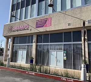
Charter High of the Arts Multimedia and Performing (or CHAMPS) is a public charter high school in Van Nuys, Los Angeles, California.
St. Elisabeth of Hungary Church and School
Catholic Church in California, USA
Distance: Approx. 390 meters
Latitude and longitude: 34.190919,-118.452823
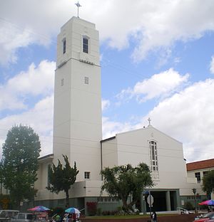
St. Elisabeth of Hungary Church and School, originally known as St. Elizabeth Church and School, is a Catholic church and elementary school located in Van Nuys, Los Angeles, California.
Van Nuys Branch
United States historic place
Distance: Approx. 834 meters
Latitude and longitude: 34.18472222,-118.44972222
Van Nuys Branch covers two branch library buildings of the Los Angeles Public Library, both located in Van Nuys, central San Fernando Valley, Los Angeles, California.

Leo Magnus Cricket Complex
Cricket ground
Distance: Approx. 1963 meters
Latitude and longitude: 34.18142778,-118.47565556
The Leo Magnus Cricket Complex (LMCC) or Sepulveda Basin Cricket Fields, aka Woodley Park, is a group of four cricket grounds located in the Van Nuys neighborhood of Los Angeles, California, United States. The facility is also called Woodley Cricket Field(s) or Woodley Cricket Complex due to its location in Woodley Park.

Tillman Water Reclamation Plant
Distance: Approx. 2217 meters
Latitude and longitude: 34.182,-118.479
The Donald C. Tillman Water Reclamation Plant is a water reclamation plant located in Van Nuys, Los Angeles, California, United States. The plant was conceived of, designed and constructed by the City of Los Angeles' Bureau of Engineering. The Administration Building was designed by California architect Anthony J. Lumsden.

The Church on the Way
Church in Van Nuys, California, United States
Distance: Approx. 1530 meters
Latitude and longitude: 34.200761,-118.4471727
The Church on the Way (The First Foursquare Church of Van Nuys) is a Pentecostal church in Van Nuys, California, led by Senior Pastor, Tim Clark. It is affiliated with the Foursquare Church. The church was formerly pastored by Jack Hayford and was widely influential in the Charismatic Movement in the 1970s through the 1990s, with services regularly televised on the Trinity Broadcasting Network and aired on its own local radio station.

Woodley Park (Los Angeles)
Distance: Approx. 2320 meters
Latitude and longitude: 34.1795,-118.4788
Woodley Park is a recreation area managed by the City of Los Angeles and located along Woodley Avenue between Victory and Burbank Boulevards in the Lake Balboa neighborhood of Los Angeles, California. The area is located within the large Sepulveda Basin Recreation Area in the central San Fernando Valley. The Tillman Water Reclamation Plant is adjacent to the park and surrounded by The Japanese Garden, a large Japanese garden open to the public.
Weather in this IP's area
clear sky
23 Celsius
22 Celsius
19 Celsius
25 Celsius
1013 hPa
24 %
1013 hPa
988 hPa
10000 meters
3.6 m/s
180 degree
06:21:38
16:53:53


