Country:
 Australia
Region:
City:
Latitude and Longitude:
Time Zone:
Postal Code:
IP information under different IP Channel
ip-api
Country
Region
City
ASN
Time Zone
ISP
Blacklist
Proxy
Latitude
Longitude
Postal
Route
IPinfo
Country
Region
City
ASN
Time Zone
ISP
Blacklist
Proxy
Latitude
Longitude
Postal
Route
MaxMind
Country
Region
City
ASN
Time Zone
ISP
Blacklist
Proxy
Latitude
Longitude
Postal
Route
Luminati
Country
AURegion
wa
City
perth
ASN
Time Zone
Australia/Perth
ISP
TPG Telecom Limited
Latitude
Longitude
Postal
db-ip
Country
Region
City
ASN
Time Zone
ISP
Blacklist
Proxy
Latitude
Longitude
Postal
Route
ipdata
Country
Region
City
ASN
Time Zone
ISP
Blacklist
Proxy
Latitude
Longitude
Postal
Route
Popular places and events near this IP address

Churchlands, Western Australia
Suburb of Perth, Western Australia
Distance: Approx. 1654 meters
Latitude and longitude: -31.922,115.79
Churchlands is a suburb of Perth, Western Australia approximately 8 km north-west of the central business district; it lies within the local government area of the City of Stirling. Churchlands is an expensive suburb with most homes built after the 1980s. Its post code is 6018.

Glendalough, Western Australia
Suburb of Perth, Western Australia
Distance: Approx. 1628 meters
Latitude and longitude: -31.918,115.824
Glendalough is a suburb of Perth, Western Australia in the local government area of the City of Stirling, about 6 kilometres from Perth's central business district along the Mitchell Freeway. It was named after Glendalough in Ireland.

Herdsman, Western Australia
Suburb of Perth, Western Australia
Distance: Approx. 357 meters
Latitude and longitude: -31.921,115.804
Herdsman is the suburb of Perth, Western Australia where Herdsman Lake and the surrounding Herdsman Lake Regional Park are situated. Its local government area is the City of Stirling. In the earlier days of settlement, cattle were raised near the lake area.

Glendalough railway station
Railway station in Perth, Western Australia
Distance: Approx. 1696 meters
Latitude and longitude: -31.914649,115.823085
Glendalough railway station is a railway station on the Transperth network in Perth, Western Australia. It is located on the Yanchep line, five kilometres from Perth Underground station serving the suburb of Glendalough.
Wembley, Western Australia
Suburb of Perth, Western Australia
Distance: Approx. 1654 meters
Latitude and longitude: -31.936,115.814
Wembley is a western suburb of Perth, Western Australia, located within the Town of Cambridge. Its postcode is 6014. The main streets in Wembley are Cambridge Street, Harborne Street, Grantham Street and Selby Street.
Churchlands Senior High School
Public high school in Western Australia
Distance: Approx. 1806 meters
Latitude and longitude: -31.917429,115.789228
Churchlands Senior High School is an independent public secondary school located in Churchlands, a suburb of Perth, Western Australia, approximately eight kilometres (five miles) northwest from the Perth central business district. It is one of the largest schools in Western Australia, with 2,357 enrolled students as of 10 May 2024.

Lake Monger
Lake in Perth, Western Australia
Distance: Approx. 1966 meters
Latitude and longitude: -31.9294,115.8265
Lake Monger (Noongar: Galup, Keiermulu) is a large urban wetland on the Swan Coastal Plain in suburban Perth, Western Australia nestled between the suburbs of Leederville, Wembley and Glendalough. Located less than 5 kilometres (3.1 mi) from the city of Perth and situated alongside the Mitchell Freeway, it runs approximately north-west to south-east towards the Swan River and consists of 70 hectares (170 acres) of mainly open shallow water, with an island of 1.3 hectares (3.2 acres) in the south-west corner. The 110 hectares (270 acres) of lake and the surrounding parklands are known as the Lake Monger Reserve.

Electoral district of Churchlands
State electoral district of Perth, Western Australia
Distance: Approx. 1868 meters
Latitude and longitude: -31.93,115.79
Churchlands is a Legislative Assembly electorate in the state of Western Australia. Churchlands is named for the western suburb of Churchlands, which falls within its borders, and was created at the 1994 redistribution, replacing the seat of Floreat which had existed since 1968. It was held for most of its history by Liz Constable, the independent former member for Floreat who had won the predecessor seat in a 1991 by-election.
Herdsman Lake
Lake in Perth, Western Australia
Distance: Approx. 250 meters
Latitude and longitude: -31.92,115.80694444
Herdsman Lake (Nyungar: Njookenbooro), is a freshwater lake located on the Swan Coastal Plain, 6 kilometres (3.7 mi) north-west of Perth, Western Australia, in the suburb of Herdsman. The main shared-use path around the lake is approximately 8 kilometres in length, whilst the wetland perimeter of the lake is approximately 7.5 kilometres.

Newman College, Perth
Private, co-educational school in Floreat & Churchlands, Western Australia, Australia
Distance: Approx. 1993 meters
Latitude and longitude: -31.9239,115.7865
Newman College is a pre-K–12 co-educational Catholic school which operates in the Marist tradition in Churchlands, Western Australia. It is currently a joint governed college with the governors being the Archbishop of Perth, Timothy Costelloe, and the Provincial of the Marist Brothers of the Southern Province of Australia, Brother Paul Gilchrist. The college is a foundation member of the Association of Marist Schools of Australia (AMSA).

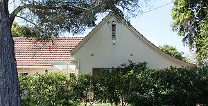
Model Timber Home
Heritage listed building in Western Australia
Distance: Approx. 1883 meters
Latitude and longitude: -31.9387,115.8031
Model Timber Home is the name, for heritage-listing purposes, of a timber-framed house in Floreat, Western Australia. Designed by Reginald Summerhayes, the plans won a competition for the design of an ideal cheap modern timber-framed home. The house was subsequently built on donated land, using donated materials and labour in 1934.
Model Brick Home
Heritage listed building in Floreat, Western Australia
Distance: Approx. 1906 meters
Latitude and longitude: -31.939,115.8036
Model Brick Home is the name, for heritage-listing purposes, of a brick-and-tile house in Floreat, Western Australia. Designed by H. Howard Bonner in 1932, the plans won a competition for the design of an ideal cheap modern brick home; and the house was subsequently built on donated land, from donated materials and labour in 1934.
Weather in this IP's area
smoke
17 Celsius
16 Celsius
15 Celsius
18 Celsius
1026 hPa
59 %
1026 hPa
1025 hPa
5000 meters
4.63 m/s
160 degree
7 %
05:44:09
18:23:37