Country:
 Australia
Region:
City:
Latitude and Longitude:
Time Zone:
Postal Code:
IP information under different IP Channel
ip-api
Country
Region
City
ASN
Time Zone
ISP
Blacklist
Proxy
Latitude
Longitude
Postal
Route
IPinfo
Country
Region
City
ASN
Time Zone
ISP
Blacklist
Proxy
Latitude
Longitude
Postal
Route
MaxMind
Country
Region
City
ASN
Time Zone
ISP
Blacklist
Proxy
Latitude
Longitude
Postal
Route
Luminati
Country
AURegion
wa
City
perth
ASN
Time Zone
Australia/Perth
ISP
TPG Telecom Limited
Latitude
Longitude
Postal
db-ip
Country
Region
City
ASN
Time Zone
ISP
Blacklist
Proxy
Latitude
Longitude
Postal
Route
ipdata
Country
Region
City
ASN
Time Zone
ISP
Blacklist
Proxy
Latitude
Longitude
Postal
Route
Popular places and events near this IP address
Balga, Western Australia
Suburb of Perth, Western Australia
Distance: Approx. 765 meters
Latitude and longitude: -31.859,115.839
Balga is a suburb of Perth, the capital city of Western Australia, 13 kilometres (8 mi) north of Perth city's central business district (CBD). Its local government area is the City of Stirling. Mark Irwin is the current mayor.

Hamersley, Western Australia
Suburb of Perth, Western Australia
Distance: Approx. 3007 meters
Latitude and longitude: -31.852,115.806
Hamersley is a residential suburb 14 kilometres (8.7 miles) north-northwest of the central business district of Perth, the capital of Western Australia, and six kilometres (4 mi) from the Indian Ocean. The suburb adjoins two major arterial roads—Mitchell Freeway to the west and Reid Highway to the south—and is within the City of Stirling local government area. It was built during the late 1960s and 1970s as part of the Government of Western Australia's response to rapidly increasing land prices across the metropolitan area.

Westminster, Western Australia
Suburb of Perth, Western Australia
Distance: Approx. 1982 meters
Latitude and longitude: -31.87,115.838
Westminster is a suburb approximately 12 kilometres north of Perth, Western Australia. Its local government area is the City of Stirling. Westminster was formerly the southern part of Balga but was renamed in 1995 at the request of residents.

Marangaroo, Western Australia
Suburb of Perth, Western Australia
Distance: Approx. 2699 meters
Latitude and longitude: -31.828,115.836
Marangaroo is a suburb of Perth, Western Australia. It is located approximately 18 km north of Perth City, within the City of Wanneroo. Marangaroo's borders comprise Wanneroo Road, Hepburn Avenue, Mirrabooka Avenue and Marangaroo Drive.

Mirrabooka bus station
Bus station in Mirrabooka, Australia
Distance: Approx. 2785 meters
Latitude and longitude: -31.87,115.8585
Mirrabooka bus station is a Transperth bus station in Mirrabooka approximately 12 kilometres north of Perth, Western Australia. It has 12 stands and is served by 14 Transperth routes operated by Path Transit and Swan Transit.
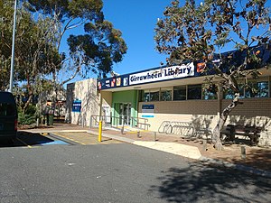
Girrawheen, Western Australia
Suburb of Perth, Western Australia
Distance: Approx. 1885 meters
Latitude and longitude: -31.836,115.832
Girrawheen is a northern suburb of Perth, the capital city of Western Australia. Its local government area is the City of Wanneroo.
Koondoola, Western Australia
Suburb of Perth, Western Australia
Distance: Approx. 2304 meters
Latitude and longitude: -31.842,115.859
Koondoola is a suburb of Perth, Western Australia, located within the City of Wanneroo. Its postcode is 6064. Most of Koondoola's infrastructure was built in the 1970s.

Warwick Senior High School
Public co-educational high day school in Australia
Distance: Approx. 2620 meters
Latitude and longitude: -31.8379,115.8158
Warwick Senior High School is a public co-educational high day school, located in Warwick, a northern suburb of Perth, Western Australia. Founded in 1981, the school provides education to approximately 900 students from Year 7 to Year 12. The school has a renowned specialist program for Australian rules football.

John Septimus Roe Anglican Community School
School in Mirrabooka, Western Australia, Australia
Distance: Approx. 1928 meters
Latitude and longitude: -31.858587,115.856751
John Septimus Roe Anglican Community School (commonly abbreviated as JSRACS or JSR) is an independent Anglican co-educational primary and secondary day school, located in Perth, Western Australia. The school is named after notable West Australian and first Surveyor-General of Western Australia, John Septimus Roe. It is the largest school of the Anglican Schools Commission.

Mercy College, Perth
School in Australia
Distance: Approx. 2095 meters
Latitude and longitude: -31.84722222,115.85916667
Mercy College is an independent Roman Catholic co-educational primary and high day school located in the Perth suburb of Koondoola, Western Australia. Mercy College caters for 1550 students from kindergarten to Year 12. Mercy College draws on its history as a part of the journey of the Sisters of Mercy, founded by Catherine McAuley.
Balga Senior High School
School in Perth, Western Australia
Distance: Approx. 834 meters
Latitude and longitude: -31.852245,115.84662
Balga Senior High School is a public co-educational high day school, located on Markham Way in the suburb of Balga, 13 kilometres (8.1 mi) north of Perth, Western Australia. Established in 1970, the school caters for students from Year 7 to Year 12.
Girrawheen Senior High School
School in Australia
Distance: Approx. 1743 meters
Latitude and longitude: -31.83694444,115.84194444
Girrawheen Senior High School is an independent public co-educational high day school, located in the Perth suburb of Girrawheen, Western Australia.
Weather in this IP's area
smoke
17 Celsius
16 Celsius
15 Celsius
18 Celsius
1025 hPa
60 %
1025 hPa
1019 hPa
5000 meters
4.63 m/s
160 degree
10 %
05:44:05
18:23:27