Country:
 Australia
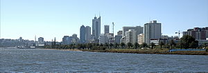
Region:
City:
Latitude and Longitude:
Time Zone:
Postal Code:
IP information under different IP Channel
ip-api
Country
Region
City
ASN
Time Zone
ISP
Blacklist
Proxy
Latitude
Longitude
Postal
Route
IPinfo
Country
Region
City
ASN
Time Zone
ISP
Blacklist
Proxy
Latitude
Longitude
Postal
Route
MaxMind
Country
Region
City
ASN
Time Zone
ISP
Blacklist
Proxy
Latitude
Longitude
Postal
Route
Luminati
Country
AURegion
wa
City
perth
ASN
Time Zone
Australia/Perth
ISP
TPG Telecom Limited
Latitude
Longitude
Postal
db-ip
Country
Region
City
ASN
Time Zone
ISP
Blacklist
Proxy
Latitude
Longitude
Postal
Route
ipdata
Country
Region
City
ASN
Time Zone
ISP
Blacklist
Proxy
Latitude
Longitude
Postal
Route
Popular places and events near this IP address

Perth Zoo
Zoo in Perth, Western Australia
Distance: Approx. 835 meters
Latitude and longitude: -31.975561,115.852216
Perth Zoo is a 17-hectare (41-acre) zoological park in South Perth, Western Australia. The zoo first opened in 1898 and by 2011 housed 1258 animals of 164 species and an extensive botanical collection. It is a full institutional member of the Zoo and Aquarium Association (ZAA) and the World Association of Zoos and Aquariums (WAZA).

City of South Perth
Local government area in Western Australia
Distance: Approx. 651 meters
Latitude and longitude: -31.982,115.863
The City of South Perth is a local government area in the inner southern suburbs of the Western Australian capital city of Perth about 4 kilometres (2.5 mi) south of Perth's central business district. The City covers an area of 19.9 square kilometres (7.7 sq mi), maintains 203 kilometres (126 mi) of roads and a little over 4.3 km2 of parks and gardens, and had a population of about 42,000 at the 2016 Census. The City is the entirety of the state electoral district of South Perth.
Perth Water
Body of water of Swan River, Western Australia
Distance: Approx. 1140 meters
Latitude and longitude: -31.966186,115.861869
Perth Water is a section of the Swan River on the southern edge of the central business district of Perth, Western Australia. It is between the Causeway to the east, and Narrows Bridge to the west – a large wide but shallow section of river, and the northern edge of the suburb South Perth. It is considered a landmark of the City of Perth.

Wesley College, Perth
School in South Perth, Western Australia
Distance: Approx. 473 meters
Latitude and longitude: -31.97861111,115.86527778
Wesley College, informally known as Wesley, is an independent, day and boarding school for boys and girls (co-ed to Year 6 and boys only Years 7–12), situated in South Perth, a suburb of Perth, Western Australia. The college is a Uniting Church school, which traces its origins back to 1923 when it was established by members of the Methodist Church which was founded by John Wesley. Since its foundation, the college has been located on a 19 hectare riverside property, near the banks of the Swan River.

Point Belches
Point into Swan River, Western Australia
Distance: Approx. 1561 meters
Latitude and longitude: -31.96609,115.84979
Point Belches is a small point on the south side of Swan River, Western Australia, about 250 metres (820 ft) east of The Narrows within the area known as Perth Water. The land is part of the South Perth Esplanade, and the water off the point is used as a commercial water skiing area. Captain James Stirling discovered Point Belches during the Swan River expedition of 1827.

South Perth, Western Australia
Suburb of Perth, Western Australia
Distance: Approx. 651 meters
Latitude and longitude: -31.982,115.863
South Perth is an inner suburb of Perth, the capital of the Australian state of Western Australia. Its local government area is the City of South Perth. South Perth is separated from the Perth central business district (CBD) by Perth Water, a section of the Swan River.

Old Mill, Perth
Mill and museum in South Perth, Western Australia
Distance: Approx. 1743 meters
Latitude and longitude: -31.9662,115.847
The Old Mill (Shenton's Mill) is a restored tower mill located on Mill Point in South Perth, Western Australia. Today, restored to its original 1830s condition, it is one of Perth's best known historic landmarks and serves as a sightseeing attraction.

Mends Street Jetty
Jetty in Perth, Western Australia
Distance: Approx. 914 meters
Latitude and longitude: -31.970887,115.853829
Mends Street Jetty is located in South Perth in Western Australia. The jetty is on the southern shore of the Swan River in the section known as Perth Water. The ferry service is primarily used for accessing the Perth Zoo from the Perth central business district While also being used for commuters.
Sir James Mitchell Park
Park in South Perth, Western Australia
Distance: Approx. 380 meters
Latitude and longitude: -31.976,115.865
Sir James Mitchell Park is a park along the southern foreshore of Perth Water in Perth, Western Australia. It lies within the suburb of South Perth from Mends Street Jetty, to just south of Heirisson Island. It is named after Sir James Mitchell, the 13th Premier of Western Australia It was formerly a riverside area with a number of issues regarding management.

South Perth Esplanade
Riverside park in South Perth, Western Australia
Distance: Approx. 1267 meters
Latitude and longitude: -31.969,115.8508
South Perth Esplanade is the name of the foreshore area of Perth Water from Point Belches to Mends Street Jetty in South Perth, Western Australia. It has been in the past susceptible to tidal and flooding inundations. It has been a desirable location for real estate looking across the Swan River to the city of Perth, as well as watching the City of Perth Skyworks.

Windsor Hotel (Perth)
Heritage listed building in Perth, Western Australia
Distance: Approx. 900 meters
Latitude and longitude: -31.9731,115.8523
The Windsor Hotel is a heritage-listed building in South Perth, Western Australia. Designed by J. J. Talbot Hobbs, the building is of Federation Filigree style. Built in 1898, it is one of the earliest surviving hotels in Perth's southern suburbs.

South Perth Post Office
Historic site in Western Australia, Australia
Distance: Approx. 952 meters
Latitude and longitude: -31.9733,115.8516
South Perth Post Office is a heritage-listed post office at 103 Mill Point Road, South Perth, Western Australia, Australia. It was added to the Australian Commonwealth Heritage List on 8 November 2011.
Weather in this IP's area
smoke
17 Celsius
16 Celsius
15 Celsius
18 Celsius
1026 hPa
57 %
1026 hPa
1025 hPa
5000 meters
4.63 m/s
160 degree
6 %
05:43:54
18:23:26