Country:
 Australia
Region:
City:
Latitude and Longitude:
Time Zone:
Postal Code:
IP information under different IP Channel
ip-api
Country
Region
City
ASN
Time Zone
ISP
Blacklist
Proxy
Latitude
Longitude
Postal
Route
IPinfo
Country
Region
City
ASN
Time Zone
ISP
Blacklist
Proxy
Latitude
Longitude
Postal
Route
MaxMind
Country
Region
City
ASN
Time Zone
ISP
Blacklist
Proxy
Latitude
Longitude
Postal
Route
Luminati
Country
AURegion
wa
City
perth
ASN
Time Zone
Australia/Perth
ISP
TPG Telecom Limited
Latitude
Longitude
Postal
db-ip
Country
Region
City
ASN
Time Zone
ISP
Blacklist
Proxy
Latitude
Longitude
Postal
Route
ipdata
Country
Region
City
ASN
Time Zone
ISP
Blacklist
Proxy
Latitude
Longitude
Postal
Route
Popular places and events near this IP address

Maddington railway station
Railway station in Perth, Western Australia
Distance: Approx. 2362 meters
Latitude and longitude: -32.049611,115.982843
Maddington railway station is on the Transperth network. It is located on the Armadale Line, 17.7 kilometres from Perth Station serving the suburb of Maddington.

Kenwick railway station
Railway station in Perth, Western Australia
Distance: Approx. 767 meters
Latitude and longitude: -32.036488,115.969942
Kenwick railway station is located on the Transperth network. It is located on the Armadale Line, 15.8 kilometres from Perth Station serving the suburb of Kenwick. The station has been closed since 20 November 2023 as the Armadale line has been temporarily shut down for construction works.

Beckenham railway station
Railway station in Perth, Western Australia
Distance: Approx. 1944 meters
Latitude and longitude: -32.0228,115.954283
Beckenham railway station is a temporarily closed railway station on the Transperth commuter rail network in Western Australia. It is located on the Armadale line, 13.8 kilometres (8.6 mi) from Perth Station serving the suburb of Beckenham. It closed on 20 November 2023 so the station could be rebuilt as part of the Victoria Park-Canning Level Crossing Removal Project.

Thornlie railway station
Railway station in Perth, Western Australia
Distance: Approx. 2730 meters
Latitude and longitude: -32.047222,115.952293
Thornlie railway station is a temporarily closed railway station on the Transperth network. It was the terminus of the Thornlie line, a spur of the Armadale Line, seventeen kilometres (11 mi) from Perth Station serving the suburb of Thornlie, Western Australia. Under construction is the Thornlie-Cockburn Link which will link to Cockburn Central railway station along the Mandurah line via two new stations, Nicholson Road railway station and Ranford Road railway station.

Brixton Street Wetlands
Wetland area in Perth, Western Australia
Distance: Approx. 698 meters
Latitude and longitude: -32.03333333,115.96666667
The Brixton Street Wetlands is an environmentally significant wetland area in the city of Perth, Western Australia. The wetlands are located in the suburb of Kenwick, in the south-east of the city not far from the foot of the Darling Scarp. The Brixton Street Wetlands occupies 126 hectares (310 acres) adjoining urban residential developments, schools and remnant semi-rural properties in an area which is rapidly urbanising.
East Cannington, Western Australia
Suburb of Perth, Western Australia
Distance: Approx. 2838 meters
Latitude and longitude: -32.008,115.958
East Cannington is a southeastern suburb of Perth, Western Australia. Its local government area is the City of Canning.

Beckenham, Western Australia
Suburb of Perth, Western Australia
Distance: Approx. 2007 meters
Latitude and longitude: -32.022,115.954
Beckenham is a suburb of Perth, Western Australia, located within the City of Gosnells.
Kenwick, Western Australia
Suburb of Perth, Western Australia
Distance: Approx. 858 meters
Latitude and longitude: -32.029,115.982
Kenwick, Western Australia is a mixed residential, light industrial and semi-rural suburb located in the south-east of Perth, Western Australia, located within the City of Gosnells. A large portion of the suburb is composed of remnant agricultural land organised as smallholdings of several acres, as well as relatively pristine native wetlands, including the Brixton Street Wetlands which are of significant conservation value. It also contains several sites of historical significance relating to its status as one of the early farming communities of the Swan River Colony.
Maddington, Western Australia
Suburb of Perth, Western Australia
Distance: Approx. 2646 meters
Latitude and longitude: -32.049,115.99
Maddington is a suburb 20 kilometres (12 mi) southeast of the central business district of Perth, the capital of Western Australia, within the City of Gosnells local government area. Maddington is a mixed-use suburb containing major residential, retail and industrial sections as well as some semi-rural areas. Unusual amongst the surrounding suburbs Maddington still retains several vineyards and orchards from when the locality was used for agricultural purposes.
Rehoboth Christian College
School in Australia
Distance: Approx. 723 meters
Latitude and longitude: -32.03361111,115.97944444
Rehoboth Christian College is a dual-campus independent trans-denominational Protestant co-educational primary and secondary day school, located in the south-eastern corridor of Perth, Western Australia. The college comprises a Year K to Year 6 campus in the suburb of Wilson, and a Year K to Year 12 campus in the suburb of Kenwick. The college currently enrols some 1000 students across its two campuses.
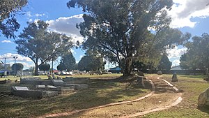
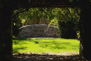
Kenwick Pioneer Cemetery
Heritage site and cemetery in Kenwick, Western Australia
Distance: Approx. 1349 meters
Latitude and longitude: -32.04222,115.97298
Kenwick Pioneer Cemetery is located in Kenwick, Western Australia adjacent to Albany Highway. It is part of the 1.2 hectares (3 acres) of land donated by Wallace Bickley for a school for the children of the Canning in 1863. In 1865 a rammed earth building with shingle roof was constructed by convicts.

Woodloes Homestead
Homestead in Cannington, Western Australia
Distance: Approx. 2950 meters
Latitude and longitude: -32.027342,115.941911
Woodloes Homestead was built in 1871 by architect Francis Bird. The homestead is situated on the banks of the Canning River in Cannington. Bird was partner in the Mason-Bird Timber Company, cut timber in the Darling Range and transported it via a horse-drawn railway to Mason's Landing, near Woodloes Homestead.
Weather in this IP's area
clear sky
17 Celsius
16 Celsius
15 Celsius
18 Celsius
1025 hPa
51 %
1025 hPa
1024 hPa
10000 meters
4.12 m/s
120 degree
05:43:25
18:23:02