106.66.251.76 - IP Lookup: Free IP Address Lookup, Postal Code Lookup, IP Location Lookup, IP ASN, Public IP
Country:
Region:
City:
Location:
Time Zone:
Postal Code:
ISP:
ASN:
language:
User-Agent:
Proxy IP:
Blacklist:
IP information under different IP Channel
ip-api
Country
Region
City
ASN
Time Zone
ISP
Blacklist
Proxy
Latitude
Longitude
Postal
Route
db-ip
Country
Region
City
ASN
Time Zone
ISP
Blacklist
Proxy
Latitude
Longitude
Postal
Route
IPinfo
Country
Region
City
ASN
Time Zone
ISP
Blacklist
Proxy
Latitude
Longitude
Postal
Route
IP2Location
106.66.251.76Country
Region
maharashtra
City
akola
Time Zone
Asia/Kolkata
ISP
Language
User-Agent
Latitude
Longitude
Postal
ipdata
Country
Region
City
ASN
Time Zone
ISP
Blacklist
Proxy
Latitude
Longitude
Postal
Route
Popular places and events near this IP address

Akola
City in Maharashtra, India
Distance: Approx. 3707 meters
Latitude and longitude: 20.7,77
Akola () is a major city in the Vidarbha region of the Indian state of Maharashtra. The third largest city in Eastern Maharashtra after Nagpur and Amravati, it is located about 580 kilometres (360 mi) east of the state capital, Mumbai, and 250 kilometres (160 mi) west of the second capital, Nagpur. Akola is the administrative headquarters of the Akola district located in the Amravati division.

Dr. Panjabrao Deshmukh Krishi Vidyapeeth
Agricultural university in Maharashtra, India
Distance: Approx. 5682 meters
Latitude and longitude: 20.71422222,77.05061389
Dr. Panjabrao Deshmukh Krishi Vidyapeeth (PDKV or PKV) is an agricultural university located at Akola, in Maharashtra, India, in the Vidarbha region. The university is responsible for agricultural education, research and extension education along with breeder and foundation seed programmes.
Malkapur, Akola
Suburb in Akola, Maharashtra, India
Distance: Approx. 6627 meters
Latitude and longitude: 20.684023,77.035704
Malkapur is a census town in Akola district in the Indian state of Maharashtra.
Umri Pragane Balapur
Suburb in Akola, Maharashtra, India
Distance: Approx. 4500 meters
Latitude and longitude: 20.7115,77.0364
Umri Pragane Balapur is a census town in Akola district in the Indian state of Maharashtra.
Akola Airport
Airport in Maharashtra, India
Distance: Approx. 7205 meters
Latitude and longitude: 20.69888889,77.05861111
Akola Airport (IATA: AKD, ICAO: VAAK) is an airport located in Akola in the Indian state of Maharashtra. The airport can currently said to be non-functional for public use, as of now no public airplane services are available in Akola. It is natively called Dr.

Akola Lok Sabha constituency
Lok Sabha constituency in Maharashtra
Distance: Approx. 2738 meters
Latitude and longitude: 20.70891389,76.99659167
Akola Lok Sabha constituency is one of the 48 Lok Sabha (parliamentary) constituencies in Maharashtra, currently represented by Anup Dhotre.

Akola Fort
Fort in Akola district, Maharashtra, India
Distance: Approx. 3188 meters
Latitude and longitude: 20.706225,76.990019
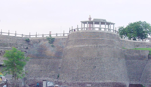
Akola fort (also called Asadgad) along with the Narnala and Akot forts forms the major fortifications of the Akola district, Maharashtra, India.

Akola East Assembly constituency
Constituency of the Maharashtra legislative assembly in India
Distance: Approx. 2738 meters
Latitude and longitude: 20.70891389,76.99659167
Akola East Assembly constituency is one of the 288 constituencies of Maharashtra Vidhan Sabha and one of the five which are located in the Akola district. It is a part of the Akola (Lok Sabha constituency) along with five other assembly constituencies, viz Akot, Balapur, Akola West, and Murtizapur (SC) and Risod from the Washim district. As per orders of Delimitation of Parliamentary and Assembly constituencies Order, 2008, No.
Akola Cricket Club Ground
Distance: Approx. 2269 meters
Latitude and longitude: 20.71300278,77.001975
Akola Cricket Club Ground is a cricket ground in Akola, Vidarbha, India. The ground has held two first-class matches, the first of which came in the 1983/84 Ranji Trophy when Vidarbha played the Railways, while the second saw Rajasthan as the visitors in the 1984/85 Ranji Trophy. The ground is open 24/7 and is well maintained.
Akola Junction railway station
Railway station in Maharashtra, India
Distance: Approx. 1262 meters
Latitude and longitude: 20.7233,77.0057
Akola Junction (station code:- AK) serves Akola in Akola district in the Indian state of Maharashtra. It is an important junction station on the Howrah–Nagpur–Mumbai line. There is a 5 ft 6 in (1,676 mm) broad gauge line to Secunderabad railway station and the metre-gauge Akola–Khandwa line is under gauge conversion.
Weather in this IP's area
clear sky
24 Celsius
23 Celsius
24 Celsius
24 Celsius
1016 hPa
34 %
1016 hPa
983 hPa
10000 meters
2.71 m/s
3.41 m/s
111 degree
3 %