105.243.7.16 - IP Lookup: Free IP Address Lookup, Postal Code Lookup, IP Location Lookup, IP ASN, Public IP
Country:
Region:
City:
Location:
Time Zone:
Postal Code:
IP information under different IP Channel
ip-api
Country
Region
City
ASN
Time Zone
ISP
Blacklist
Proxy
Latitude
Longitude
Postal
Route
Luminati
Country
Region
mp
City
secunda
ASN
Time Zone
Africa/Johannesburg
ISP
Vodacom-VB
Latitude
Longitude
Postal
IPinfo
Country
Region
City
ASN
Time Zone
ISP
Blacklist
Proxy
Latitude
Longitude
Postal
Route
IP2Location
105.243.7.16Country
Region
mpumalanga
City
secunda
Time Zone
Africa/Johannesburg
ISP
Language
User-Agent
Latitude
Longitude
Postal
db-ip
Country
Region
City
ASN
Time Zone
ISP
Blacklist
Proxy
Latitude
Longitude
Postal
Route
ipdata
Country
Region
City
ASN
Time Zone
ISP
Blacklist
Proxy
Latitude
Longitude
Postal
Route
Popular places and events near this IP address

Secunda, South Africa
Town in the province of Mpumalanga, South Africa
Distance: Approx. 5210 meters
Latitude and longitude: -26.51611111,29.20277778
Secunda (from Latin: second, secund, secundi meaning second/following) is a town built amidst the coalfields of the Mpumalanga province of South Africa. It was named for being the second Sasol extraction refinery producing oil from coal, after Sasolburg, some 140 kilometres (87 mi) to the west.

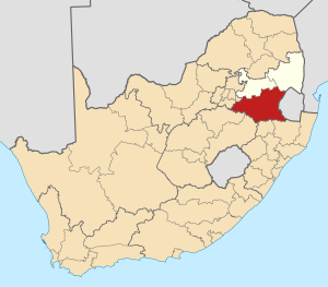
Gert Sibande District Municipality
District municipality in Mpumalanga, South Africa
Distance: Approx. 3 meters
Latitude and longitude: -26.55,29.16666667
Gert Sibande (until 2004 known as the Eastvaal District Municipality) is one of the 3 districts of Mpumalanga province of South Africa. The seat of Gert Sibande is Ermelo. The majority of its 900 007 people speak IsiZulu (2001 Census).

Secunda CTL
Distance: Approx. 422 meters
Latitude and longitude: -26.55369444,29.16575
Secunda CTL is a synthetic fuel plant owned by Sasol at Secunda, Mpumalanga in South Africa. It uses coal liquefaction to produce petroleum-like synthetic crude oil from coal. The process used by Sasol is based on the Fischer–Tropsch process.
Borehole UC 65
Distance: Approx. 6148 meters
Latitude and longitude: -26.50861111,29.12583333
Borehole UC 65 is a provincial heritage site near Evander in the Mpumalanga province of South Africa. In 1985 it was described in the Government Gazette as In 1951 Borehole U.C. 65 was the first prospecting hole to penetrate the auriferous Kimberley Reef in the vicinity of the present Evander. This event led to the development of an important new South African goldfield, viz the Evander Goldfield.

Albert Luthuli Local Municipality
Local municipality in Mpumalanga, South Africa
Distance: Approx. 3 meters
Latitude and longitude: -26.55,29.16666667
Albert Luthuli Municipality (Swazi: Masipaladi iAlbert Luthuli; Zulu: UMasipala iAlbert Luthuli) is a local municipality within the Gert Sibande District Municipality, in the Mpumalanga province of South Africa. It was named after Albert Luthuli. Carolina is the seat of the municipality.

Govan Mbeki Local Municipality
Local municipality in Mpumalanga, South Africa
Distance: Approx. 3 meters
Latitude and longitude: -26.55,29.16666667
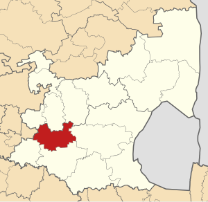
Govan Mbeki Municipality (Zulu: UMasipala iGovan Mbeki; Afrikaans: Govan Mbeki Munisipaliteit), formerly the Highveld East Local Municipality, is a local municipality within the Gert Sibande District Municipality, in the Mpumalanga province of South Africa. Secunda is the seat of the municipality.

Msukaligwa Local Municipality
Local municipality in Mpumalanga, South Africa
Distance: Approx. 3 meters
Latitude and longitude: -26.55,29.16666667
Msukaligwa Municipality (Zulu: UMasipala wase Msukaligwa; Afrikaans: Msukaligwa Munisipaliteit) is a local municipality within the Gert Sibande District Municipality, in the Mpumalanga province of South Africa. Ermelo is the seat of the municipality.

Lekwa Local Municipality
Local municipality in Mpumalanga, South Africa
Distance: Approx. 3 meters
Latitude and longitude: -26.55,29.16666667
Lekwa Municipality (Zulu: UMasipala wase Lekwa; Afrikaans: Lekwa Munisipaliteit; Sotho: Masepala wa Lekwa) is a local municipality situated in the southwest of the Gert Sibande District Municipality, in the Mpumalanga province of South Africa. Standerton, an urban node, is the seat of the municipality. It was inaugurated on 5 December 2000 after the amalgamation of the Standerton, Sakhile and Morgenzon councils.

Dipaleseng Local Municipality
Local municipality in Mpumalanga, South Africa
Distance: Approx. 3 meters
Latitude and longitude: -26.55,29.16666667
Dipaleseng Municipality (Zulu: UMasipala wase Dipaleseng; Sotho: Masepala wa Dipaleseng) is a local municipality within the Gert Sibande District Municipality, in the Mpumalanga province of South Africa. Balfour is the seat of the municipality.

Pixley ka Seme Local Municipality
Local municipality in Mpumalanga, South Africa
Distance: Approx. 3 meters
Latitude and longitude: -26.55,29.16666667
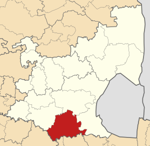
Pixley Ka Seme Municipality (Zulu: UMasipala iPixley ka Seme) is a local municipality within the Gert Sibande District Municipality, in the Mpumalanga province of South Africa. Volksrust is the seat of the municipality. The municipality is named after Pixley ka Isaka Seme, a founder and president of the African National Congress.

Mkhondo Local Municipality
Local municipality in Mpumalanga, South Africa
Distance: Approx. 3 meters
Latitude and longitude: -26.55,29.16666667
Mkhondo Municipality (Zulu: UMasipala wase Mkhondo) is a local municipality within the Gert Sibande District Municipality, in the Mpumalanga province of South Africa. Piet Retief is the seat of the municipality.
Embalenhle
Place in Mpumalanga, South Africa
Distance: Approx. 8546 meters
Latitude and longitude: -26.546,29.081
eMbalenhle is a township in Govan Mbeki Local Municipality in the Mpumalanga province of South Africa. It was established in the 1970s to serve as a black-only township for the neighbouring Secunda, which was founded at the same time. Similar to Secunda, a substantial part of housing in eMbalenhle has been constructed by Sasol for its workers.
Weather in this IP's area
overcast clouds
17 Celsius
17 Celsius
17 Celsius
17 Celsius
1020 hPa
100 %
1020 hPa
848 hPa
10000 meters
1.79 m/s
2.68 m/s
100 %