105.202.7.27 - IP Lookup: Free IP Address Lookup, Postal Code Lookup, IP Location Lookup, IP ASN, Public IP
Country:
Region:
City:
Location:
Time Zone:
Postal Code:
ISP:
ASN:
language:
User-Agent:
Proxy IP:
Blacklist:
IP information under different IP Channel
ip-api
Country
Region
City
ASN
Time Zone
ISP
Blacklist
Proxy
Latitude
Longitude
Postal
Route
db-ip
Country
Region
City
ASN
Time Zone
ISP
Blacklist
Proxy
Latitude
Longitude
Postal
Route
IPinfo
Country
Region
City
ASN
Time Zone
ISP
Blacklist
Proxy
Latitude
Longitude
Postal
Route
IP2Location
105.202.7.27Country
Region
qina
City
kousa
Time Zone
Africa/Cairo
ISP
Language
User-Agent
Latitude
Longitude
Postal
ipdata
Country
Region
City
ASN
Time Zone
ISP
Blacklist
Proxy
Latitude
Longitude
Postal
Route
Popular places and events near this IP address

Naqada
Place in Qena, Egypt
Distance: Approx. 4955 meters
Latitude and longitude: 25.9,32.71666667
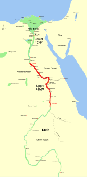
Naqada (Egyptian Arabic: نقادة Naqāda; Coptic language: ⲛⲉⲕⲁⲧⲏⲣⲓⲟⲛ Nekatērion; Ancient Greek: Παμπανις Pampanis, Ancient Egyptian: Nbyt) is a town on the west bank of the Nile in Qena Governorate, Egypt, situated ca. 20 km north of Luxor. It includes the villages of Tukh, Khatara, Danfiq, and Zawayda.
Qus
City in Qena Governorate, Egypt
Distance: Approx. 2163 meters
Latitude and longitude: 25.93333333,32.76666667
Qus (Arabic: قوص, older name Arabic: قوص واروير, romanized: qus warwir, from Coptic: ⲕⲱⲥ ⲃⲉⲣⲃⲓⲣ) is a city in the modern Qena Governorate, Egypt, located on the east bank of the Nile.

Naqada culture
Archaeological culture of pre-dynastic Egypt
Distance: Approx. 5015 meters
Latitude and longitude: 25.95,32.73333333
The Naqada culture is an archaeological culture of Chalcolithic Predynastic Egypt (c. 4000–3000 BC), named for the town of Naqada, Qena Governorate. A 2013 Oxford University radiocarbon dating study of the Predynastic period suggests a beginning date sometime between 3,800 and 3,700 BC. The final phase of the Naqada culture is Naqada III, which is coterminous with the Protodynastic Period (Early Bronze Age c. 3200–3000 BC) in ancient Egypt.
Pyramid of Naqada
Egyptian pyramid
Distance: Approx. 7592 meters
Latitude and longitude: 25.9765,32.733
The pyramid of Naqada, also called the pyramid of Ombos, is part of a group of seven very similar small step pyramids, which were all erected far from the major centres of Egypt and about which very little is known. It is located about 300 metres north of the ruins of the ancient site of Ombos, near the modern city of Naqada in Upper Egypt. The first (and so far only) excavation was undertaken in 1895 by Flinders Petrie and James Edward Quibell.
Garagos, Egypt
Place in Qena Governorate, Egypt
Distance: Approx. 5170 meters
Latitude and longitude: 25.86808333,32.75661111
Garagos (Arabic: جراجوس) is a village in Qena Governorate in Egypt, which is famous for "Garagos Pottery". The older name of the village is Jazirat Qaraqush (Arabic: جزيرة قراقش). This village is the birthplace of Saint Verena.

Alharajia
Village in Egypt
Distance: Approx. 3806 meters
Latitude and longitude: 25.94638889,32.77611111
Al Harajiyyah (Arabic: الحراجية) is a village located in the markaz of Qus in Qena Governorate in Egypt, with a population of 15,281 people. There are 7,541 men and 7,740 women.

Almasid
Village in Egypt
Distance: Approx. 4594 meters
Latitude and longitude: 25.89222222,32.8025
Al Masid (Arabic: المسيد) is a village in Qus in Egypt, with a population of 11,977 people. There are 5,652 men and 6,352 women.
Weather in this IP's area
clear sky
16 Celsius
14 Celsius
16 Celsius
16 Celsius
1017 hPa
41 %
1017 hPa
1002 hPa
10000 meters
2.81 m/s
2.82 m/s
310 degree
5 %