105.202.58.129 - IP Lookup: Free IP Address Lookup, Postal Code Lookup, IP Location Lookup, IP ASN, Public IP
Country:
Region:
City:
Location:
Time Zone:
Postal Code:
ISP:
ASN:
language:
User-Agent:
Proxy IP:
Blacklist:
IP information under different IP Channel
ip-api
Country
Region
City
ASN
Time Zone
ISP
Blacklist
Proxy
Latitude
Longitude
Postal
Route
db-ip
Country
Region
City
ASN
Time Zone
ISP
Blacklist
Proxy
Latitude
Longitude
Postal
Route
IPinfo
Country
Region
City
ASN
Time Zone
ISP
Blacklist
Proxy
Latitude
Longitude
Postal
Route
IP2Location
105.202.58.129Country
Region
suhaj
City
sohag
Time Zone
Africa/Cairo
ISP
Language
User-Agent
Latitude
Longitude
Postal
ipdata
Country
Region
City
ASN
Time Zone
ISP
Blacklist
Proxy
Latitude
Longitude
Postal
Route
Popular places and events near this IP address

Sohag Governorate
Governorate of Egypt
Distance: Approx. 622 meters
Latitude and longitude: 26.56,31.7
Sohag Governorate (Arabic: محافظة سوهاج) is one of the governorates of Egypt. It is located in the southern part of the country (Upper Egypt), and covers a stretch of the Nile Valley. Since 1960, its capital has been the city of Sohag.

Akhmim
City in Sohag, Egypt
Distance: Approx. 5603 meters
Latitude and longitude: 26.56666667,31.75
Akhmim (Arabic: أخميم, pronounced [ʔæxˈmiːm]; Akhmimic Coptic: ⳉⲙⲓⲙ, Coptic pronunciation: [xmiːm]; Sahidic/Bohairic Coptic: ϣⲙⲓⲛ Coptic pronunciation: [ʃmiːn]) is a city in the Sohag Governorate of Upper Egypt. Referred to by the ancient Greeks as Khemmis or Chemmis (Ancient Greek: Χέμμις) and Panopolis (Ancient Greek: Πανὸς πόλις and Πανόπολις), it is located on the east bank of the Nile, 6 kilometres (4 mi) to the northeast of Sohag.

Sohag
City in Egypt
Distance: Approx. 926 meters
Latitude and longitude: 26.55,31.7
Sohag (Arabic: سوهاج, romanized: Sawhāj, Egyptian Arabic pronunciation: [soˈhæːɡ], Sa'idi Arabic pronunciation: [suːˈhaːdʒ]), also spelled as Suhag or Suhaj, is a city on the west bank of the Nile in Egypt. It has been the capital of Sohag Governorate since 1960, before which the capital was Girga and the name of the governorate was Girga Governorate. It also included Esna Governorate (nowadays Qena Governorate).
Athribis (Upper Egypt)
Place in Sohag, Egypt
Distance: Approx. 5858 meters
Latitude and longitude: 26.51138889,31.66527778
Athribis (Ancient Greek: Ἄθλιβις; Coptic: ⲁⲧⲣⲉⲡⲉ or ⲁⲑⲣⲏⲃⲓ), also known to the ancient Greeks as Triphieion or Tripheion, and to the ancient Egyptians as Hut-Repyt, was an ancient city of Egypt, in the Panopolite nome. The modern villages of Wannina and Nag' Hamad in the Sohag Governorate are situated nearby. It is located some 10 km (6 mi) southwest of the city of Akhmim and about 3 km (2 mi) south of the White Monastery, on the west bank of the Nile.

Red Monastery
Coptic Orthodox monastery
Distance: Approx. 7483 meters
Latitude and longitude: 26.554931,31.619686
The Red Monastery (Arabic: الدير الاحمر) or The Monastery of Apa Psoi (Coptic: ⲡⲙⲟⲛⲁⲥⲧⲏⲣⲓⲟⲛ ⲛ̀ⲧⲉ ⲁⲡⲁ ⲡⲯⲟⲓ) is a Coptic Orthodox monastery named after an Egyptian saint named Psoi (Coptic: ⲯⲟⲓ) or Pishoy (Coptic: ⲡⲓϣⲱⲓ), not to be confused with Pishoy, Bishop of Sketis (now the Wadi al-Natrun). It is located near the Upper Egyptian city of Souhag, and about two and a half miles (4.0 km) north-west of the White Monastery. The monastery's name is derived from the colour of the construction material of its outside walls, consisting of red (burnt) brick.

White Monastery
Coptic Orthodox monastery
Distance: Approx. 5476 meters
Latitude and longitude: 26.534761,31.645694
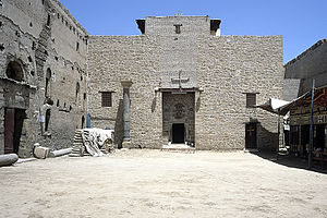
The Coptic White Monastery (Arabic: الدير أبيض), also The Monastery of Abba Shenouda (Coptic: ⲡⲙⲟⲛⲁⲥⲧⲏⲣⲓⲟⲛ ⲛ̀ⲧⲉ ⲁⲡⲁ ϣⲉⲛⲟⲩϯ) and The Athribian Monastery ([ⲡⲧⲱⲟⲩ ⲛ̀ⲁⲑⲣⲏⲃⲓ] Error: {{Langx}}: transliteration text not Latin script (pos 14: β) (help)) is a Coptic Orthodox monastery named after Saint Shenoute. It is located near the Upper Egyptian cities of Tahta and Sohag, and about two and a half miles (4.0 km) south-east of the Red Monastery. The name of the monastery is derived from the colour of the white limestone of its outside walls.

Sohag Stadium
Distance: Approx. 1434 meters
Latitude and longitude: 26.55777778,31.70916667
Sohag Stadium is located in the city centre of Sohag, its capacity is 20,000.

Sidi Arif Mosque
Mosque in Sohag, Egypt
Distance: Approx. 1158 meters
Latitude and longitude: 26.54833333,31.70138889
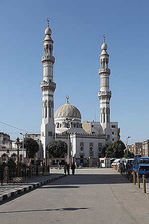
The Sidi Arif Mosque (also known as Masjid Al-Arif Bellah, Arabic: مسجد العارف بالله; transliterated: Masjid al-Aarif bi Allah) is one of the largest mosques in Sohag Governorate. It was built for the first time at the 14th century and was reconstructed several times; the last one was in 1968 and being renewed in 1998 for the last time. The mosque is named after the Sufi mystic buried in it, Sidi Arif, whose real name is Ismail ibn Ali ibn Abdussami, a member of the Ashraf family of mystics.
Tunis, Faiyum Governorate
Distance: Approx. 6750 meters
Latitude and longitude: 26.61666667,31.68333333
Tunis is a modern-village in the Egyptian oasis of Faiyum Governorate known for its pottery workshops and small art galleries.
Idfa
Village in Sohag, Egypt
Distance: Approx. 5832 meters
Latitude and longitude: 26.5725,31.63888889
Idfa (Arabic: إدفا) is a village in Sohag Governorate in Upper Egypt located 6.4 km (4.0 mi) from the nearby city of Sohag. In antiquity, it was known by the ancient Egyptians as Iteb, then it was named by the Greeks as Itos (Ancient Greek: Ἰτος).
Tunis, Sohag Governorate
Village in Sohag Governorate, Egypt
Distance: Approx. 6760 meters
Latitude and longitude: 26.61666667,31.68277778
Tunis is a village in Sohag Governorate, Egypt located in the Sohag Markaz. In 2006 it was inhabited by 19 495 people.
Weather in this IP's area
clear sky
12 Celsius
11 Celsius
12 Celsius
12 Celsius
1021 hPa
56 %
1021 hPa
1006 hPa
10000 meters
3.55 m/s
6.17 m/s
324 degree